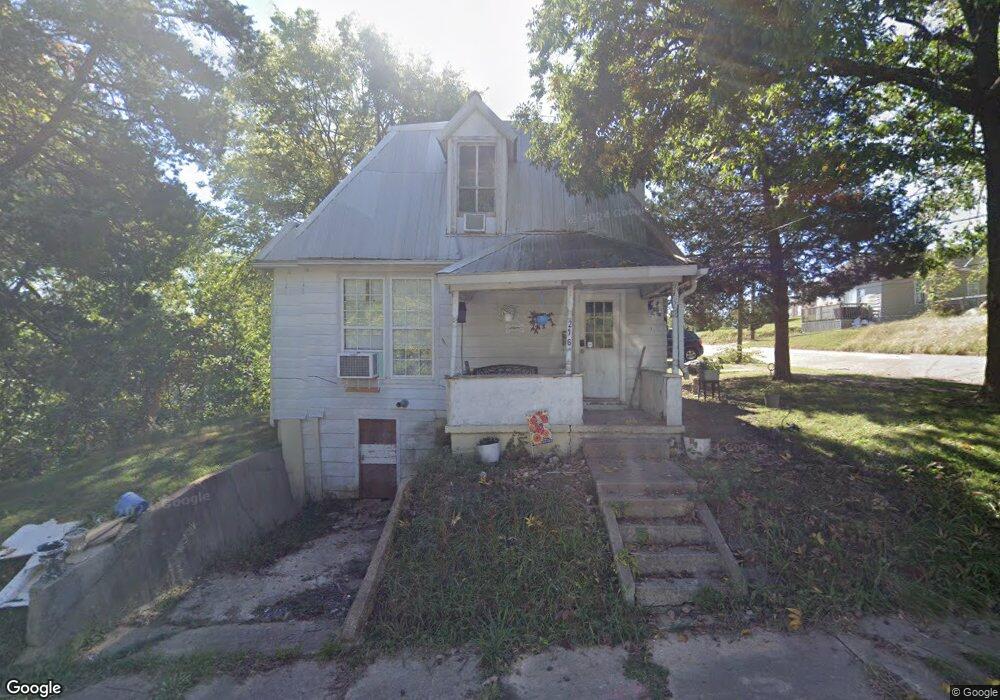
216 Euclid Ave Poplar Bluff, MO 63901
Estimated Value: $39,000 - $70,261
2
Beds
--
Bath
1,134
Sq Ft
$49/Sq Ft
Est. Value
About This Home
This home is located at 216 Euclid Ave, Poplar Bluff, MO 63901 and is currently estimated at $55,065, approximately $48 per square foot. 216 Euclid Ave is a home located in Butler County with nearby schools including Poplar Bluff Fifth & Sixth Grade Center, Lake Road Elementary School, and Poplar Bluff Junior High School.
Ownership History
Date
Name
Owned For
Owner Type
Purchase Details
Closed on
Sep 19, 2024
Sold by
Willcut Keith
Bought by
Kw Property Management Llc
Current Estimated Value
Purchase Details
Closed on
May 29, 2009
Sold by
Sullivan Lisa
Bought by
Foust Bobby Lee and Foust Sandra
Home Financials for this Owner
Home Financials are based on the most recent Mortgage that was taken out on this home.
Original Mortgage
$11,464
Interest Rate
4.76%
Mortgage Type
Future Advance Clause Open End Mortgage
Create a Home Valuation Report for This Property
The Home Valuation Report is an in-depth analysis detailing your home's value as well as a comparison with similar homes in the area
Home Values in the Area
Average Home Value in this Area
Purchase History
| Date | Buyer | Sale Price | Title Company |
|---|---|---|---|
| Kw Property Management Llc | -- | None Listed On Document | |
| Foust Bobby Lee | -- | -- |
Source: Public Records
Mortgage History
| Date | Status | Borrower | Loan Amount |
|---|---|---|---|
| Previous Owner | Foust Bobby Lee | $11,464 |
Source: Public Records
Tax History Compared to Growth
Tax History
| Year | Tax Paid | Tax Assessment Tax Assessment Total Assessment is a certain percentage of the fair market value that is determined by local assessors to be the total taxable value of land and additions on the property. | Land | Improvement |
|---|---|---|---|---|
| 2024 | $3 | $5,450 | $0 | $0 |
| 2023 | $263 | $5,450 | $0 | $0 |
| 2022 | $248 | $5,140 | $0 | $0 |
| 2021 | $247 | $5,130 | $0 | $0 |
| 2020 | $229 | $4,690 | $0 | $0 |
| 2019 | $229 | $4,690 | $0 | $0 |
| 2018 | $229 | $4,690 | $0 | $0 |
| 2017 | -- | $4,690 | $0 | $0 |
| 2016 | -- | $4,690 | $0 | $0 |
| 2015 | -- | $4,690 | $0 | $0 |
| 2014 | -- | $4,230 | $0 | $0 |
| 2012 | $180 | $4,230 | $0 | $0 |
Source: Public Records
Map
Nearby Homes