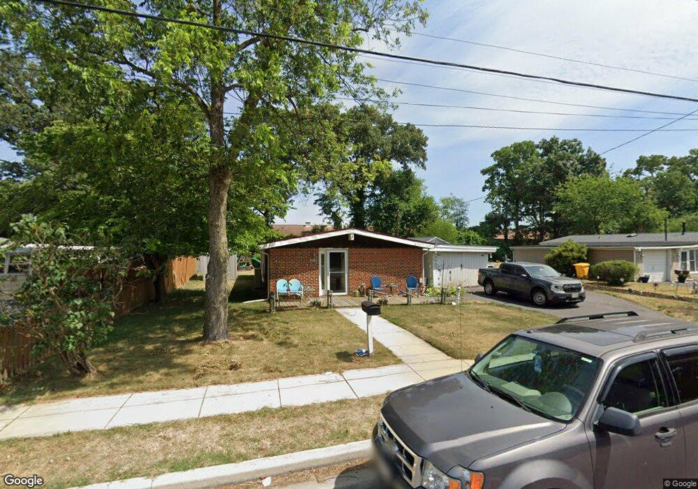
216 Gloucester Dr Glen Burnie, MD 21061
Estimated Value: $284,109 - $382,000
--
Bed
1
Bath
1,032
Sq Ft
$316/Sq Ft
Est. Value
About This Home
This home is located at 216 Gloucester Dr, Glen Burnie, MD 21061 and is currently estimated at $326,277, approximately $316 per square foot. 216 Gloucester Dr is a home located in Anne Arundel County with nearby schools including Oakwood Elementary School, Corkran Middle School, and Glen Burnie High School.
Ownership History
Date
Name
Owned For
Owner Type
Purchase Details
Closed on
May 31, 2022
Sold by
Robinson Colleen D
Bought by
Robinson Colleen D and Robinson Eric M
Current Estimated Value
Home Financials for this Owner
Home Financials are based on the most recent Mortgage that was taken out on this home.
Original Mortgage
$150,000
Outstanding Balance
$134,990
Interest Rate
5.27%
Mortgage Type
New Conventional
Estimated Equity
$191,287
Purchase Details
Closed on
May 11, 1988
Sold by
Meeks James
Bought by
Robinson Michael C and Robinson Colleen D
Home Financials for this Owner
Home Financials are based on the most recent Mortgage that was taken out on this home.
Original Mortgage
$86,309
Interest Rate
10.32%
Create a Home Valuation Report for This Property
The Home Valuation Report is an in-depth analysis detailing your home's value as well as a comparison with similar homes in the area
Home Values in the Area
Average Home Value in this Area
Purchase History
| Date | Buyer | Sale Price | Title Company |
|---|---|---|---|
| Robinson Colleen D | $15,000,000 | Staiti Law Firm | |
| Robinson Michael C | $83,900 | -- |
Source: Public Records
Mortgage History
| Date | Status | Borrower | Loan Amount |
|---|---|---|---|
| Open | Robinson Colleen D | $150,000 | |
| Previous Owner | Robinson Michael C | $86,309 |
Source: Public Records
Tax History Compared to Growth
Tax History
| Year | Tax Paid | Tax Assessment Tax Assessment Total Assessment is a certain percentage of the fair market value that is determined by local assessors to be the total taxable value of land and additions on the property. | Land | Improvement |
|---|---|---|---|---|
| 2025 | $2,299 | $258,200 | $150,500 | $107,700 |
| 2024 | $2,299 | $241,300 | $0 | $0 |
| 2023 | $2,217 | $224,400 | $0 | $0 |
| 2022 | $2,056 | $207,500 | $135,500 | $72,000 |
| 2021 | $4,051 | $205,133 | $0 | $0 |
| 2020 | $1,955 | $202,767 | $0 | $0 |
| 2019 | $3,772 | $200,400 | $130,500 | $69,900 |
| 2018 | $1,907 | $188,067 | $0 | $0 |
| 2017 | $1,779 | $175,733 | $0 | $0 |
| 2016 | -- | $163,400 | $0 | $0 |
| 2015 | -- | $161,400 | $0 | $0 |
| 2014 | -- | $159,400 | $0 | $0 |
Source: Public Records
Map
Nearby Homes
- 203 Buckingham Dr
- 409 Aquahart Rd
- 308 Aquahart Rd
- 306 Woodleaf Ct
- 7818 Oakwood Rd
- 262 Woodoak Ct
- 405 Morningside Dr
- 125 Range Rd
- 1423 Braden Loop
- 1002 Lee Rd
- 0 Irene Dr
- 251 Oakview Village Dr
- 7808 Five Oaks Ct
- 1475 Braden Loop
- 1324 Ray Ln
- 118 Heather Stone Way Unit 80
- 707 Delmar Ave
- 112 Kindred Way
- 338 White Oak Way
- 267 Truck Farm Dr
- 218 Gloucester Dr
- 214 Gloucester Dr
- 220 Gloucester Dr
- 212 Gloucester Dr
- 1031 Phillip Dr
- 217 Gloucester Dr
- 215 Gloucester Dr
- 219 Gloucester Dr
- 1029 Phillip Dr
- 300 Gloucester Dr
- 213 Gloucester Dr
- 1027 Phillip Dr
- 1202 Montgomery Dr
- 211 Gloucester Dr
- 210 Gloucester Dr
- 1024 Phillip Dr
- 1201 Montgomery Dr
- 218 King George Dr
- 216 King George Dr
- 1025 Phillip Dr