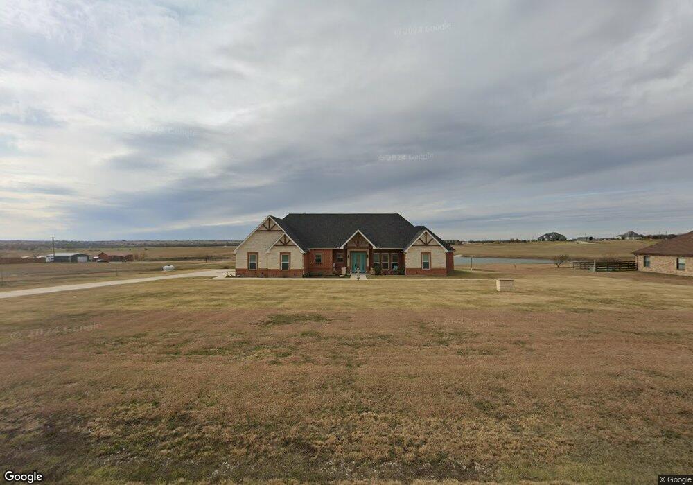
216 Hawk Ridge Rd Decatur, TX 76234
Estimated Value: $668,000 - $714,000
--
Bed
1
Bath
2,799
Sq Ft
$247/Sq Ft
Est. Value
About This Home
This home is located at 216 Hawk Ridge Rd, Decatur, TX 76234 and is currently estimated at $690,156, approximately $246 per square foot. 216 Hawk Ridge Rd is a home with nearby schools including Decatur High School.
Ownership History
Date
Name
Owned For
Owner Type
Purchase Details
Closed on
Aug 23, 2018
Sold by
Powell Jerrilyn Kaye and Powell Raymond Eugene
Bought by
Sparks Richard T and Sparks Jean M
Current Estimated Value
Purchase Details
Closed on
Apr 4, 2016
Sold by
Team G Square Llc
Bought by
Powell Raymond E and Powell Jerrilyn K
Purchase Details
Closed on
Mar 31, 2016
Sold by
Team G Square Llc
Bought by
Powell Raymond E and Powell Jerrilyn K
Purchase Details
Closed on
May 29, 2014
Sold by
Jasper Creek Properties Lp
Bought by
Teamgsquare Llc
Purchase Details
Closed on
Aug 29, 2007
Sold by
Tricomi Vincent
Bought by
Jasper Creek Properties
Purchase Details
Closed on
Oct 25, 2005
Sold by
Hawk Ridge Limited Partnership
Bought by
Powell Raymond E and Powell Jerrilyn K
Create a Home Valuation Report for This Property
The Home Valuation Report is an in-depth analysis detailing your home's value as well as a comparison with similar homes in the area
Home Values in the Area
Average Home Value in this Area
Purchase History
| Date | Buyer | Sale Price | Title Company |
|---|---|---|---|
| Sparks Richard T | -- | None Available | |
| Powell Raymond E | -- | -- | |
| Powell Raymond E | -- | -- | |
| Teamgsquare Llc | -- | Guardian Title Co | |
| Jasper Creek Properties | -- | -- | |
| Powell Raymond E | -- | -- |
Source: Public Records
Tax History Compared to Growth
Tax History
| Year | Tax Paid | Tax Assessment Tax Assessment Total Assessment is a certain percentage of the fair market value that is determined by local assessors to be the total taxable value of land and additions on the property. | Land | Improvement |
|---|---|---|---|---|
| 2025 | $7,323 | $751,374 | $149,970 | $601,404 |
| 2024 | $7,323 | $707,474 | $100,999 | $606,475 |
| 2023 | $7,928 | $656,266 | $0 | $0 |
| 2022 | $7,037 | $549,405 | $0 | $0 |
| 2021 | $8,007 | $499,460 | $79,990 | $419,470 |
| 2020 | $7,652 | $474,320 | $69,990 | $404,330 |
| 2019 | $4,278 | $248,950 | $64,990 | $183,960 |
| 2018 | $360 | $20,260 | $20,260 | $0 |
| 2017 | $299 | $16,840 | $16,840 | $0 |
| 2016 | $353 | $16,040 | $16,040 | $0 |
| 2015 | -- | $40,000 | $40,000 | $0 |
| 2014 | -- | $25,990 | $25,990 | $0 |
Source: Public Records
Map
Nearby Homes
- 1495 County Road 4530
- 709 County Road 4530
- 705 County Road 4530
- 112 Emma Ct
- 117 Emma Ct
- 1421 County Road 4530
- 160 Quail Run Ct
- 1746 County Road 4522
- TBD County Road 4511
- 5926 High Mesa Dr
- 5090 Fm 2264
- 6270 High Mesa Dr
- 249 Private Road 4434
- 197 Pond View Dr
- 414 County Road 4421
- 5345 Moncrief Rd
- 237 Chisholm Hills Dr
- 135 Branding Iron Rd
- 234 Private Road 4441
- TBD Branding Iron Rd
- 151 Hawk Ridge Rd
- 212 Hawk Ridge Rd
- 210 Hawk Ridge Rd
- 156 Hawk Ridge
- Lot 11 Hawk Ridge
- 145 Hawk Ridge Rd
- 218 Hawk Ridge Rd
- 135 Private Rd 4537
- 157 Hawk Ridge Rd
- 222 Hawk Ridge Rd
- 141 Hawk Ridge Rd
- 0000 Hawk Ridge Dr
- 192 Hawk Ridge Rd
- 188 Hawk Ridge Rd
- 137 Hawk Ridge Rd
- 226 Hawk Ridge Rd
- 163 W Ridge St
- 185 Nash Ln
- 145 Nash Ln
- 145 Grover Ct