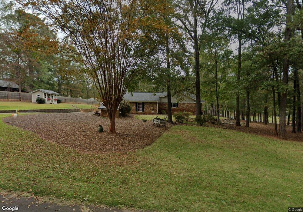
216 Julia Cir Manchester, GA 31816
Estimated Value: $231,000 - $294,000
3
Beds
2
Baths
2,201
Sq Ft
$123/Sq Ft
Est. Value
About This Home
This home is located at 216 Julia Cir, Manchester, GA 31816 and is currently estimated at $271,774, approximately $123 per square foot. 216 Julia Cir is a home located in Meriwether County with nearby schools including Mountain View Elementary School, Manchester Middle School, and Manchester High School.
Ownership History
Date
Name
Owned For
Owner Type
Purchase Details
Closed on
Oct 31, 2017
Sold by
Harbin Kay B
Bought by
Rogers Richard Charles
Current Estimated Value
Home Financials for this Owner
Home Financials are based on the most recent Mortgage that was taken out on this home.
Original Mortgage
$155,000
Outstanding Balance
$85,118
Interest Rate
3.83%
Mortgage Type
New Conventional
Estimated Equity
$186,656
Purchase Details
Closed on
Dec 18, 2012
Sold by
Rogers Richard Charles
Bought by
Rogers Richard Charles and Harbin Kay B
Purchase Details
Closed on
Apr 22, 2009
Sold by
Young Danny Joe
Bought by
Rogers Richard Charles
Home Financials for this Owner
Home Financials are based on the most recent Mortgage that was taken out on this home.
Original Mortgage
$169,100
Interest Rate
4.86%
Mortgage Type
New Conventional
Purchase Details
Closed on
Apr 21, 2009
Sold by
Young Danny Joe
Bought by
Rogers Richard Charles
Home Financials for this Owner
Home Financials are based on the most recent Mortgage that was taken out on this home.
Original Mortgage
$169,100
Interest Rate
4.86%
Mortgage Type
New Conventional
Purchase Details
Closed on
Aug 13, 2007
Sold by
Spates Tommy
Bought by
Young Danny Joe
Home Financials for this Owner
Home Financials are based on the most recent Mortgage that was taken out on this home.
Original Mortgage
$151,200
Interest Rate
6.65%
Mortgage Type
New Conventional
Purchase Details
Closed on
Sep 30, 1998
Sold by
Whitner James M and Whitner Ma
Bought by
Spates Tommy and Spates Debra
Purchase Details
Closed on
Nov 22, 1995
Sold by
Whitner James M
Bought by
Whitner James M and Whitner Ma
Purchase Details
Closed on
Nov 1, 1995
Sold by
Whitner Marion A
Bought by
Whitner James M
Purchase Details
Closed on
May 31, 1994
Sold by
Whitner James M
Bought by
Whitner Marion A
Purchase Details
Closed on
May 1, 1994
Sold by
Hildreth Bobby D
Bought by
Whitner James M
Create a Home Valuation Report for This Property
The Home Valuation Report is an in-depth analysis detailing your home's value as well as a comparison with similar homes in the area
Home Values in the Area
Average Home Value in this Area
Purchase History
| Date | Buyer | Sale Price | Title Company |
|---|---|---|---|
| Rogers Richard Charles | -- | -- | |
| Rogers Richard Charles | -- | -- | |
| Rogers Richard Charles | $178,000 | -- | |
| Rogers Richard Charles | $178,000 | -- | |
| Young Danny Joe | $159,250 | -- | |
| Spates Tommy | $109,000 | -- | |
| Whitner James M | -- | -- | |
| Whitner James M | -- | -- | |
| Whitner Marion A | -- | -- | |
| Whitner James M | $105,000 | -- |
Source: Public Records
Mortgage History
| Date | Status | Borrower | Loan Amount |
|---|---|---|---|
| Open | Rogers Richard Charles | $155,000 | |
| Previous Owner | Rogers Richard Charles | $169,100 | |
| Previous Owner | Rogers Richard Charles | $169,100 | |
| Previous Owner | Young Danny Joe | $151,200 |
Source: Public Records
Tax History Compared to Growth
Tax History
| Year | Tax Paid | Tax Assessment Tax Assessment Total Assessment is a certain percentage of the fair market value that is determined by local assessors to be the total taxable value of land and additions on the property. | Land | Improvement |
|---|---|---|---|---|
| 2024 | $2,208 | $99,428 | $8,040 | $91,388 |
| 2023 | $2,186 | $65,108 | $8,040 | $57,068 |
| 2022 | $2,186 | $65,108 | $8,040 | $57,068 |
| 2021 | $2,220 | $65,108 | $8,040 | $57,068 |
| 2020 | $2,237 | $65,108 | $8,040 | $57,068 |
| 2019 | $2,244 | $65,108 | $8,040 | $57,068 |
| 2018 | $2,265 | $65,108 | $8,040 | $57,068 |
| 2017 | $2,291 | $65,108 | $8,040 | $57,068 |
| 2016 | $2,079 | $65,108 | $8,040 | $57,068 |
| 2015 | $2,082 | $65,108 | $8,040 | $57,068 |
| 2014 | $2,082 | $65,108 | $8,040 | $57,068 |
| 2013 | -- | $65,108 | $8,040 | $57,068 |
Source: Public Records
Map
Nearby Homes
- 0 Phil Howe Rd Unit 10494213
- 200 Hunt Cir
- 305 Holy Hill Place
- 802 Jd Parham Dr
- 919 L S Glencamp Way
- 4162 Roosevelt Hwy
- 603 Atlantic St
- 922 Linda Ln
- 904 Linda Ln
- 322 Chalybeate St
- 434 Parkman Dr
- 514 Farris Blvd
- 13.27 ACRES Roosevelt Hwy
- 522 4th St
- 604 Farris Blvd
- 731 Jenni Ln
- 621 Mayes Way
- 77 Cordwood St
- 617 Mayes Way
- 304 4th St
- 285 Roberta Rd
- 260 Julia Cir
- 215 Julia Cir
- 177 Julia Cir
- 167 Julia Cir
- 0 Julia Cir Unit 3250416
- 0 Julia Cir Unit 2800310
- 0 Julia Cir
- 133 Julia Cir
- 365 Roberta Dr
- 105 Julia Cir
- 257 Roberta Rd
- 365 Roberta Rd
- 225 Roberta Dr
- 225 Roberta Rd
- 0 Roberta Dr Unit 7298560
- 0 Roberta Dr
- 324 Roberta Rd
- 270 Roberta Rd
- 397 Roberta Rd