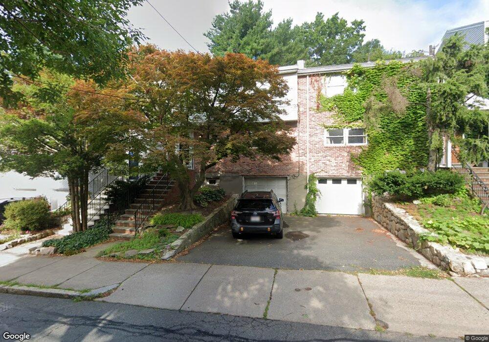
216 Kent St Brookline, MA 02446
Coolidge Corner NeighborhoodEstimated Value: $1,299,000 - $1,882,000
3
Beds
3
Baths
1,485
Sq Ft
$1,024/Sq Ft
Est. Value
About This Home
This home is located at 216 Kent St, Brookline, MA 02446 and is currently estimated at $1,520,229, approximately $1,023 per square foot. 216 Kent St is a home located in Norfolk County with nearby schools including Amos A. Lawrence School, Brookline High School, and St. Mary of the Assumption Elementary School.
Ownership History
Date
Name
Owned For
Owner Type
Purchase Details
Closed on
Sep 27, 2020
Sold by
Steinberg Rick and Steinberg Leslie
Bought by
Steinberg Ft
Current Estimated Value
Purchase Details
Closed on
Oct 1, 1996
Sold by
Roytman Anatoly and Roytman Katya
Bought by
Steinberg Rick and Steinberg Leslie
Home Financials for this Owner
Home Financials are based on the most recent Mortgage that was taken out on this home.
Original Mortgage
$270,000
Interest Rate
7.83%
Mortgage Type
Purchase Money Mortgage
Purchase Details
Closed on
Jun 28, 1994
Sold by
Melendez Josefina
Bought by
Roytman Anatoly and Roytman Katya
Home Financials for this Owner
Home Financials are based on the most recent Mortgage that was taken out on this home.
Original Mortgage
$200,000
Interest Rate
8.74%
Mortgage Type
Purchase Money Mortgage
Create a Home Valuation Report for This Property
The Home Valuation Report is an in-depth analysis detailing your home's value as well as a comparison with similar homes in the area
Home Values in the Area
Average Home Value in this Area
Purchase History
| Date | Buyer | Sale Price | Title Company |
|---|---|---|---|
| Steinberg Ft | -- | None Available | |
| Steinberg Rick | $300,000 | -- | |
| Roytman Anatoly | $250,000 | -- |
Source: Public Records
Mortgage History
| Date | Status | Borrower | Loan Amount |
|---|---|---|---|
| Previous Owner | Roytman Anatoly | $64,000 | |
| Previous Owner | Roytman Anatoly | $267,000 | |
| Previous Owner | Roytman Anatoly | $270,000 | |
| Previous Owner | Roytman Anatoly | $200,000 |
Source: Public Records
Tax History
| Year | Tax Paid | Tax Assessment Tax Assessment Total Assessment is a certain percentage of the fair market value that is determined by local assessors to be the total taxable value of land and additions on the property. | Land | Improvement |
|---|---|---|---|---|
| 2025 | $14,430 | $1,462,000 | $1,063,600 | $398,400 |
| 2024 | $13,746 | $1,407,000 | $1,022,700 | $384,300 |
| 2023 | $12,449 | $1,248,600 | $844,400 | $404,200 |
| 2022 | $12,116 | $1,189,000 | $804,100 | $384,900 |
| 2021 | $11,204 | $1,143,300 | $773,200 | $370,100 |
| 2020 | $10,093 | $1,068,000 | $703,000 | $365,000 |
| 2019 | $9,530 | $1,017,100 | $669,500 | $347,600 |
| 2018 | $8,017 | $847,500 | $519,200 | $328,300 |
| 2017 | $7,899 | $799,500 | $489,800 | $309,700 |
| 2016 | $7,786 | $747,200 | $457,700 | $289,500 |
| 2015 | $7,042 | $659,400 | $388,900 | $270,500 |
| 2014 | $7,178 | $630,200 | $353,500 | $276,700 |
Source: Public Records
Map
Nearby Homes
- 15 Kent Square
- 15 Francis St Unit 16
- 65 Francis St Unit A
- 61 Toxteth St
- 216 Aspinwall Ave
- 216 Aspinwall Ave Unit 3
- 81 Francis St Unit 2
- 20 Chapel St Unit B811
- 20 Chapel St Unit A703
- 6 Parkway Rd Unit 6
- 57 Saint Paul St Unit 19
- 131 Sewall Ave Unit 61
- 37 Saint Paul St Unit 3
- 80 Fenwood Rd Unit 706
- 106 Brook St
- 60 Longwood Ave Unit 802
- 60 Longwood Ave Unit 307
- 100 Sewall Ave Unit 5
- 45 Longwood Ave Unit 712
- 45 Longwood Ave Unit 812
- 216 Kent St Unit 15
- 216 Kent St Unit 23
- 216 Kent St Unit 22
- 216 Kent St Unit 28
- 216 Kent St Unit 12
- 218 Kent St
- 218 Kent St Unit 4
- 218 Kent St Unit 24
- 218 Kent St Unit 21
- 218 Kent St Unit 16
- 218 Kent St
- 218 Kent St Unit 28
- 214 Kent St Unit 44
- 214 Kent St Unit 24
- 214 Kent St Unit 3
- 214 Kent St Unit 214
- 220 Kent St
- 220 Kent St Unit 1
- 212 Kent St
- 212 Kent St Unit 23
Your Personal Tour Guide
Ask me questions while you tour the home.