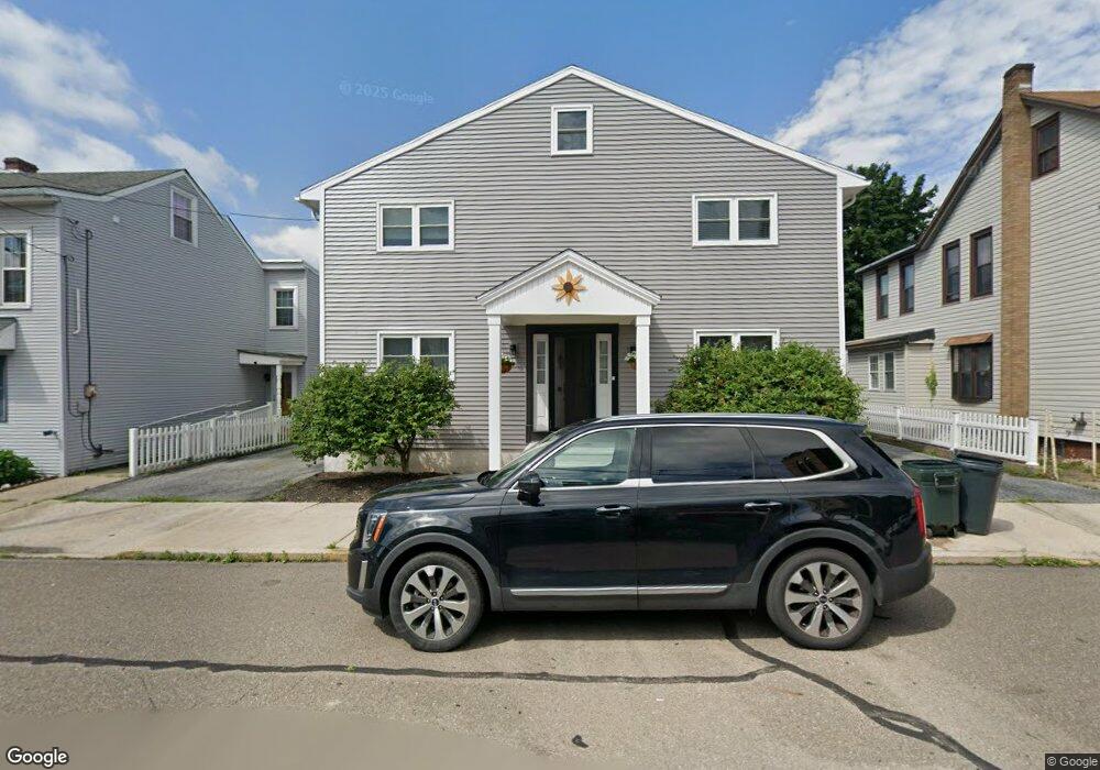
216 N Mill St Saint Clair, PA 17970
Estimated Value: $201,000 - $370,000
3
Beds
4
Baths
3,342
Sq Ft
$82/Sq Ft
Est. Value
About This Home
This home is located at 216 N Mill St, Saint Clair, PA 17970 and is currently estimated at $272,513, approximately $81 per square foot. 216 N Mill St is a home located in Schuylkill County with nearby schools including Saint Clair Area Elementary/Middle School, Gillingham Charter School, and ASSUMPTION BVM SCHOOL.
Ownership History
Date
Name
Owned For
Owner Type
Purchase Details
Closed on
Dec 23, 2019
Sold by
Most Reverend Alfred A Schiert D D J C L
Bought by
Actors Guild Of Schuylkill Co Inc
Current Estimated Value
Purchase Details
Closed on
Jun 18, 2010
Sold by
Dd John O Barres Std Jcl
Bought by
Smulligan Charles A and Smulligan Leeann E
Home Financials for this Owner
Home Financials are based on the most recent Mortgage that was taken out on this home.
Original Mortgage
$118,750
Interest Rate
4.88%
Mortgage Type
New Conventional
Create a Home Valuation Report for This Property
The Home Valuation Report is an in-depth analysis detailing your home's value as well as a comparison with similar homes in the area
Home Values in the Area
Average Home Value in this Area
Purchase History
| Date | Buyer | Sale Price | Title Company |
|---|---|---|---|
| Actors Guild Of Schuylkill Co Inc | $10,000 | None Available | |
| Smulligan Charles A | $125,000 | None Available |
Source: Public Records
Mortgage History
| Date | Status | Borrower | Loan Amount |
|---|---|---|---|
| Previous Owner | Smulligan Charles A | $118,750 |
Source: Public Records
Tax History Compared to Growth
Tax History
| Year | Tax Paid | Tax Assessment Tax Assessment Total Assessment is a certain percentage of the fair market value that is determined by local assessors to be the total taxable value of land and additions on the property. | Land | Improvement |
|---|---|---|---|---|
| 2025 | $3,317 | $50,440 | $5,550 | $44,890 |
| 2024 | $3,103 | $50,440 | $5,550 | $44,890 |
| 2023 | $2,952 | $50,440 | $5,550 | $44,890 |
| 2022 | $2,952 | $50,440 | $5,550 | $44,890 |
| 2021 | $2,982 | $50,440 | $5,550 | $44,890 |
| 2020 | $2,982 | $50,440 | $5,550 | $44,890 |
| 2018 | $2,920 | $50,440 | $5,550 | $44,890 |
| 2017 | $2,807 | $50,440 | $5,550 | $44,890 |
| 2015 | -- | $50,440 | $5,550 | $44,890 |
| 2011 | -- | $50,440 | $0 | $0 |
Source: Public Records
Map
Nearby Homes
- 320 S Mill St
- 219 S 3rd St
- 101 S 2nd St
- 438 S Front St
- 122 S 3rd St
- 32 S Front St
- 20 S 2nd St
- 48 N 2nd St
- Lot 30 Elmwood Ct
- 144 N Mill St
- 0 - Lot 10 Elmwood Ct Unit 10
- 0 Caroline Ave Unit PASK2022658
- 225 Cherry St
- 108 Cherry St
- 702 & 698 Port Carbon St Clair Hwy
- 311 Broad St
- 212 Broad St
- 665 Port Carbon Saint Clair Hwy
- 309 Chestnut St
- 145 Chamberlaine Ave
- 212 S Mill St
- 234 S Mill St
- 222 S Mill St
- 208 S Mill St
- 216 S Mill St
- 206 S Mill St
- 204 S Mill St
- 204 N Mill St
- 114 E Railroad St
- 232 S Mill St
- 234 N Mill St
- 236 S Mill St
- 106 E Railroad St
- 105 E Patterson St
- 211 N Mill St
- 119 E Railroad St Unit 121
- 129 E Railroad St
- 145 N Mill St
- 143 N Mill St
- 143 N Mill St