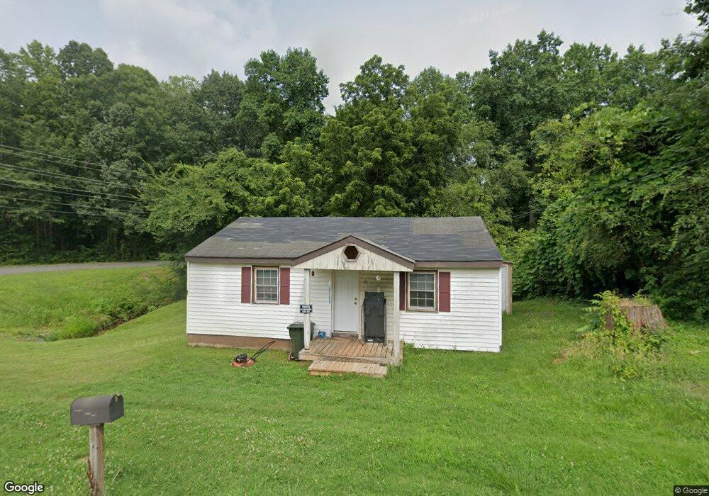
216 N Sims St Kings Mountain, NC 28086
Estimated Value: $135,000 - $211,000
--
Bed
--
Bath
768
Sq Ft
$208/Sq Ft
Est. Value
About This Home
This home is located at 216 N Sims St, Kings Mountain, NC 28086 and is currently estimated at $160,044, approximately $208 per square foot. 216 N Sims St is a home located in Cleveland County with nearby schools including North Elementary School, Kings Mountain Middle, and Kings Mountain Intermediate School.
Ownership History
Date
Name
Owned For
Owner Type
Purchase Details
Closed on
Mar 31, 2009
Sold by
Hopper Donia B Goforth and Hopper Stacy Lee
Bought by
Heritage Builders & Developers Llc
Current Estimated Value
Home Financials for this Owner
Home Financials are based on the most recent Mortgage that was taken out on this home.
Original Mortgage
$28,900
Interest Rate
5.13%
Mortgage Type
Purchase Money Mortgage
Purchase Details
Closed on
Jul 10, 2008
Sold by
Goforth Donna M
Bought by
Hopper Donia B Goforth
Create a Home Valuation Report for This Property
The Home Valuation Report is an in-depth analysis detailing your home's value as well as a comparison with similar homes in the area
Home Values in the Area
Average Home Value in this Area
Purchase History
| Date | Buyer | Sale Price | Title Company |
|---|---|---|---|
| Heritage Builders & Developers Llc | $28,000 | None Available | |
| Hopper Donia B Goforth | -- | None Available |
Source: Public Records
Mortgage History
| Date | Status | Borrower | Loan Amount |
|---|---|---|---|
| Closed | Heritage Builders & Developers Llc | $28,900 |
Source: Public Records
Tax History Compared to Growth
Tax History
| Year | Tax Paid | Tax Assessment Tax Assessment Total Assessment is a certain percentage of the fair market value that is determined by local assessors to be the total taxable value of land and additions on the property. | Land | Improvement |
|---|---|---|---|---|
| 2025 | $802 | $78,200 | $23,735 | $54,465 |
| 2024 | $655 | $53,970 | $18,988 | $34,982 |
| 2023 | $552 | $53,970 | $18,988 | $34,982 |
| 2022 | $623 | $53,819 | $18,988 | $34,831 |
| 2021 | $626 | $53,819 | $18,988 | $34,831 |
| 2020 | $560 | $46,781 | $14,715 | $32,066 |
| 2019 | $560 | $46,781 | $14,715 | $32,066 |
| 2018 | $559 | $46,781 | $14,715 | $32,066 |
| 2017 | $556 | $46,781 | $14,715 | $32,066 |
| 2016 | $557 | $46,781 | $14,715 | $32,066 |
| 2015 | $468 | $40,161 | $10,918 | $29,243 |
| 2014 | $468 | $40,161 | $10,918 | $29,243 |
Source: Public Records
Map
Nearby Homes
- 300 N Watterson St
- 310 Campbell Cir
- 106 N Tracy St
- 522 Waco Rd
- 811 W Gold St Unit 26
- 524 Waco Rd
- 207 Morris St
- 312 Fulton St
- 400 S Cansler St
- 316 S Cansler St
- 300 Fulton St
- 208 Victoria Cir
- 116 Walker St
- 5066 Beargrass Dr
- 442 Phifer Rd
- 200 E Gold St
- 411 S Battleground Ave
- 109 Fulton St Unit 9
- 110 N Gaston St
- 104 Edison St