Estimated Value: $708,000 - $928,000
3
Beds
2
Baths
1,267
Sq Ft
$633/Sq Ft
Est. Value
About This Home
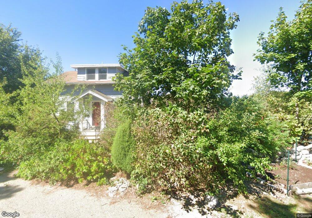
This home is located at 216 N Truro St, Hull, MA 02045 and is currently estimated at $801,702, approximately $632 per square foot. 216 N Truro St is a home located in Plymouth County with nearby schools including Lillian M. Jacobs Elementary School, Memorial Middle School, and Hull High School.
Ownership History
Date
Name
Owned For
Owner Type
Purchase Details
Closed on
Oct 25, 2013
Sold by
Muir Andrew R and Muir Eileen J
Bought by
Muir Clive A
Current Estimated Value
Home Financials for this Owner
Home Financials are based on the most recent Mortgage that was taken out on this home.
Original Mortgage
$330,000
Outstanding Balance
$238,122
Interest Rate
4.56%
Mortgage Type
New Conventional
Estimated Equity
$563,580
Purchase Details
Closed on
May 16, 2000
Sold by
Cox Richard T
Bought by
Muir Eileen J and Muir Andrew R
Create a Home Valuation Report for This Property
The Home Valuation Report is an in-depth analysis detailing your home's value as well as a comparison with similar homes in the area
Home Values in the Area
Average Home Value in this Area
Purchase History
| Date | Buyer | Sale Price | Title Company |
|---|---|---|---|
| Muir Clive A | $330,000 | -- | |
| Muir Eileen J | $265,000 | -- |
Source: Public Records
Mortgage History
| Date | Status | Borrower | Loan Amount |
|---|---|---|---|
| Open | Muir Clive A | $330,000 | |
| Previous Owner | Muir Eileen J | $20,000 |
Source: Public Records
Tax History Compared to Growth
Tax History
| Year | Tax Paid | Tax Assessment Tax Assessment Total Assessment is a certain percentage of the fair market value that is determined by local assessors to be the total taxable value of land and additions on the property. | Land | Improvement |
|---|---|---|---|---|
| 2025 | $7,796 | $696,100 | $477,400 | $218,700 |
| 2024 | $7,207 | $618,600 | $443,000 | $175,600 |
| 2023 | $7,098 | $583,200 | $427,700 | $155,500 |
| 2022 | $6,927 | $552,400 | $404,800 | $147,600 |
| 2021 | $6,637 | $523,400 | $381,900 | $141,500 |
| 2020 | $6,477 | $505,200 | $366,700 | $138,500 |
| 2019 | $5,879 | $450,500 | $320,800 | $129,700 |
| 2018 | $5,867 | $437,200 | $320,800 | $116,400 |
| 2017 | $5,878 | $428,400 | $320,800 | $107,600 |
| 2016 | $5,775 | $428,400 | $320,800 | $107,600 |
| 2015 | $5,120 | $367,300 | $259,700 | $107,600 |
| 2014 | $5,094 | $367,300 | $259,700 | $107,600 |
Source: Public Records
Map
Nearby Homes
- 61 Barnstable Rd
- 67 Hampton Cir
- 14 Standish Rd
- 92 Hampton Cir
- 134 Hampton Cir
- 15 Lincoln Ave
- 40 Rockaway Ave
- 23 Wyola Rd
- 15 Park Ave Unit 307
- 10 Sagamore Terrace
- 8 Evergreen Ln
- 22 Berkley Rd Unit C
- 22 Berkley Rd Unit B
- 19 Berkley Rd
- LOT 1B Rockland St
- 4 Atherton Rd
- 155 Nantasket Ave Unit B402
- 7 Cliff Rd
- 101 Rockland St
- 120 Nantasket Ave Unit 304