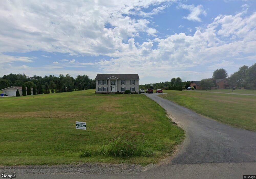
216 Shields Rd Slippery Rock, PA 16057
Mercer Township NeighborhoodEstimated Value: $305,000 - $422,000
3
Beds
2
Baths
1,509
Sq Ft
$237/Sq Ft
Est. Value
About This Home
This home is located at 216 Shields Rd, Slippery Rock, PA 16057 and is currently estimated at $357,628, approximately $236 per square foot. 216 Shields Rd is a home located in Butler County with nearby schools including Slippery Rock Area High School.
Ownership History
Date
Name
Owned For
Owner Type
Purchase Details
Closed on
Sep 30, 2008
Sold by
Bercury Homes Ltd
Bought by
Hindman Wendy S
Current Estimated Value
Home Financials for this Owner
Home Financials are based on the most recent Mortgage that was taken out on this home.
Original Mortgage
$186,505
Interest Rate
6.43%
Mortgage Type
FHA
Purchase Details
Closed on
Mar 24, 2008
Sold by
Hanna Roger D
Bought by
Bercury Homes Ltd
Purchase Details
Closed on
Feb 14, 2008
Sold by
Vandyke Ronald D
Bought by
Hanna Roger D
Create a Home Valuation Report for This Property
The Home Valuation Report is an in-depth analysis detailing your home's value as well as a comparison with similar homes in the area
Home Values in the Area
Average Home Value in this Area
Purchase History
| Date | Buyer | Sale Price | Title Company |
|---|---|---|---|
| Hindman Wendy S | $189,900 | -- | |
| Bercury Homes Ltd | $21,000 | -- | |
| Hanna Roger D | -- | -- |
Source: Public Records
Mortgage History
| Date | Status | Borrower | Loan Amount |
|---|---|---|---|
| Previous Owner | Hindman Wendy S | $186,505 |
Source: Public Records
Tax History Compared to Growth
Tax History
| Year | Tax Paid | Tax Assessment Tax Assessment Total Assessment is a certain percentage of the fair market value that is determined by local assessors to be the total taxable value of land and additions on the property. | Land | Improvement |
|---|---|---|---|---|
| 2025 | $3,612 | $24,870 | $1,180 | $23,690 |
| 2024 | $3,469 | $24,870 | $1,180 | $23,690 |
| 2023 | $3,407 | $24,870 | $1,180 | $23,690 |
| 2022 | $3,332 | $24,870 | $1,180 | $23,690 |
| 2021 | $3,332 | $24,870 | $0 | $0 |
| 2020 | $3,332 | $24,870 | $1,180 | $23,690 |
| 2019 | $3,284 | $24,870 | $1,180 | $23,690 |
| 2018 | $3,284 | $24,870 | $1,180 | $23,690 |
| 2017 | $3,259 | $24,870 | $1,180 | $23,690 |
| 2016 | $942 | $24,870 | $1,180 | $23,690 |
| 2015 | $504 | $24,870 | $1,180 | $23,690 |
| 2014 | $504 | $24,870 | $1,180 | $23,690 |
Source: Public Records
Map
Nearby Homes
- 224 Boyers Rd
- --- Pink Rd
- 0 Browntown Rd
- 117 Saloom Ln
- 216 Edna St
- 0 Frampton Rd Unit 1707752
- 0 Camp Ground Rd
- 3256 William Flynn Hwy
- 464 Franklin St
- 217 Normal Ave
- 121 Parklane Dr
- 323 Franklin St
- 137 Arlington Dr
- 240 Normal Ave
- 000 E Water St
- 311 Center St
- 250 E Water St
- 88 Fleming Rd
- 108 Oak St
- 230 E Water St
- 212 Shields Rd
- 218 Shields Rd
- 204 Shields Rd
- 200 Shields Rd
- 120 Crystal Ln
- 138 Shields Rd
- 4101 William Flynn Hwy
- 4101 William Flynn Hwy
- 118 Shields Rd
- 4126 William Flynn Hwy
- 4121 William Flynn Hwy
- 4107 William Flynn Hwy
- 4140 William Flynn Hwy
- 4058 William Flynn Hwy
- 4119 William Flynn Hwy
- 123 Shields Rd
- 4067 William Flynn Hwy
- 4051 William Flynn Hwy
- 4065 William Flynn Hwy
- 4128 William Flynn Hwy