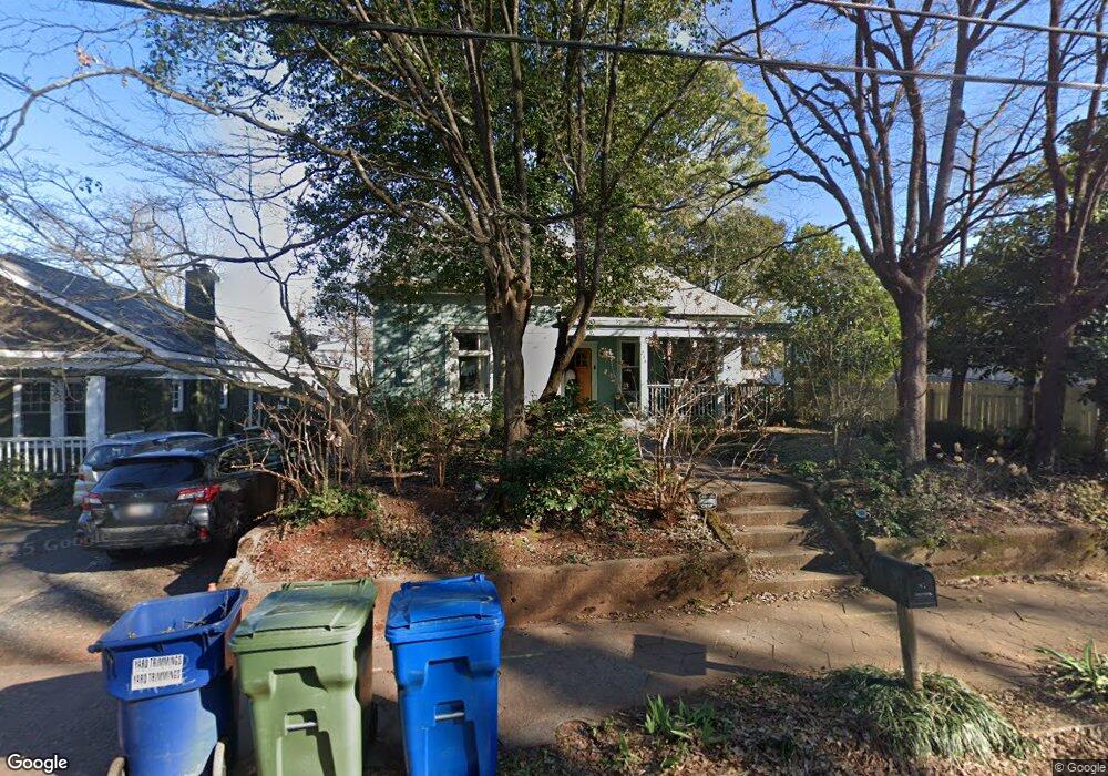
216 Stovall St SE Atlanta, GA 30316
Reynoldstown NeighborhoodEstimated Value: $501,261 - $592,000
2
Beds
1
Bath
1,295
Sq Ft
$424/Sq Ft
Est. Value
About This Home
This home is located at 216 Stovall St SE, Atlanta, GA 30316 and is currently estimated at $548,815, approximately $423 per square foot. 216 Stovall St SE is a home located in Fulton County with nearby schools including Burgess-Peterson Elementary School, King Middle School, and Maynard Holbrook Jackson High School.
Ownership History
Date
Name
Owned For
Owner Type
Purchase Details
Closed on
Jul 29, 1998
Sold by
Merlino Frank
Bought by
Wells Susan E
Current Estimated Value
Home Financials for this Owner
Home Financials are based on the most recent Mortgage that was taken out on this home.
Original Mortgage
$86,642
Outstanding Balance
$18,138
Interest Rate
6.96%
Mortgage Type
New Conventional
Estimated Equity
$530,677
Purchase Details
Closed on
Aug 3, 1993
Sold by
Johnson Robert
Bought by
Schofield David
Create a Home Valuation Report for This Property
The Home Valuation Report is an in-depth analysis detailing your home's value as well as a comparison with similar homes in the area
Home Values in the Area
Average Home Value in this Area
Purchase History
| Date | Buyer | Sale Price | Title Company |
|---|---|---|---|
| Wells Susan E | $64,000 | -- | |
| Schofield David | $11,000 | -- |
Source: Public Records
Mortgage History
| Date | Status | Borrower | Loan Amount |
|---|---|---|---|
| Open | Wells Susan E | $86,642 |
Source: Public Records
Tax History Compared to Growth
Tax History
| Year | Tax Paid | Tax Assessment Tax Assessment Total Assessment is a certain percentage of the fair market value that is determined by local assessors to be the total taxable value of land and additions on the property. | Land | Improvement |
|---|---|---|---|---|
| 2025 | $3,485 | $180,280 | $96,960 | $83,320 |
| 2023 | $7,672 | $185,320 | $96,960 | $88,360 |
| 2022 | $3,511 | $169,320 | $84,040 | $85,280 |
| 2021 | $3,459 | $167,320 | $104,240 | $63,080 |
| 2020 | $2,373 | $119,800 | $65,440 | $54,360 |
| 2019 | $485 | $117,680 | $64,280 | $53,400 |
| 2018 | $3,110 | $114,880 | $62,760 | $52,120 |
| 2017 | $1,239 | $57,480 | $23,520 | $33,960 |
| 2016 | $385 | $37,680 | $23,520 | $14,160 |
| 2015 | $858 | $37,680 | $23,520 | $14,160 |
| 2014 | $398 | $37,680 | $23,520 | $14,160 |
Source: Public Records
Map
Nearby Homes
- 211 Wilbur Ave SE Unit A
- 242 Wilbur Ave SE
- 952 Northern Ave SE
- 313 Stovall St SE
- 219 Howell Dr SE Unit A
- 183 Cleveland St SE Unit B
- 333 Stovall St SE
- 919 Hughley Cir SE Unit 72
- 920 Memorial Dr SE Unit 35
- 924 Hughley Cir SE Unit 11
- 924 Hughley Cir SE Unit 82
- 924 Hughley Cir SE Unit 84
- 920 Hughley Cir SE Unit 76
- 921 Hughley Cir SE Unit 66
- 924 Hughley Cir SE Unit 12
- 946 Hughley Cir SE
- 924 Hughley Cir SE Unit 85
- 352 Gibson St SE
- 922 Hughley Cirlce Unit 81
- 127 Stein Steel St SE Unit 112
- 210 Stovall St SE
- 206 Stovall St SE
- 230 Stovall St SE
- 200 Stovall St SE
- 209 Wilbur Ave SE Unit B
- 209 Wilbur Ave SE Unit A
- 209 Wilbur Ave SE
- 211 Wilbur Ave SE
- 194 Stovall St SE
- 194 Stovall St SE Unit SE
- 227 Wilbur Ave SE
- 205 Wilbur Ave SE Unit B
- 205 Wilbur Ave SE Unit A
- 205 Wilbur Ave SE
- 205 Wilbur Ave SE
- 205 Stovall St SE
- 215 Stovall St SE
- 219 Stovall St SE
- 982 Northern Ave SE
- 209 Stovall St SE