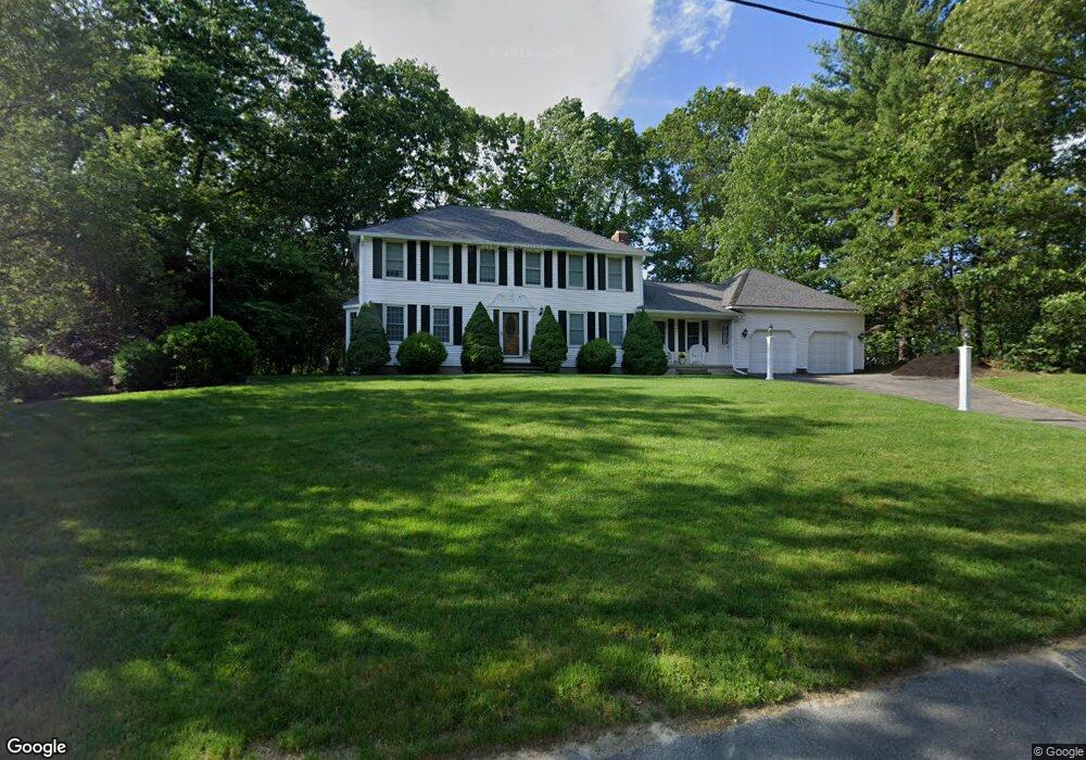
216 Trout Brook Rd Dracut, MA 01826
Estimated Value: $728,680 - $832,000
4
Beds
2
Baths
2,442
Sq Ft
$323/Sq Ft
Est. Value
About This Home
This home is located at 216 Trout Brook Rd, Dracut, MA 01826 and is currently estimated at $789,170, approximately $323 per square foot. 216 Trout Brook Rd is a home located in Middlesex County with nearby schools including Joseph A. Campbell Elementary School, Richardson Middle School, and Dracut Senior High School.
Ownership History
Date
Name
Owned For
Owner Type
Purchase Details
Closed on
Sep 26, 2019
Sold by
Durkin Thomas J and Durkin Kathleen A
Bought by
Durkin Ft 2019
Current Estimated Value
Purchase Details
Closed on
Sep 1, 1983
Bought by
Durkin Thomas J
Create a Home Valuation Report for This Property
The Home Valuation Report is an in-depth analysis detailing your home's value as well as a comparison with similar homes in the area
Home Values in the Area
Average Home Value in this Area
Purchase History
| Date | Buyer | Sale Price | Title Company |
|---|---|---|---|
| Durkin Ft 2019 | -- | -- | |
| Durkin Thomas J | $96,800 | -- |
Source: Public Records
Mortgage History
| Date | Status | Borrower | Loan Amount |
|---|---|---|---|
| Previous Owner | Durkin Thomas J | $286,500 | |
| Previous Owner | Durkin Thomas J | $9,500 | |
| Previous Owner | Durkin Thomas J | $235,000 |
Source: Public Records
Tax History Compared to Growth
Tax History
| Year | Tax Paid | Tax Assessment Tax Assessment Total Assessment is a certain percentage of the fair market value that is determined by local assessors to be the total taxable value of land and additions on the property. | Land | Improvement |
|---|---|---|---|---|
| 2025 | $7,043 | $695,900 | $228,300 | $467,600 |
| 2024 | $6,798 | $650,500 | $217,600 | $432,900 |
| 2023 | $6,596 | $569,600 | $189,300 | $380,300 |
| 2022 | $6,468 | $526,300 | $172,200 | $354,100 |
| 2021 | $6,397 | $491,700 | $156,300 | $335,400 |
| 2020 | $6,178 | $462,800 | $151,600 | $311,200 |
| 2019 | $5,899 | $429,000 | $144,400 | $284,600 |
| 2018 | $5,895 | $416,900 | $144,400 | $272,500 |
| 2017 | $5,835 | $416,900 | $144,400 | $272,500 |
| 2016 | $5,850 | $394,200 | $145,100 | $249,100 |
| 2015 | $5,626 | $376,800 | $145,100 | $231,700 |
| 2014 | $5,244 | $361,900 | $145,100 | $216,800 |
Source: Public Records
Map
Nearby Homes
- 277 Loon Hill Rd
- 315 Broadway Rd Unit 7
- 241 Broadway Rd Unit 50
- 785 Broadway Rd
- 23 Blackberry Fields Rd
- 109 Meadow Creek Dr
- 12 Hayfield Rd
- 820 Methuen St Unit 820
- 50 Cheever Ave
- 35 Thissell Ave
- 675 Robbins Ave Unit 1
- 4 Hazelwood Ave Unit 12
- 15 Wildwood St Unit B10
- 700 Robbins Ave Unit 6
- 668 Robbins Ave Unit 1
- 40 Arlington Ave
- 1391 Bridge St
- 120 Amesbury St
- 89 Newbury St
- 1572 Bridge St
- 206 Trout Brook Rd
- 226 Trout Brook Rd
- 217 Trout Brook Rd
- 207 Trout Brook Rd
- 196 Trout Brook Rd
- 197 Trout Brook Rd
- 134 Heather Rd
- 121 Heather Rd
- 72 Colonial Dr
- 144 Heather Rd
- 62 Colonial Dr
- 111 Heather Rd
- 186 Trout Brook Rd
- 135 Heather Rd
- 187 Trout Brook Rd
- 54 Colonial Dr
- 154 Heather Rd
- 101 Heather Rd
- 145 Heather Rd
- 69 Colonial Dr