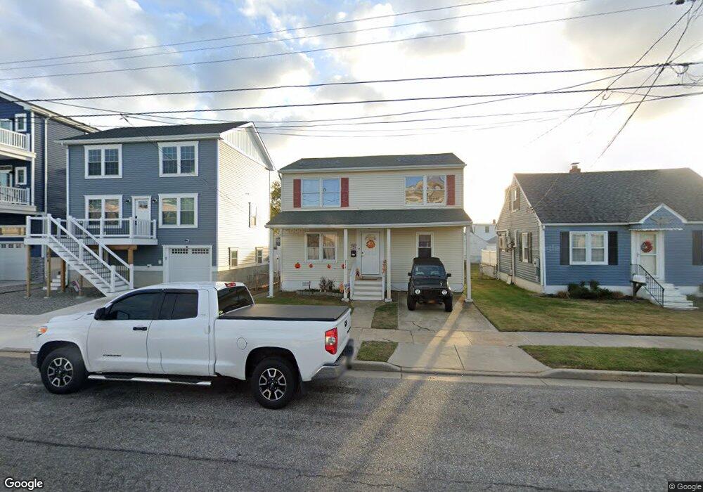
216 W 20th Ave Wildwood, NJ 08260
The Wildwoods NeighborhoodEstimated Value: $661,168 - $1,280,000
--
Bed
--
Bath
1,392
Sq Ft
$611/Sq Ft
Est. Value
About This Home
This home is located at 216 W 20th Ave, Wildwood, NJ 08260 and is currently estimated at $850,542, approximately $611 per square foot. 216 W 20th Ave is a home located in Cape May County with nearby schools including Margaret Mace Elementary School, Wildwood Catholic Academy, and Wildwood Catholic High School.
Ownership History
Date
Name
Owned For
Owner Type
Purchase Details
Closed on
Aug 31, 2023
Sold by
Scott Peter
Bought by
Stone Harbor Real Estate Developers Llc
Current Estimated Value
Purchase Details
Closed on
Dec 23, 2004
Purchase Details
Closed on
Mar 10, 1995
Sold by
Krohn Gary
Bought by
Corsale Alfred and Corsale Agnes
Home Financials for this Owner
Home Financials are based on the most recent Mortgage that was taken out on this home.
Original Mortgage
$105,000
Interest Rate
8.89%
Mortgage Type
VA
Purchase Details
Closed on
Oct 14, 1994
Sold by
Demaio Nicholas
Bought by
Krohn Gary
Create a Home Valuation Report for This Property
The Home Valuation Report is an in-depth analysis detailing your home's value as well as a comparison with similar homes in the area
Home Values in the Area
Average Home Value in this Area
Purchase History
| Date | Buyer | Sale Price | Title Company |
|---|---|---|---|
| Stone Harbor Real Estate Developers Llc | -- | Seaboard Title | |
| Stone Harbor Real Estate Developers Llc | -- | Seaboard Title | |
| -- | $262,100 | -- | |
| Peter Scott | $262,050 | Shore Title Agency Inc | |
| Corsale Alfred | $105,000 | -- | |
| Krohn Gary | $58,900 | -- |
Source: Public Records
Mortgage History
| Date | Status | Borrower | Loan Amount |
|---|---|---|---|
| Previous Owner | Corsale Alfred | $105,000 |
Source: Public Records
Tax History Compared to Growth
Tax History
| Year | Tax Paid | Tax Assessment Tax Assessment Total Assessment is a certain percentage of the fair market value that is determined by local assessors to be the total taxable value of land and additions on the property. | Land | Improvement |
|---|---|---|---|---|
| 2025 | $4,336 | $279,400 | $150,000 | $129,400 |
| 2024 | $4,336 | $279,400 | $150,000 | $129,400 |
| 2023 | $4,244 | $279,400 | $150,000 | $129,400 |
| 2022 | $4,074 | $279,400 | $150,000 | $129,400 |
| 2021 | $3,907 | $279,400 | $150,000 | $129,400 |
| 2020 | $3,775 | $279,400 | $150,000 | $129,400 |
| 2019 | $3,649 | $279,400 | $150,000 | $129,400 |
| 2018 | $3,546 | $279,400 | $150,000 | $129,400 |
| 2017 | $3,470 | $279,400 | $150,000 | $129,400 |
| 2016 | $3,403 | $279,400 | $150,000 | $129,400 |
| 2015 | $3,215 | $285,000 | $160,000 | $125,000 |
| 2014 | $3,138 | $285,000 | $160,000 | $125,000 |
Source: Public Records
Map
Nearby Homes
- 2100 New York Ave
- 102 W 21st Ave
- 223 W 19th Ave
- 103 W 22nd Ave
- 105 W 22nd Ave
- 119 W 20th Ave Unit 119-East
- 1816 New York Ave
- 2213 New York Ave Unit 2213
- 121 W 20th Ave Unit 121-West
- 2211 New York Ave
- 204 W 17th Ave
- 111 E 19th Ave
- 421 W 19th Ave
- 221 W 25th Ave
- 120 E 18th Ave
- 420 W 17th Ave
- 331 W 16th Ave
- 108 E 16th Ave
- 110 E 24th Ave Unit A
- 240 W 26th Ave
- 214 W 20th Ave
- 218 W 20th Ave
- 212 W 20th Ave
- 213 W 21st Ave
- 211 W 21st Ave
- 215 W 21st Ave
- 209 W 21st Ave
- 210 W 20th Ave
- 210 W 20th Ave
- 217 W 21st Ave
- 201 W 20th Ave Unit B
- 203 W 20th Ave Unit A
- 201 W 20th Ave Unit A
- 201 W 20th Ave
- 2001 Delaware Ave Unit 200
- 2001 Delaware Ave Unit 100
- 2001 Delaware Ave Unit 102
- 2001 Delaware Ave Unit 2001
- 207 W 21st Ave
- 208 W 20th Ave