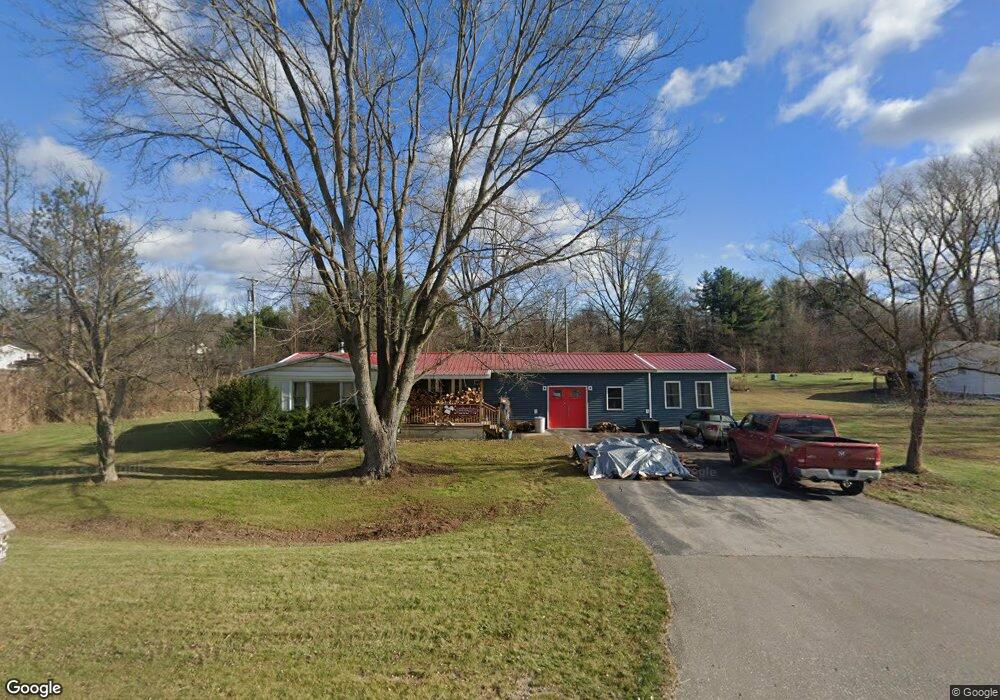
2160 Range Rd Port Huron, MI 48060
Estimated Value: $168,452 - $196,000
2
Beds
1
Bath
999
Sq Ft
$185/Sq Ft
Est. Value
About This Home
This home is located at 2160 Range Rd, Port Huron, MI 48060 and is currently estimated at $184,363, approximately $184 per square foot. 2160 Range Rd is a home located in St. Clair County with nearby schools including Kimball Elementary School, Central Middle School, and Port Huron High School.
Ownership History
Date
Name
Owned For
Owner Type
Purchase Details
Closed on
May 7, 2019
Sold by
Reichwald Joann and Mcginnis Ruth
Bought by
Reichwald Joann and Askin Jaonn Valery
Current Estimated Value
Purchase Details
Closed on
Oct 25, 2018
Sold by
Mcginnis Ruth
Bought by
Joann Mcginnis Ruth and Joann Reichwals
Purchase Details
Closed on
Jan 10, 2014
Sold by
Mcginnis Ruth and Mcginnis Charles Edward
Bought by
Mcginnis Ruth and Mcginnis Charles Edward
Create a Home Valuation Report for This Property
The Home Valuation Report is an in-depth analysis detailing your home's value as well as a comparison with similar homes in the area
Home Values in the Area
Average Home Value in this Area
Purchase History
| Date | Buyer | Sale Price | Title Company |
|---|---|---|---|
| Reichwald Joann | -- | Land Title | |
| Joann Mcginnis Ruth | -- | None Available | |
| Mcginnis Ruth | -- | Huron Title Company |
Source: Public Records
Tax History
| Year | Tax Paid | Tax Assessment Tax Assessment Total Assessment is a certain percentage of the fair market value that is determined by local assessors to be the total taxable value of land and additions on the property. | Land | Improvement |
|---|---|---|---|---|
| 2025 | $691 | $75,600 | $0 | $0 |
| 2024 | $671 | $77,600 | $0 | $0 |
| 2023 | $619 | $71,300 | $0 | $0 |
| 2022 | $1,254 | $59,500 | $0 | $0 |
| 2020 | $1,166 | $49,900 | $49,900 | $0 |
| 2019 | $1,151 | $42,000 | $0 | $0 |
| 2018 | $1,131 | $42,000 | $0 | $0 |
| 2017 | $1,113 | $34,300 | $0 | $0 |
| 2016 | $508 | $34,300 | $0 | $0 |
| 2015 | -- | $30,900 | $30,900 | $0 |
| 2014 | -- | $29,100 | $29,100 | $0 |
| 2013 | -- | $28,200 | $0 | $0 |
Source: Public Records
Map
Nearby Homes
- 0000 Range Rd
- 0 Wall Rd Unit 50185999
- 00 Howard Rd
- 4380 Lapeer Rd
- 1405 Range Rd
- 0 Lapeer Rd Unit 50137357
- 1786 Omar Rd
- 0 Allen Rd Unit 20250008597
- 0 Allen Rd Unit 20250008612
- 00 Range Rd
- V/L Allen
- 4911 Castlewood Dr
- 1604 Allen Rd
- 3101 Range Rd
- 265 Westbrook Ct
- 3255 Harrington Rd
- 0000 W Water St
- 4459 Cambridge Dr
- 3115 Spruce Dr
- 174 Meadow Ln
Your Personal Tour Guide
Ask me questions while you tour the home.