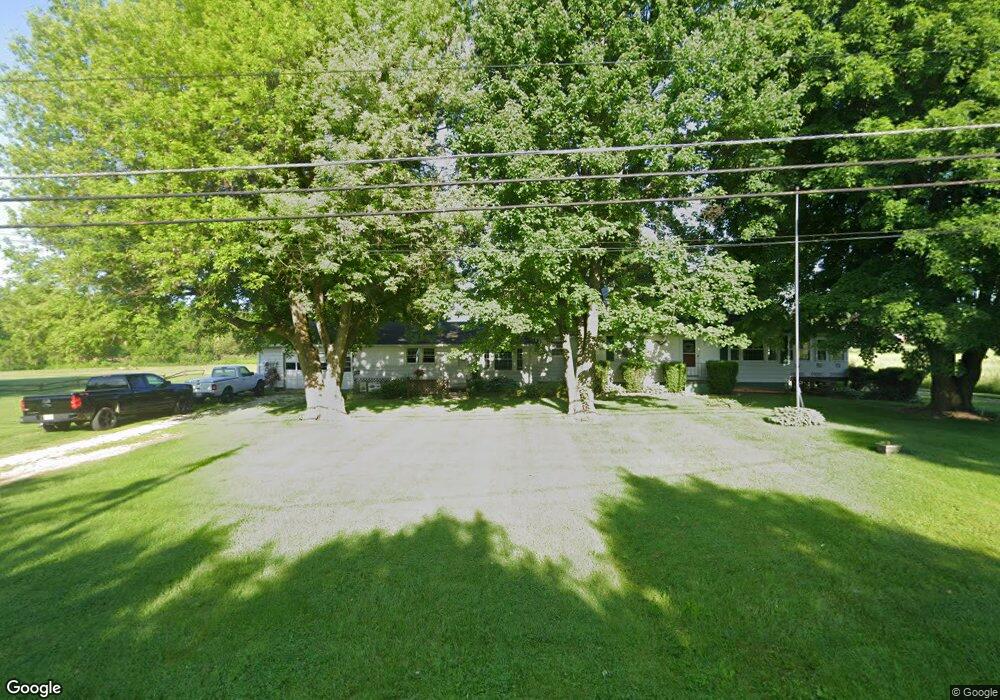
2161 Kenyon Ave NW Massillon, OH 44647
Amherst Heights-Clearview NeighborhoodEstimated Value: $194,000 - $302,000
5
Beds
2
Baths
2,132
Sq Ft
$123/Sq Ft
Est. Value
About This Home
This home is located at 2161 Kenyon Ave NW, Massillon, OH 44647 and is currently estimated at $262,082, approximately $122 per square foot. 2161 Kenyon Ave NW is a home located in Stark County with nearby schools including Tuslaw Elementary School, Tuslaw Middle School, and Tuslaw High School.
Ownership History
Date
Name
Owned For
Owner Type
Purchase Details
Closed on
May 8, 2024
Sold by
Nodo Samuel R and Nodo Jody
Bought by
Wolfe James D and Wolfe Amelia J
Current Estimated Value
Home Financials for this Owner
Home Financials are based on the most recent Mortgage that was taken out on this home.
Original Mortgage
$145,000
Outstanding Balance
$142,932
Interest Rate
6.79%
Mortgage Type
New Conventional
Estimated Equity
$119,150
Purchase Details
Closed on
May 13, 2003
Sold by
Estate Of Lura J Nodo
Bought by
Nodo Samuel R
Create a Home Valuation Report for This Property
The Home Valuation Report is an in-depth analysis detailing your home's value as well as a comparison with similar homes in the area
Home Values in the Area
Average Home Value in this Area
Purchase History
| Date | Buyer | Sale Price | Title Company |
|---|---|---|---|
| Wolfe James D | $185,000 | None Listed On Document | |
| Nodo Samuel R | -- | -- |
Source: Public Records
Mortgage History
| Date | Status | Borrower | Loan Amount |
|---|---|---|---|
| Open | Wolfe James D | $145,000 |
Source: Public Records
Tax History Compared to Growth
Tax History
| Year | Tax Paid | Tax Assessment Tax Assessment Total Assessment is a certain percentage of the fair market value that is determined by local assessors to be the total taxable value of land and additions on the property. | Land | Improvement |
|---|---|---|---|---|
| 2025 | -- | $70,880 | $21,810 | $49,070 |
| 2024 | -- | $72,140 | $23,070 | $49,070 |
| 2023 | $2,067 | $61,180 | $17,360 | $43,820 |
| 2022 | $1,041 | $61,180 | $17,360 | $43,820 |
| 2021 | $2,112 | $61,180 | $17,360 | $43,820 |
| 2020 | $1,803 | $50,860 | $14,210 | $36,650 |
| 2019 | $1,743 | $50,860 | $14,210 | $36,650 |
| 2018 | $1,717 | $50,860 | $14,210 | $36,650 |
| 2017 | $1,572 | $45,020 | $12,780 | $32,240 |
| 2016 | $1,403 | $41,100 | $12,780 | $28,320 |
| 2015 | $1,420 | $41,100 | $12,780 | $28,320 |
| 2014 | $1,421 | $39,710 | $12,330 | $27,380 |
| 2013 | $717 | $39,710 | $12,330 | $27,380 |
Source: Public Records
Map
Nearby Homes
- 3610 Kenyon Creek Ave NW
- 3575 Kenyon Creek Ave NW
- 3564 Kenyon Creek Ave NW
- 1783 Heron Creek St NW
- 2636 Kenyon Ave NW
- 4420 Lockhart Cir NW
- 1350 Alpha St NW
- 4745 Sippo Reserves Dr NW
- 1252 Gabrielle Cir NW
- 3069 Castle West Cir NW
- 982 Lanedale St NW
- 3130 Lincoln Way W
- 822 32nd St NW
- 2855 Poplar St NW
- 1220 Ben Fulton Ave NW
- 1174 Manchester Ave SW
- 1173 Manchester Ave SW
- 0 Manchester Ave NW
- 350 Noble Place NW
- 830 Standish Cir NW
- 3680 Silver Creek Cir NW
- 2115 Kenyon Ave NW
- 3683 Silver Creek Cir NW
- 3674 Silver Creek Cir NW
- 3696 Kenyon Creek Ave NW
- 3675 Silver Creek Cir NW
- 50 Kenyon Creek Ave NW
- 30 Kenyon Creek Ave NW
- 28 Kenyon Creek Ave NW
- 3672 Silver Creek Cir NW
- 3676 Kenyon Creek Ave NW
- 3671 Silver Creek Cir NW
- 3668 Silver Creek Cir NW
- 51 Kenyon Creek Ave NW
- 29 Kenyon Creek Ave NW
- 27 Kenyon Creek Ave NW
- TBD Kenyon Creek
- 3675 Kenyon Creek Ave NW
- 3667 Silver Creek Cir NW
- 3658 Kenyon Creek Ave NW