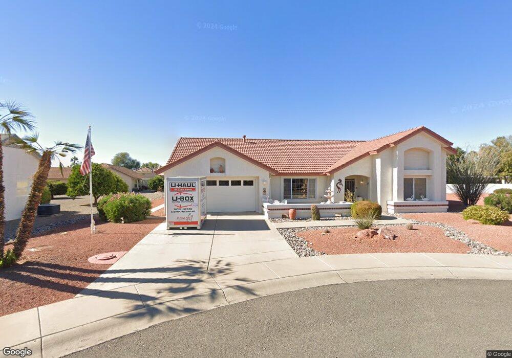
21616 N 141st Dr Sun City West, AZ 85375
Estimated Value: $347,000 - $405,000
--
Bed
2
Baths
1,733
Sq Ft
$216/Sq Ft
Est. Value
About This Home
This home is located at 21616 N 141st Dr, Sun City West, AZ 85375 and is currently estimated at $374,707, approximately $216 per square foot. 21616 N 141st Dr is a home located in Maricopa County with nearby schools including FourteenSix Christian Academy.
Ownership History
Date
Name
Owned For
Owner Type
Purchase Details
Closed on
Jun 20, 2024
Sold by
C Daniel Kohl Trust and Kohl Jeffrey Alan
Bought by
Holden Sharon Margaret
Current Estimated Value
Purchase Details
Closed on
Apr 19, 2024
Sold by
Kohl Jeffrey Alan and Voigt Judith Lynn
Bought by
C Daniel Kohl Trust and Kohl
Purchase Details
Closed on
Mar 29, 2018
Sold by
Kohl C Daniel and Kohl Nancy J
Bought by
Kohl C Daniel and Kohl Nancy J
Purchase Details
Closed on
Jun 14, 2006
Sold by
Kohl C Daniel and Kohl Nancy J
Bought by
Kohl C Daniel and Kohl Nancy J
Home Financials for this Owner
Home Financials are based on the most recent Mortgage that was taken out on this home.
Original Mortgage
$381,900
Interest Rate
6.54%
Mortgage Type
FHA
Create a Home Valuation Report for This Property
The Home Valuation Report is an in-depth analysis detailing your home's value as well as a comparison with similar homes in the area
Home Values in the Area
Average Home Value in this Area
Purchase History
| Date | Buyer | Sale Price | Title Company |
|---|---|---|---|
| Holden Sharon Margaret | $345,000 | None Listed On Document | |
| C Daniel Kohl Trust | -- | None Listed On Document | |
| Kohl C Daniel | -- | None Available | |
| Kohl C Daniel | -- | First American Title | |
| Kohl C Daniel | -- | First American Title |
Source: Public Records
Mortgage History
| Date | Status | Borrower | Loan Amount |
|---|---|---|---|
| Previous Owner | Kohl C Daniel | $381,900 |
Source: Public Records
Tax History Compared to Growth
Tax History
| Year | Tax Paid | Tax Assessment Tax Assessment Total Assessment is a certain percentage of the fair market value that is determined by local assessors to be the total taxable value of land and additions on the property. | Land | Improvement |
|---|---|---|---|---|
| 2025 | $1,828 | $22,739 | -- | -- |
| 2024 | $1,491 | $21,656 | -- | -- |
| 2023 | $1,491 | $29,030 | $5,800 | $23,230 |
| 2022 | $1,396 | $23,650 | $4,730 | $18,920 |
| 2021 | $1,456 | $21,570 | $4,310 | $17,260 |
| 2020 | $1,420 | $20,150 | $4,030 | $16,120 |
| 2019 | $1,391 | $17,780 | $3,550 | $14,230 |
| 2018 | $1,339 | $16,680 | $3,330 | $13,350 |
| 2017 | $1,288 | $15,850 | $3,170 | $12,680 |
| 2016 | $756 | $14,810 | $2,960 | $11,850 |
| 2015 | $1,183 | $13,960 | $2,790 | $11,170 |
Source: Public Records
Map
Nearby Homes
- 14010 W Pavillion Dr
- 14102 W Whitewood Dr
- 21433 N 142nd Dr
- 14133 W Vía Montoya
- 22010 N Mirage Ln
- 22009 N Vía de La Caballa
- 21627 N 139th Dr
- 14117 W Pecos Ln
- 14105 W Sky Hawk Dr Unit 40
- 14307 W Whitewood Dr
- 21606 N Yellowstone Cir
- 14111 W Circle Ridge Dr
- 14123 W Circle Ridge Dr Unit 40
- 13709 W Whitewood Dr
- 14140 W Circle Ridge Dr
- 13718 W Gable Hill Dr
- 14422 W Greystone Dr
- 13711 W Gable Hill Dr
- 13919 W Gable Hill Dr
- 14209 W Territorial Ln
- 21602 N 141st Dr
- 21615 N 142nd Dr
- 21630 N 141st Dr
- 14114 W Pavillion Dr
- 21617 N 142nd Dr
- 21631 N 141st Dr
- 14120 W Pavillion Dr
- 21611 N 142nd Dr
- 21617 N 141st Dr Unit 39
- 21603 N 141st Dr
- 14115 W Pavillion Dr
- 14121 W Pavillion Dr
- 14121 W Parada Dr
- 14117 W Parada Dr
- 14103 W Pavillion Dr
- 21614 N 142nd Dr
- 14126 W Pavillion Dr
- 14125 W Parada Dr
- 14113 W Parada Dr
- 21607 N 142nd Dr