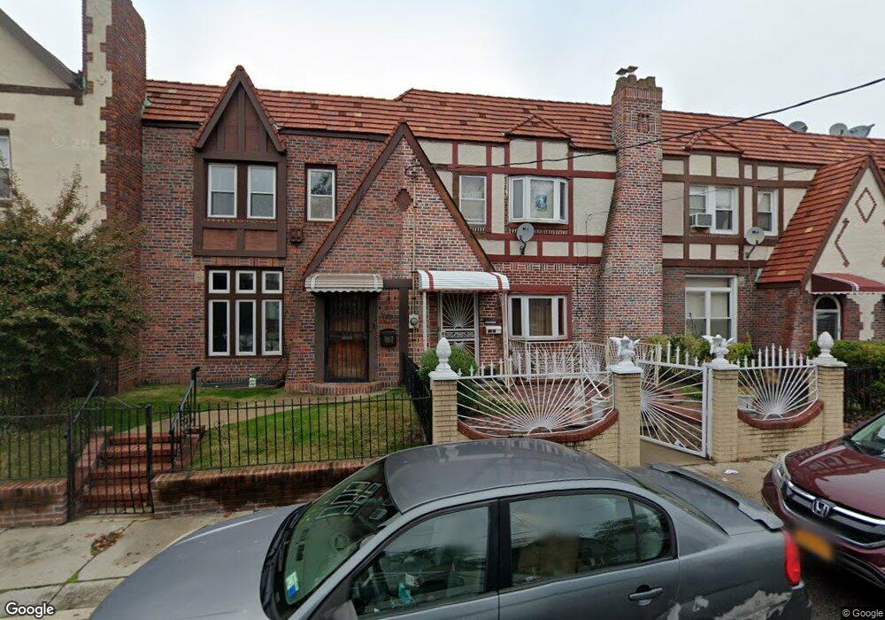
21619 113th Dr Queens Village, NY 11429
Queens Village NeighborhoodEstimated Value: $694,143 - $937,000
--
Bed
--
Bath
1,688
Sq Ft
$475/Sq Ft
Est. Value
About This Home
This home is located at 21619 113th Dr, Queens Village, NY 11429 and is currently estimated at $802,536, approximately $475 per square foot. 21619 113th Dr is a home located in Queens County with nearby schools including P.S./M.S. 147 Ronald Mcnair, I.S. 192 The Linden, and Ss Joachim & Anne School.
Ownership History
Date
Name
Owned For
Owner Type
Purchase Details
Closed on
Sep 24, 1999
Sold by
Antoine Yvana G
Bought by
Diego Charlene D and Hamilton Theodore G
Current Estimated Value
Home Financials for this Owner
Home Financials are based on the most recent Mortgage that was taken out on this home.
Original Mortgage
$192,200
Outstanding Balance
$56,587
Interest Rate
7.73%
Mortgage Type
FHA
Estimated Equity
$745,949
Purchase Details
Closed on
Jun 21, 1994
Sold by
Antoine Astrel G and Antoine Yvanna C
Bought by
Antoine Yvana G
Create a Home Valuation Report for This Property
The Home Valuation Report is an in-depth analysis detailing your home's value as well as a comparison with similar homes in the area
Home Values in the Area
Average Home Value in this Area
Purchase History
| Date | Buyer | Sale Price | Title Company |
|---|---|---|---|
| Diego Charlene D | $198,000 | Prestige Title Agency | |
| Diego Charlene D | $198,000 | Prestige Title Agency | |
| Antoine Yvana G | -- | Commonwealth Land Title Ins | |
| Antoine Yvana G | -- | Commonwealth Land Title Ins |
Source: Public Records
Mortgage History
| Date | Status | Borrower | Loan Amount |
|---|---|---|---|
| Open | Diego Charlene D | $192,200 | |
| Closed | Diego Charlene D | $192,200 |
Source: Public Records
Tax History Compared to Growth
Tax History
| Year | Tax Paid | Tax Assessment Tax Assessment Total Assessment is a certain percentage of the fair market value that is determined by local assessors to be the total taxable value of land and additions on the property. | Land | Improvement |
|---|---|---|---|---|
| 2025 | $6,199 | $32,712 | $9,070 | $23,642 |
| 2024 | $6,199 | $30,862 | $8,848 | $22,014 |
| 2023 | $5,848 | $29,117 | $8,336 | $20,781 |
| 2022 | $5,484 | $38,940 | $12,660 | $26,280 |
| 2021 | $5,781 | $32,820 | $12,660 | $20,160 |
| 2020 | $5,770 | $31,380 | $12,660 | $18,720 |
| 2019 | $5,380 | $29,580 | $12,660 | $16,920 |
| 2018 | $4,946 | $24,264 | $12,103 | $12,161 |
| 2017 | $4,666 | $22,891 | $12,228 | $10,663 |
| 2016 | $4,576 | $22,891 | $12,228 | $10,663 |
| 2015 | $2,385 | $22,717 | $13,190 | $9,527 |
| 2014 | $2,385 | $21,432 | $12,925 | $8,507 |
Source: Public Records
Map
Nearby Homes
- 21531 Murdock Ave
- 113-66 Springfield Blvd
- 214-38 113th Ave
- 21438 112th Rd
- 21739 114th Rd
- 214-10 113th Ave
- 217-39 114th Rd
- 112-29 219th St
- 114-54 212th St
- 115-20 217th St
- 215-28 112th Ave
- 21610 115th Ct
- 21231 113th Ave
- 114-36 220th St
- 215-11 112th Ave
- 114-42 211th St
- 216-04 115th Terrace
- 11419 210th St
- 22117 Murdock Ave
- 11221 212th St
- 21617 113th Dr
- 21615 113th Dr
- 216-31 113th Dr
- 21621 113th Dr
- 21609 113th Dr
- 21623 113th Dr
- 21607 113th Dr
- 21625 113th Dr
- 21605 113th Dr
- 21512 Murdock Ave
- 21514 Murdock Ave
- 21627 113th Dr
- 21516 Murdock Ave
- 11327 Springfield Blvd
- 21603 113th Dr
- 215-12 Murdock Ave
- 21518 Murdock Ave
- 215-14 Murdock Ave
- 21629 113th Dr
- 21520 Murdock Ave