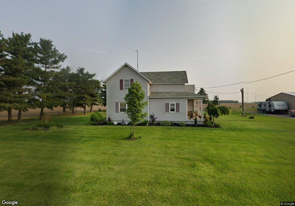
21619 Sterling Rd Delphos, OH 45833
Estimated Value: $168,000 - $223,000
4
Beds
1
Bath
1,996
Sq Ft
$98/Sq Ft
Est. Value
About This Home
This home is located at 21619 Sterling Rd, Delphos, OH 45833 and is currently estimated at $194,642, approximately $97 per square foot. 21619 Sterling Rd is a home located in Van Wert County with nearby schools including Lincolnview Elementary School and Lincolnview Junior/Senior High School.
Ownership History
Date
Name
Owned For
Owner Type
Purchase Details
Closed on
Aug 31, 2021
Sold by
Beair Thomas A
Bought by
Sterling Road Llc
Current Estimated Value
Purchase Details
Closed on
Dec 14, 2020
Sold by
Beair Douglas P and Beair Rick L
Bought by
Beair Thomas A
Purchase Details
Closed on
Oct 7, 2020
Sold by
Estate Of Phyllis M Beair
Bought by
Beair Douglas P and Beair Rick L
Create a Home Valuation Report for This Property
The Home Valuation Report is an in-depth analysis detailing your home's value as well as a comparison with similar homes in the area
Home Values in the Area
Average Home Value in this Area
Purchase History
| Date | Buyer | Sale Price | Title Company |
|---|---|---|---|
| Sterling Road Llc | $99,600 | None Available | |
| Beair Thomas A | -- | None Available | |
| Beair Douglas P | -- | None Available |
Source: Public Records
Tax History Compared to Growth
Tax History
| Year | Tax Paid | Tax Assessment Tax Assessment Total Assessment is a certain percentage of the fair market value that is determined by local assessors to be the total taxable value of land and additions on the property. | Land | Improvement |
|---|---|---|---|---|
| 2024 | $1,496 | $47,380 | $8,030 | $39,350 |
| 2023 | $1,496 | $47,380 | $8,030 | $39,350 |
| 2022 | $1,539 | $35,790 | $6,220 | $29,570 |
| 2021 | $1,119 | $34,850 | $6,220 | $28,630 |
| 2020 | $1,113 | $34,850 | $6,220 | $28,630 |
| 2019 | $925 | $32,000 | $5,380 | $26,620 |
| 2018 | $912 | $32,000 | $5,380 | $26,620 |
| 2017 | $900 | $32,000 | $5,380 | $26,620 |
| 2016 | $666 | $28,340 | $5,380 | $22,960 |
| 2015 | $656 | $28,340 | $5,380 | $22,960 |
| 2014 | $682 | $28,340 | $5,380 | $22,960 |
| 2013 | $818 | $28,340 | $5,380 | $22,960 |
Source: Public Records
Map
Nearby Homes
- 8951 Brickner Rd
- 7510 State Route 66
- 0 Road 24-Q
- 320 Auglaize St
- 0 Heritage Cir Unit 6112034
- 0 Heritage Cir Unit 303239
- 104 W Railroad St
- 112 W Railroad St
- 104 W South St
- TBD Dog Creek Rd
- 604 W 6th St
- 616 W 5th St
- 503 W 6th St
- 409 N Bredeick St
- 810 N Franklin St
- 1303 Carolyn Dr
- 11630 Clearview Dr
- 610 N Washington St
- 704 N Franklin St
- 1220 Rose Anna Dr
- 21452 Sterling Rd
- 21892 Sterling Rd
- 0 Bockey Rd
- 4730 Rd
- 18499 Road 28
- 18023 Road 28
- 21109 Sterling Rd
- 21483 Church Rd
- 21405 Convoy Rd
- - Church
- 18887 Road 28
- 6615 Converse Roselm Rd
- 6408 Converse Roselm Rd
- 18981 Road 28
- 6813 Converse Roselm Rd
- 5765 Adams Rd
- 27758 Road R
- 17733 Road 28
- 7264 Bockey Rd
- 18304 Road 27r