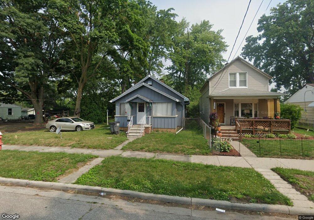
2162 Airline Ave Toledo, OH 43609
Southside NeighborhoodEstimated Value: $57,025 - $89,000
2
Beds
1
Bath
716
Sq Ft
$103/Sq Ft
Est. Value
About This Home
This home is located at 2162 Airline Ave, Toledo, OH 43609 and is currently estimated at $73,756, approximately $103 per square foot. 2162 Airline Ave is a home located in Lucas County with nearby schools including Burroughs Elementary School, Bowsher High School, and Explorers Academy of Science and Technology.
Ownership History
Date
Name
Owned For
Owner Type
Purchase Details
Closed on
Sep 14, 2015
Sold by
Plicinski Michelle L
Bought by
Plicinski Todd M
Current Estimated Value
Purchase Details
Closed on
Nov 9, 2005
Sold by
Westenberg Jane A and Pryba Cornelia Adriana
Bought by
Plicinski Todd M and Plicinski Michelle L
Home Financials for this Owner
Home Financials are based on the most recent Mortgage that was taken out on this home.
Original Mortgage
$56,500
Interest Rate
7.62%
Mortgage Type
Fannie Mae Freddie Mac
Purchase Details
Closed on
May 26, 1998
Sold by
Westenberg Jane A and Westenberg Adriana Maria
Bought by
Westenberg Jane A and Pryda Cornelia Adriana
Create a Home Valuation Report for This Property
The Home Valuation Report is an in-depth analysis detailing your home's value as well as a comparison with similar homes in the area
Home Values in the Area
Average Home Value in this Area
Purchase History
| Date | Buyer | Sale Price | Title Company |
|---|---|---|---|
| Plicinski Todd M | -- | None Available | |
| Plicinski Todd M | $56,500 | Metro Title Agency Inc | |
| Westenberg Jane A | -- | -- |
Source: Public Records
Mortgage History
| Date | Status | Borrower | Loan Amount |
|---|---|---|---|
| Closed | Plicinski Todd M | $56,500 |
Source: Public Records
Tax History Compared to Growth
Tax History
| Year | Tax Paid | Tax Assessment Tax Assessment Total Assessment is a certain percentage of the fair market value that is determined by local assessors to be the total taxable value of land and additions on the property. | Land | Improvement |
|---|---|---|---|---|
| 2024 | $1,003 | $14,280 | $4,340 | $9,940 |
| 2023 | $863 | $12,215 | $3,220 | $8,995 |
| 2022 | $867 | $12,215 | $3,220 | $8,995 |
| 2021 | $884 | $12,215 | $3,220 | $8,995 |
| 2020 | $927 | $11,270 | $2,940 | $8,330 |
| 2019 | $898 | $11,270 | $2,940 | $8,330 |
| 2018 | $915 | $11,270 | $2,940 | $8,330 |
| 2017 | $903 | $11,025 | $2,870 | $8,155 |
| 2016 | $931 | $31,500 | $8,200 | $23,300 |
| 2015 | $925 | $31,500 | $8,200 | $23,300 |
| 2014 | $1,069 | $11,030 | $2,870 | $8,160 |
| 2013 | $713 | $11,030 | $2,870 | $8,160 |
Source: Public Records
Map
Nearby Homes
- 304 Mayberry St
- 321 Mayberry St
- 226 Somerset St
- 221 Somerset St
- 2126 Airport Hwy
- 224 S Fearing Blvd
- 440 Somerset St
- 142 S Detroit Ave
- 556 Apple Ave
- 531 Shasta Dr
- 140 Whiting Ave
- 1754 Finch St
- 512 Woodsdale Ave
- 576 Bronx Dr
- 1777 South Ave
- 649 Wright Ave
- 705 Wright Ave
- 710 Durango Dr
- 2828 South Ave
- 323 Champion St
- 2160 Airline Ave
- 2156 Airline Ave
- 2204 Airline Ave
- 2150 Airline Ave
- 235 Danberry St
- 2144 Airline Ave
- 2210 Airline Ave
- 241 Danberry St
- 2142 Airline Ave
- 2218 Airline Ave
- 233 Danberry St
- 238 Mayberry St
- 2207 Airline Ave
- 247 Danberry St
- 240 Mayberry St
- 2220 Airline Ave
- 2140 Airline Ave
- 2211 Airline Ave
- 246 Mayberry St
- 251 Danberry St