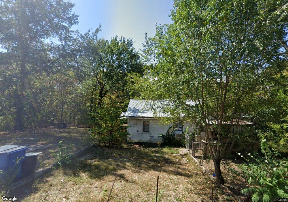
2162 Sunset Dr Oak Grove, MO 64075
Estimated Value: $82,154 - $188,000
1
Bed
1
Bath
879
Sq Ft
$165/Sq Ft
Est. Value
About This Home
This home is located at 2162 Sunset Dr, Oak Grove, MO 64075 and is currently estimated at $145,039, approximately $165 per square foot. 2162 Sunset Dr is a home located in Jackson County with nearby schools including Mason Elementary School, Bernard C. Campbell Middle School, and Lee's Summit North High School.
Ownership History
Date
Name
Owned For
Owner Type
Purchase Details
Closed on
Jun 15, 2020
Sold by
Hanaway Allan F and Hanaway Sandra D
Bought by
162 Sunset A Series Of Hanaway Investmen
Current Estimated Value
Purchase Details
Closed on
Jun 9, 1998
Sold by
Guffey Ronald D and Guffey Joy
Bought by
Hanaway Allan F and Hanaway Sandra D
Home Financials for this Owner
Home Financials are based on the most recent Mortgage that was taken out on this home.
Original Mortgage
$25,000
Interest Rate
7.27%
Mortgage Type
Purchase Money Mortgage
Create a Home Valuation Report for This Property
The Home Valuation Report is an in-depth analysis detailing your home's value as well as a comparison with similar homes in the area
Purchase History
| Date | Buyer | Sale Price | Title Company |
|---|---|---|---|
| 162 Sunset A Series Of Hanaway Investmen | -- | None Available | |
| Hanaway Allan F | -- | Stewart Title |
Source: Public Records
Mortgage History
| Date | Status | Borrower | Loan Amount |
|---|---|---|---|
| Closed | Hanaway Allan F | $25,000 |
Source: Public Records
Tax History
| Year | Tax Paid | Tax Assessment Tax Assessment Total Assessment is a certain percentage of the fair market value that is determined by local assessors to be the total taxable value of land and additions on the property. | Land | Improvement |
|---|---|---|---|---|
| 2025 | $465 | $6,282 | $2,022 | $4,260 |
| 2024 | $461 | $6,675 | $76 | $6,599 |
| 2023 | $461 | $6,675 | $637 | $6,038 |
| 2022 | $373 | $4,750 | $57 | $4,693 |
| 2021 | $356 | $4,750 | $57 | $4,693 |
| 2020 | $352 | $4,657 | $57 | $4,600 |
| 2019 | $343 | $4,657 | $57 | $4,600 |
| 2018 | $311 | $3,899 | $72 | $3,827 |
| 2016 | $291 | $3,592 | $86 | $3,506 |
Source: Public Records
Map
Nearby Homes
- 2409 Cherry Dr
- 1604 SW Stonewall Dr
- 1602 SW Stonewall Dr
- 9401 S Buckner Tarsney Rd
- 1500 SW Stonewall Dr
- 34805 E Colbern Rd
- 8721 S Hardsaw Rd
- 34906 E Colbern Rd
- 32315 E Colbern Rd
- 7915 S Old Major Rd
- 32000 E Major Rd
- 33108 E Hammond Rd
- 34918 E Colbern Rd
- 10510 S Cedar Ridge Trail
- 7516 S Arnett Rd
- 30202 E Norris Ct
- 40 A St
- 40 W St
- TBD E Stony Point School Rd
- 12 W St
- 2019 Sunset Dr
- 2018 Sunset Dr
- 2158 Sunset Dr
- 2160 Sunset Dr
- 2015 Sunset Dr
- 2021 Sunset Dr
- 2168 Sunset Dr
- 2368 Hillside Dr
- 2156 Sunset Dr
- 2041 Summit Dr
- 2022 Sunset Dr
- 2045 Summit Dr
- 2121 Hillside Dr
- 2170 Sunset Dr
- 2024 Sunset Dr
- 2039 Summit Dr
- 2377 Hillside Dr
- 2364 Hillside Dr
- 2008 Sunset Dr
- 2329 Park Ln
Your Personal Tour Guide
Ask me questions while you tour the home.