Estimated Value: $339,703 - $443,000
3
Beds
2
Baths
1,040
Sq Ft
$388/Sq Ft
Est. Value
About This Home
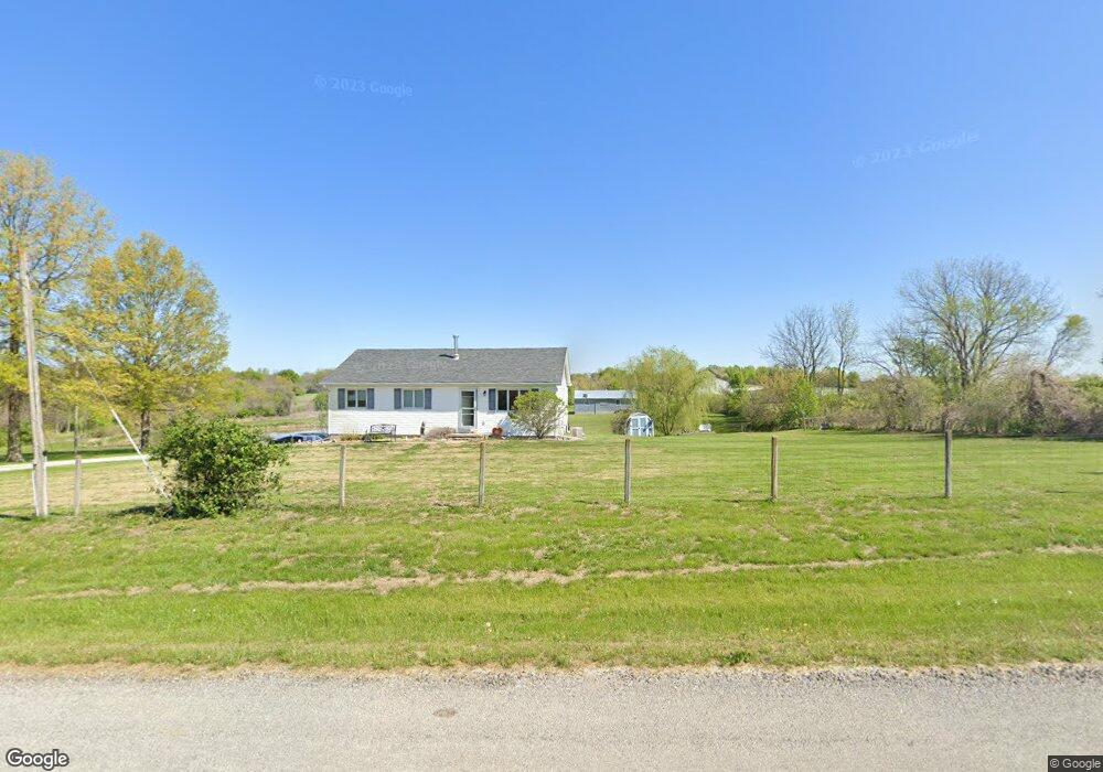
This home is located at 21624 NE 172nd St, Holt, MO 64048 and is currently estimated at $403,901, approximately $388 per square foot. 21624 NE 172nd St is a home located in Clay County with nearby schools including Kearney Junior High School and Kearney High School.
Ownership History
Date
Name
Owned For
Owner Type
Purchase Details
Closed on
May 27, 2004
Sold by
Andreas Andrew Stanley Konstantino
Bought by
Masters Jeremy J and Masters Jenny M
Current Estimated Value
Home Financials for this Owner
Home Financials are based on the most recent Mortgage that was taken out on this home.
Original Mortgage
$146,400
Outstanding Balance
$76,266
Interest Rate
6.99%
Mortgage Type
Purchase Money Mortgage
Estimated Equity
$327,635
Purchase Details
Closed on
Jul 21, 1999
Sold by
Cornish Phyllis
Bought by
Andreas Andrew Stanley Konstantino
Home Financials for this Owner
Home Financials are based on the most recent Mortgage that was taken out on this home.
Original Mortgage
$102,000
Interest Rate
7.47%
Create a Home Valuation Report for This Property
The Home Valuation Report is an in-depth analysis detailing your home's value as well as a comparison with similar homes in the area
Purchase History
| Date | Buyer | Sale Price | Title Company |
|---|---|---|---|
| Masters Jeremy J | -- | Thomson Title Corporation | |
| Andreas Andrew Stanley Konstantino | -- | United Title Company |
Source: Public Records
Mortgage History
| Date | Status | Borrower | Loan Amount |
|---|---|---|---|
| Open | Masters Jeremy J | $146,400 | |
| Previous Owner | Andreas Andrew Stanley Konstantino | $102,000 | |
| Closed | Masters Jeremy J | $36,600 |
Source: Public Records
Tax History
| Year | Tax Paid | Tax Assessment Tax Assessment Total Assessment is a certain percentage of the fair market value that is determined by local assessors to be the total taxable value of land and additions on the property. | Land | Improvement |
|---|---|---|---|---|
| 2025 | $2,255 | $38,870 | -- | -- |
| 2024 | $2,255 | $35,640 | -- | -- |
| 2023 | $2,247 | $35,640 | $0 | $0 |
| 2022 | $1,867 | $28,690 | $0 | $0 |
| 2021 | $1,827 | $28,690 | $5,909 | $22,781 |
| 2020 | $1,755 | $25,040 | $0 | $0 |
| 2019 | $1,745 | $25,040 | $0 | $0 |
Source: Public Records
Map
Nearby Homes
- 22612 N Prestige Dr
- 22223 NE 159th St
- 0 Meadow Ln
- 21619 NE 150th St
- Lot 10 188th St & Downing Rd
- 17504 State Route 33
- 16816 Landmark Loop
- 201 S Marimack Dr
- 17102 Barr Ave
- 102 W Lawrence St
- 905 Susan St
- 9900 NE 172nd St
- 26626 NE 162nd St
- 1300 Melissa Ct
- 1102 Susan St
- 1210 E 15th St
- 1202 Noah's Ln
- 1207 E 15th St
- 1204 Noah's Ln
- 1209 Noah's Ln
- 21615 NE 172nd St
- 17208 Old Bb
- 21604 NE 172nd St
- 17306 Old Bb
- 17219 Old Bb
- 22009 NE 172nd St
- 17108 Old Bb
- 17105 Old Bb Hwy
- 17318 Old Bb
- 21406 NE 172nd St
- 21409 NE 172nd St
- 17019 Old Bb Hwy
- 22023 NE 172nd St
- 21222 NE 172nd St
- 17406 Old Bb
- 16920 Old Bb Hwy
- 22205 NE 172nd St
- 21219 NE 172nd St
- 17109 Stewart Cir
- 17005 Old Bb Hwy
Your Personal Tour Guide
Ask me questions while you tour the home.