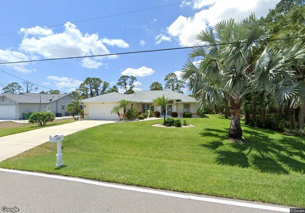
2163 Cannolot Blvd Port Charlotte, FL 33948
Estimated Value: $317,000 - $413,000
3
Beds
2
Baths
1,538
Sq Ft
$234/Sq Ft
Est. Value
About This Home
This home is located at 2163 Cannolot Blvd, Port Charlotte, FL 33948 and is currently estimated at $359,518, approximately $233 per square foot. 2163 Cannolot Blvd is a home located in Charlotte County with nearby schools including Liberty Elementary School, Murdock Middle School, and Port Charlotte High School.
Ownership History
Date
Name
Owned For
Owner Type
Purchase Details
Closed on
Jan 30, 2015
Sold by
Dixon Janice and Moore Michelle
Bought by
Hurst Frank J and Hurst Debra
Current Estimated Value
Purchase Details
Closed on
Mar 30, 1995
Sold by
Phillips Wilfred G
Bought by
Dixon Janice and Moore Michelle
Home Financials for this Owner
Home Financials are based on the most recent Mortgage that was taken out on this home.
Original Mortgage
$20,037
Interest Rate
8.86%
Create a Home Valuation Report for This Property
The Home Valuation Report is an in-depth analysis detailing your home's value as well as a comparison with similar homes in the area
Home Values in the Area
Average Home Value in this Area
Purchase History
| Date | Buyer | Sale Price | Title Company |
|---|---|---|---|
| Hurst Frank J | $220,000 | Stewart Title Company | |
| Dixon Janice | $24,000 | -- |
Source: Public Records
Mortgage History
| Date | Status | Borrower | Loan Amount |
|---|---|---|---|
| Previous Owner | Dixon Janice | $20,037 |
Source: Public Records
Tax History Compared to Growth
Tax History
| Year | Tax Paid | Tax Assessment Tax Assessment Total Assessment is a certain percentage of the fair market value that is determined by local assessors to be the total taxable value of land and additions on the property. | Land | Improvement |
|---|---|---|---|---|
| 2023 | $6,059 | $283,236 | $0 | $0 |
| 2022 | $5,105 | $307,311 | $34,000 | $273,311 |
| 2021 | $4,548 | $234,079 | $18,700 | $215,379 |
| 2020 | $4,288 | $221,807 | $18,700 | $203,107 |
| 2019 | $3,901 | $196,934 | $18,700 | $178,234 |
| 2018 | $3,464 | $182,413 | $17,000 | $165,413 |
| 2017 | $3,430 | $177,791 | $15,980 | $161,811 |
| 2016 | $3,473 | $177,003 | $0 | $0 |
| 2015 | $2,863 | $133,410 | $0 | $0 |
| 2014 | -- | $121,282 | $0 | $0 |
Source: Public Records
Map
Nearby Homes
- 18275 Troon Ave
- 2123 Cannolot Blvd
- 2113 Barksdale St
- 2059 Cannolot Blvd
- 2051 Cannolot Blvd
- 18323 Troon Ave
- 18323 Yale Ave
- 18316 Monmouth Ave
- 18161 Windswept Ave
- 2072 Barksdale St
- 2083 Leisure St
- 2145 Winningway St
- 2267 Cannolot Blvd
- 2082 Winningway St
- 2051 Midnight St
- 18071 Windswept Ave
- 2281 Barksdale St
- 18088 Windingvail Ave
- 18183 Windingvail Ave
- 2027 Cannolot Blvd
- 2171 Cannolot Blvd
- 2147 Cannolot Blvd
- 2179 Cannolot Blvd
- 18268 Troon Ave
- 2172 Cannolot Blvd
- 2160 Barksdale St
- 2152 Barksdale St
- 2187 Cannolot Blvd
- 18276 Troon Ave
- 18267 Cortland Ave
- 18268 Yale Ave
- 2144 Barksdale St
- 2168 Barksdale St
- 2176 Barksdale St
- 18275 Cortland Ave
- 2195 Cannolot Blvd
- 2136 Barksdale St
- 18284 Troon Ave
- 18276 Yale Ave
- 18291 Yale Ave