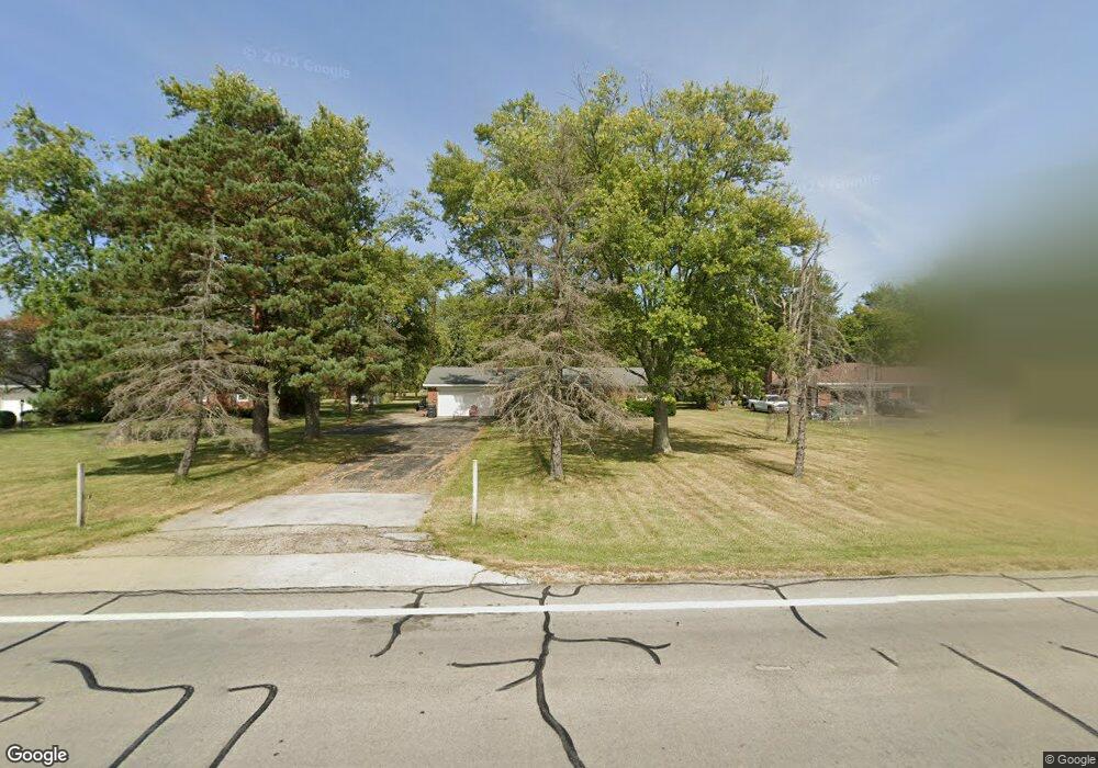
2163 State Route 49 Arcanum, OH 45304
Estimated Value: $205,000 - $223,000
3
Beds
2
Baths
1,215
Sq Ft
$174/Sq Ft
Est. Value
About This Home
This home is located at 2163 State Route 49, Arcanum, OH 45304 and is currently estimated at $211,614, approximately $174 per square foot. 2163 State Route 49 is a home located in Darke County with nearby schools including Franklin Monroe Elementary School and Franklin Monroe High School.
Ownership History
Date
Name
Owned For
Owner Type
Purchase Details
Closed on
Sep 21, 2018
Sold by
Neitzelt Helen L
Bought by
Eubank Douglas
Current Estimated Value
Home Financials for this Owner
Home Financials are based on the most recent Mortgage that was taken out on this home.
Original Mortgage
$103,098
Outstanding Balance
$91,567
Interest Rate
5.5%
Mortgage Type
FHA
Estimated Equity
$120,047
Purchase Details
Closed on
Mar 30, 2009
Sold by
Estate Of John H Neitzelt
Bought by
Neitzelt Helen L
Create a Home Valuation Report for This Property
The Home Valuation Report is an in-depth analysis detailing your home's value as well as a comparison with similar homes in the area
Home Values in the Area
Average Home Value in this Area
Purchase History
| Date | Buyer | Sale Price | Title Company |
|---|---|---|---|
| Eubank Douglas | $105,000 | Republic Title Agency Inc | |
| Neitzelt Helen L | -- | None Available |
Source: Public Records
Mortgage History
| Date | Status | Borrower | Loan Amount |
|---|---|---|---|
| Open | Eubank Douglas | $103,098 |
Source: Public Records
Tax History Compared to Growth
Tax History
| Year | Tax Paid | Tax Assessment Tax Assessment Total Assessment is a certain percentage of the fair market value that is determined by local assessors to be the total taxable value of land and additions on the property. | Land | Improvement |
|---|---|---|---|---|
| 2024 | $2,249 | $54,720 | $6,480 | $48,240 |
| 2023 | $2,251 | $54,720 | $6,480 | $48,240 |
| 2022 | $2,074 | $43,210 | $5,570 | $37,640 |
| 2021 | $2,089 | $43,210 | $5,570 | $37,640 |
| 2020 | $2,019 | $43,210 | $5,570 | $37,640 |
| 2019 | $1,852 | $36,940 | $5,570 | $31,370 |
| 2018 | $1,444 | $36,940 | $5,570 | $31,370 |
| 2017 | $1,384 | $36,940 | $5,570 | $31,370 |
| 2016 | $1,392 | $37,120 | $7,740 | $29,380 |
| 2015 | $1,392 | $37,120 | $7,740 | $29,380 |
| 2014 | $1,398 | $37,120 | $7,740 | $29,380 |
| 2013 | $1,470 | $37,120 | $7,740 | $29,380 |
Source: Public Records
Map
Nearby Homes
- 2012 Ohio 49
- 107 Merrie Ln
- 200 N Jefferson St
- 8784 Grubbs Rex Rd
- 1486 Ohio 49
- 6977 Alternate State Route 49
- 0 Delisle Fourman Rd
- 9 Seminole Ln
- 5 Seminole Ln
- Oh-722
- 404 W 1st St
- Alt St Rt 49 Alt State Route 49
- 406 W South St
- 8 Parkdale Dr
- 2 Edgewood Dr
- 604 W North St
- 22 Greenmoor Dr
- 3 Harvest Dr
- 9 Harvest Dr
- 8 Harvest Dr
- 2155 State Route 49
- 2155 State Route 49
- 2149 State Route 49
- 2177 State Route 49
- 2143 State Route 49
- 2187 State Route 49
- 2130 Meadow Ln
- 2135 State Route 49
- 2191 State Route 49
- 2148 Meadow Ln
- 2156 Meadow Ln
- 2197 State Route 49
- 2123 State Route 49
- 2123 Ohio 49
- 2123 State Route 49
- 8179 Oakes Rd
- 2170 Meadow Ln
- 8199 Oakes Rd
- 8169 Oakes Rd
- 8211 Oakes Rd