Estimated Value: $219,802 - $289,000
3
Beds
2
Baths
1,907
Sq Ft
$127/Sq Ft
Est. Value
About This Home
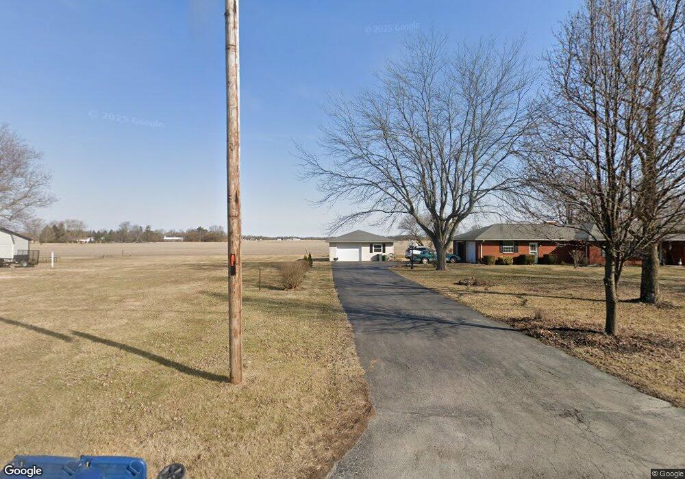
This home is located at 2163 State Route 81, Ada, OH 45810 and is currently estimated at $241,951, approximately $126 per square foot. 2163 State Route 81 is a home located in Hardin County with nearby schools including Ada Elementary School and Ada High School.
Ownership History
Date
Name
Owned For
Owner Type
Purchase Details
Closed on
Jan 31, 2024
Sold by
Dysert Shelby J
Bought by
Dysert Rodney A and Dysert Dustin
Current Estimated Value
Purchase Details
Closed on
Sep 15, 1995
Bought by
Dysert Shelby J
Purchase Details
Closed on
Sep 23, 1993
Bought by
Dysert Shelby J
Create a Home Valuation Report for This Property
The Home Valuation Report is an in-depth analysis detailing your home's value as well as a comparison with similar homes in the area
Home Values in the Area
Average Home Value in this Area
Purchase History
| Date | Buyer | Sale Price | Title Company |
|---|---|---|---|
| Dysert Rodney A | -- | None Listed On Document | |
| Dysert Rodney A | -- | None Listed On Document | |
| Dysert Shelby J | -- | -- | |
| Dysert Shelby J | -- | -- |
Source: Public Records
Tax History Compared to Growth
Tax History
| Year | Tax Paid | Tax Assessment Tax Assessment Total Assessment is a certain percentage of the fair market value that is determined by local assessors to be the total taxable value of land and additions on the property. | Land | Improvement |
|---|---|---|---|---|
| 2024 | $1,752 | $57,020 | $6,210 | $50,810 |
| 2023 | $1,752 | $57,020 | $6,210 | $50,810 |
| 2022 | $1,810 | $51,180 | $3,130 | $48,050 |
| 2021 | $1,993 | $51,180 | $3,130 | $48,050 |
| 2020 | $2,021 | $51,180 | $3,130 | $48,050 |
| 2019 | $1,736 | $45,640 | $2,980 | $42,660 |
| 2018 | $1,697 | $45,640 | $2,980 | $42,660 |
| 2017 | $1,513 | $45,640 | $2,980 | $42,660 |
| 2016 | $1,372 | $40,980 | $2,610 | $38,370 |
| 2015 | $1,706 | $40,980 | $2,610 | $38,370 |
| 2014 | $1,338 | $40,980 | $2,610 | $38,370 |
| 2013 | $1,428 | $41,280 | $2,610 | $38,670 |
Source: Public Records
Map
Nearby Homes
- 128 W North Ave
- 629 N Main St
- 211 W Buckeye Ave Unit 211 1/2
- 210 N Gilbert St
- 118 W Buckeye Ave
- 211 S Main St
- 301 S Main St
- 444 Edwards St Unit A, B
- 444 Edwards St Unit 2
- 442 Edwards St
- 212 N Simon St
- 4071 Township Road 35
- 613 S Gilbert St
- 617 S Gilbert St
- 623 S Gilbert St
- 308-310 S Simon St
- 314 E University Ave
- 710 S Main St
- 2072 State Route 235
- 2864 Ohio 309
- 2172 Ohio 81
- 2172 Ohio 81
- 2191 State Route 81
- 2172 State Route 81
- 2105 Sr
- 2134 State Route 81
- 2219 State Route 81
- 2105 State Route 81
- 2237 State Route 81
- 2230 State Route 81
- 2098 State Route 81
- 2098 State Route 81
- 2032 State Route 81
- 2025 State Route 81
- 2025 State Route 81
- 2016 State Route 81
- 2319 State Route 81
- 2860 Township Road 35
- 1970 Sr