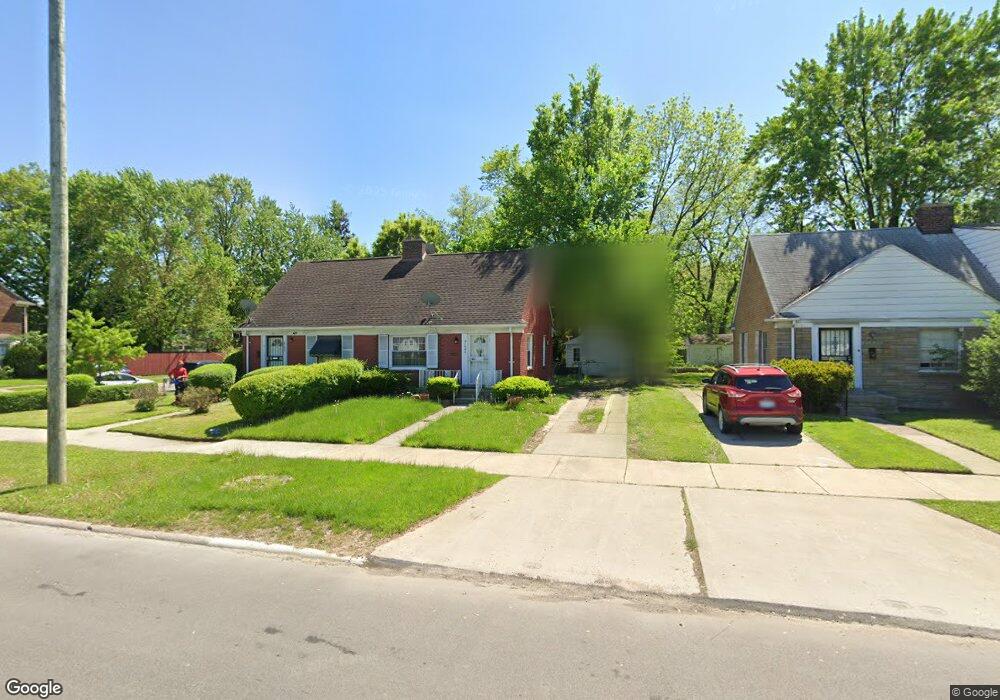
21636 Moross Rd Grosse Pointe, MI 48236
Cornerstone Village NeighborhoodEstimated Value: $80,000 - $140,000
Studio
1
Bath
819
Sq Ft
$128/Sq Ft
Est. Value
About This Home
This home is located at 21636 Moross Rd, Grosse Pointe, MI 48236 and is currently estimated at $105,160, approximately $128 per square foot. 21636 Moross Rd is a home located in Wayne County with nearby schools including Marquette Elementary-Middle School, Edward 'Duke' Ellington Conservatory of Music and Art, and Charles L. Spain Elementary-Middle School.
Ownership History
Date
Name
Owned For
Owner Type
Purchase Details
Closed on
Sep 3, 2025
Sold by
Wayne County Treasurer
Bought by
City Of Detroit Planning And Development Depa
Current Estimated Value
Purchase Details
Closed on
Jan 5, 2019
Sold by
Allison Valerie
Bought by
Ruva Louise
Purchase Details
Closed on
Sep 26, 2009
Sold by
Gaggini Agnes
Bought by
Allison Stanley and Allison Valerie
Purchase Details
Closed on
May 20, 2009
Sold by
Gaggini Agnes and Gaggini Allen S
Bought by
Gaggini Agnes
Create a Home Valuation Report for This Property
The Home Valuation Report is an in-depth analysis detailing your home's value as well as a comparison with similar homes in the area
Home Values in the Area
Average Home Value in this Area
Purchase History
| Date | Buyer | Sale Price | Title Company |
|---|---|---|---|
| City Of Detroit Planning And Development Depa | $6,111 | None Listed On Document | |
| Ruva Louise | $5,500 | None Available | |
| Allison Stanley | $3,000 | None Available | |
| Gaggini Agnes | -- | None Available |
Source: Public Records
Tax History
| Year | Tax Paid | Tax Assessment Tax Assessment Total Assessment is a certain percentage of the fair market value that is determined by local assessors to be the total taxable value of land and additions on the property. | Land | Improvement |
|---|---|---|---|---|
| 2025 | $1,189 | $32,700 | $0 | $0 |
| 2024 | $923 | $28,100 | $0 | $0 |
| 2023 | $1,141 | $21,000 | $0 | $0 |
| 2022 | $1,206 | $16,700 | $0 | $0 |
| 2021 | $1,177 | $13,200 | $0 | $0 |
| 2020 | $1,177 | $11,900 | $0 | $0 |
| 2019 | $1,061 | $10,000 | $0 | $0 |
| 2018 | $938 | $9,500 | $0 | $0 |
| 2017 | $168 | $9,700 | $0 | $0 |
| 2016 | $963 | $10,400 | $0 | $0 |
| 2015 | $1,040 | $10,400 | $0 | $0 |
| 2013 | $1,486 | $14,860 | $0 | $0 |
| 2010 | -- | $21,787 | $802 | $20,985 |
Source: Public Records
Map
Nearby Homes
- 21718 Moross Rd
- 21756 Moross Rd
- 21800 Moross Rd
- 19134 Mallina St
- 21806 Moross Rd
- 21820 Moross Rd
- 19196 Berden St
- 6144 Radnor St
- 6300 Radnor St
- 21970 Moross Rd
- 6166 Farmbrook St
- 5951 Radnor St
- 6306 Farmbrook St
- 21602 Newcastle Rd
- 19299 Raymond St
- 5514 Ashley St
- 5754 Farmbrook St
- 19265 Tyrone St
- 5915 Lodewyck St
- 21440 Prestwick Ave
- 21646 Moross Rd
- 21646 Moross Rd
- 21632 Moross Rd
- 21650 Moross Rd
- 21624 Moross Rd
- 19019 Rolandale St
- 21620 Moross Rd
- 19009 Rolandale St
- 21608 Moross Rd
- 18948 Berden St
- 21700 Moross Rd
- 21604 Moross Rd
- 21604 Moross Rd
- 19001 Rolandale St
- 21706 Moross Rd
- 6024 Hillcrest St
- 18930 Berden St
- 18921 Rolandale St
- 6016 Hillcrest St
- 18920 Berden St
Your Personal Tour Guide
Ask me questions while you tour the home.