Estimated Value: $287,456 - $322,000
4
Beds
1
Bath
2,226
Sq Ft
$134/Sq Ft
Est. Value
About This Home
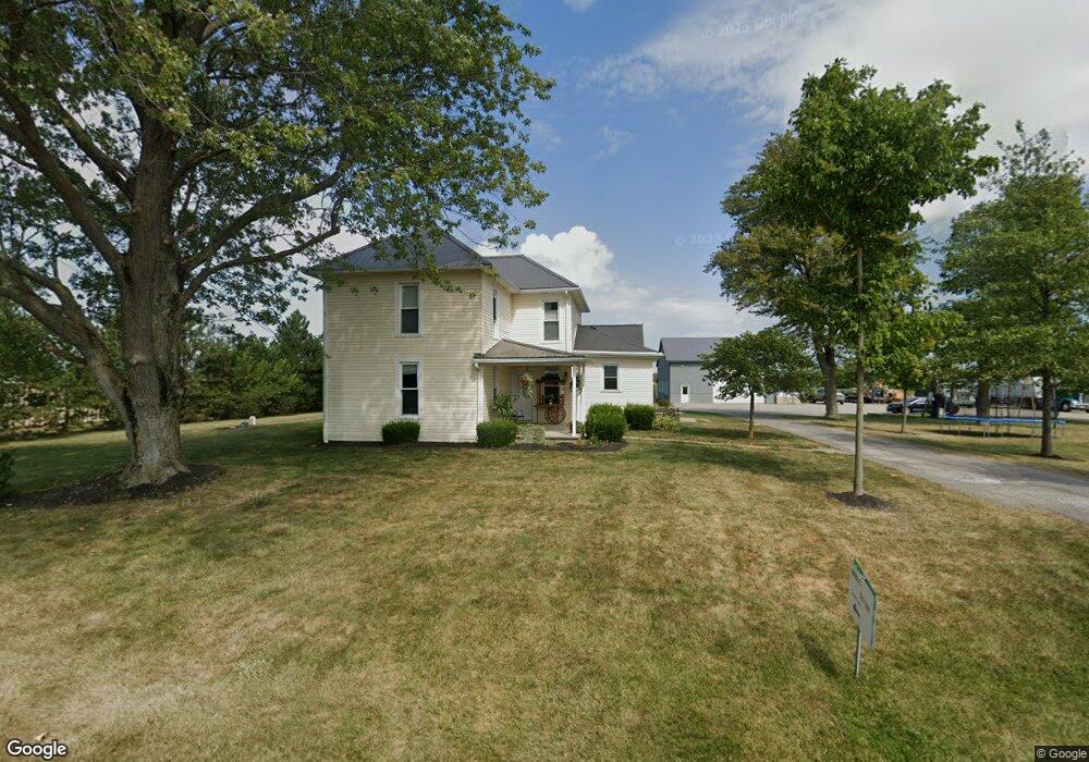
This home is located at 2164 Beery Rd, Lima, OH 45807 and is currently estimated at $298,364, approximately $134 per square foot. 2164 Beery Rd is a home located in Allen County with nearby schools including Elida Elementary School, Elida Middle School, and Elida High School.
Ownership History
Date
Name
Owned For
Owner Type
Purchase Details
Closed on
Apr 26, 2012
Sold by
King Alvin and King Karen
Bought by
J & M Farms Llc
Current Estimated Value
Purchase Details
Closed on
Aug 21, 2007
Sold by
King Jesse D
Bought by
King Jesse D and King Melanie D
Purchase Details
Closed on
Aug 5, 2005
Sold by
King Jesse D
Bought by
King Jesse D and Jesse D King Revocable Trust
Purchase Details
Closed on
Mar 27, 1986
Bought by
Thompson James L
Create a Home Valuation Report for This Property
The Home Valuation Report is an in-depth analysis detailing your home's value as well as a comparison with similar homes in the area
Purchase History
| Date | Buyer | Sale Price | Title Company |
|---|---|---|---|
| J & M Farms Llc | -- | Attorney | |
| King Jesse D | -- | None Available | |
| King Jesse D | -- | None Available | |
| Thompson James L | $30,000 | -- |
Source: Public Records
Tax History
| Year | Tax Paid | Tax Assessment Tax Assessment Total Assessment is a certain percentage of the fair market value that is determined by local assessors to be the total taxable value of land and additions on the property. | Land | Improvement |
|---|---|---|---|---|
| 2024 | $3,671 | $83,900 | $15,510 | $68,390 |
| 2023 | $2,996 | $60,800 | $11,240 | $49,560 |
| 2022 | $3,047 | $60,800 | $11,240 | $49,560 |
| 2021 | $3,063 | $60,800 | $11,240 | $49,560 |
| 2020 | $2,795 | $51,660 | $10,710 | $40,950 |
| 2019 | $2,795 | $51,520 | $10,570 | $40,950 |
| 2018 | $2,638 | $51,520 | $10,570 | $40,950 |
| 2017 | $2,439 | $46,170 | $10,570 | $35,600 |
| 2016 | $2,375 | $44,980 | $10,570 | $34,410 |
| 2015 | $2,438 | $44,980 | $10,570 | $34,410 |
| 2014 | $2,438 | $44,520 | $10,990 | $33,530 |
| 2013 | $2,192 | $44,520 | $10,990 | $33,530 |
Source: Public Records
Map
Nearby Homes
- 0 Fraunfelter Unit 307817
- 0 N Eastown Rd Unit 1034495
- 2718 Carolyn Dr
- 1743 Sherry Lee Dr
- 2511 Debbie Dr
- 2630 Carolyn Dr
- 3137 Thorndyke Dr
- 2275 N Cable Rd Unit 178
- 2275 N Cable Rd Unit 130
- 2275 N Cable Rd Unit 43 Unit Package
- 2275 N Cable Rd Unit 42
- 2275 N Cable Rd Unit 12
- 2275 N Cable Rd Unit 24
- 2275 N Cable Rd Unit 1
- 2275 N Cable Rd
- 2275 N Cable Rd Unit 97
- 2275 N Cable Rd Unit 98
- 2275 N Cable Rd Unit 137
- 2225 N Cable Rd
- 2113 Kimberly Dr