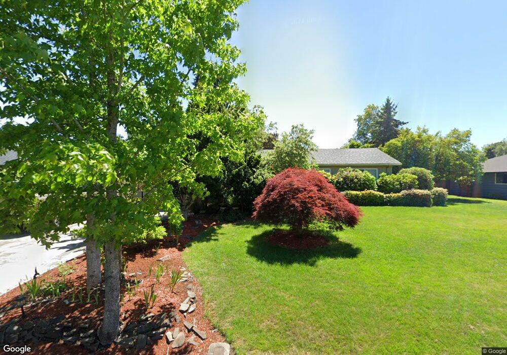
2164 Keith Way Eugene, OR 97401
Cal Young NeighborhoodEstimated Value: $565,604 - $658,000
3
Beds
2
Baths
1,770
Sq Ft
$348/Sq Ft
Est. Value
About This Home
This home is located at 2164 Keith Way, Eugene, OR 97401 and is currently estimated at $616,651, approximately $348 per square foot. 2164 Keith Way is a home located in Lane County with nearby schools including Willagillespie Elementary School, Monroe Middle School, and Sheldon High School.
Ownership History
Date
Name
Owned For
Owner Type
Purchase Details
Closed on
Mar 20, 2007
Sold by
Thomas Teresa A
Bought by
Moe Kristien Einar and Moe Arlin
Current Estimated Value
Home Financials for this Owner
Home Financials are based on the most recent Mortgage that was taken out on this home.
Original Mortgage
$262,400
Outstanding Balance
$158,473
Interest Rate
6.31%
Mortgage Type
Purchase Money Mortgage
Estimated Equity
$458,178
Purchase Details
Closed on
May 19, 2004
Sold by
Maynor Gene P and Maynor Helaine S
Bought by
Thomas Teresa A
Home Financials for this Owner
Home Financials are based on the most recent Mortgage that was taken out on this home.
Original Mortgage
$216,000
Interest Rate
6.37%
Mortgage Type
Stand Alone First
Purchase Details
Closed on
Jun 2, 2003
Sold by
Thompson Michael E and Thompson Emma C
Bought by
Maynor Gene P and Maynor Helaine S
Home Financials for this Owner
Home Financials are based on the most recent Mortgage that was taken out on this home.
Original Mortgage
$201,600
Interest Rate
5.71%
Mortgage Type
Purchase Money Mortgage
Purchase Details
Closed on
Sep 24, 2001
Sold by
Skoglund James and Skoglund Melissa
Bought by
Thompson Michael E and Thompson Emma C
Home Financials for this Owner
Home Financials are based on the most recent Mortgage that was taken out on this home.
Original Mortgage
$198,679
Interest Rate
6.91%
Purchase Details
Closed on
Apr 15, 2000
Sold by
Olson Jeffery E and Olson Darla J
Bought by
Skoglund James and Skoglund Melissa
Home Financials for this Owner
Home Financials are based on the most recent Mortgage that was taken out on this home.
Original Mortgage
$175,000
Interest Rate
8.26%
Purchase Details
Closed on
Mar 30, 1998
Sold by
Moore John Andrew and Moore Donna Marie
Bought by
Olson Jeffery E and Olson Darla J
Home Financials for this Owner
Home Financials are based on the most recent Mortgage that was taken out on this home.
Original Mortgage
$152,000
Interest Rate
7%
Create a Home Valuation Report for This Property
The Home Valuation Report is an in-depth analysis detailing your home's value as well as a comparison with similar homes in the area
Home Values in the Area
Average Home Value in this Area
Purchase History
| Date | Buyer | Sale Price | Title Company |
|---|---|---|---|
| Moe Kristien Einar | $328,000 | Western Title & Escrow Compa | |
| Thomas Teresa A | $270,000 | Western Title & Escrow Co | |
| Maynor Gene P | $252,000 | Western Title & Escrow Compa | |
| Thompson Michael E | $221,000 | Western Title & Escrow Compa | |
| Skoglund James | $195,000 | Western Title & Escrow Compa | |
| Olson Jeffery E | $179,900 | Fidelity National Title Ins |
Source: Public Records
Mortgage History
| Date | Status | Borrower | Loan Amount |
|---|---|---|---|
| Open | Moe Kristien Einar | $262,400 | |
| Previous Owner | Thomas Teresa A | $216,000 | |
| Previous Owner | Maynor Gene P | $201,600 | |
| Previous Owner | Thompson Michael E | $198,679 | |
| Previous Owner | Skoglund James | $175,000 | |
| Previous Owner | Olson Jeffery E | $152,000 |
Source: Public Records
Tax History
| Year | Tax Paid | Tax Assessment Tax Assessment Total Assessment is a certain percentage of the fair market value that is determined by local assessors to be the total taxable value of land and additions on the property. | Land | Improvement |
|---|---|---|---|---|
| 2025 | $6,007 | $308,310 | -- | -- |
| 2024 | $5,932 | $299,331 | -- | -- |
| 2023 | $5,932 | $290,613 | -- | -- |
| 2022 | $5,558 | $282,149 | $0 | $0 |
| 2021 | $5,220 | $273,932 | $0 | $0 |
| 2020 | $5,238 | $265,954 | $0 | $0 |
| 2019 | $5,059 | $258,208 | $0 | $0 |
| 2018 | $4,736 | $243,386 | $0 | $0 |
| 2017 | $4,477 | $243,386 | $0 | $0 |
| 2016 | $4,285 | $236,297 | $0 | $0 |
| 2015 | $4,135 | $229,415 | $0 | $0 |
| 2014 | $4,055 | $222,733 | $0 | $0 |
Source: Public Records
Map
Nearby Homes
- 1521 Gilham Rd
- 820 Lariat Dr
- 2150 Greenview St
- 0 Cal Young Rd Unit Lot 4
- 2250 Turnberry Ct
- 1943 Monterey Ln
- 1090 Corydon St
- 982 Shaughnessy Ln
- 950 Coburg Rd
- 516 Spyglass Dr
- 1328 Spyglass Dr
- 410 Spyglass Dr
- 1625 Monterey Ln
- 2345 Pioneer Pike
- 1810 Minda Dr
- 1901 Minda Dr
- 1376 Brickley Rd
- 1500 Norkenzie Rd Unit 12
- 2495 Jeppesen Acres Rd
- 600 Cherry Dr Unit 8
Your Personal Tour Guide
Ask me questions while you tour the home.