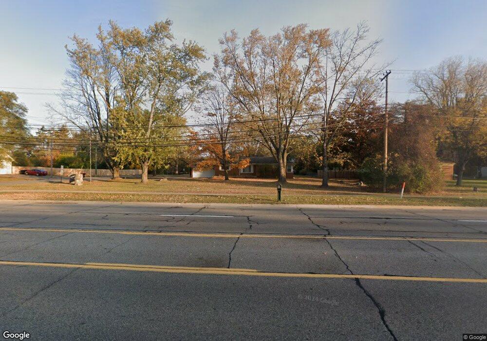
21640 W 10 Mile Rd Southfield, MI 48075
Estimated Value: $213,000 - $285,000
3
Beds
2
Baths
1,391
Sq Ft
$171/Sq Ft
Est. Value
About This Home
This home is located at 21640 W 10 Mile Rd, Southfield, MI 48075 and is currently estimated at $237,702, approximately $170 per square foot. 21640 W 10 Mile Rd is a home located in Oakland County with nearby schools including Morris Adler Elementary School, Glenn W. Levey Middle School, and Laurus Academy.
Ownership History
Date
Name
Owned For
Owner Type
Purchase Details
Closed on
Dec 3, 2007
Sold by
Yonko David
Bought by
Sterling Mortgage & Investment Company
Current Estimated Value
Purchase Details
Closed on
May 24, 2005
Sold by
Sterling Mortgage & Investment Co
Bought by
Yonko Ricky
Home Financials for this Owner
Home Financials are based on the most recent Mortgage that was taken out on this home.
Original Mortgage
$85,000
Interest Rate
5.91%
Mortgage Type
Purchase Money Mortgage
Purchase Details
Closed on
Jul 23, 1998
Sold by
Griffin Sandra
Bought by
Sterling Mortgage Inv Co
Create a Home Valuation Report for This Property
The Home Valuation Report is an in-depth analysis detailing your home's value as well as a comparison with similar homes in the area
Home Values in the Area
Average Home Value in this Area
Purchase History
| Date | Buyer | Sale Price | Title Company |
|---|---|---|---|
| Sterling Mortgage & Investment Company | -- | None Available | |
| Yonko Ricky | $100,000 | -- | |
| Yonko David | $85,000 | -- | |
| Sterling Mortgage Inv Co | -- | -- |
Source: Public Records
Mortgage History
| Date | Status | Borrower | Loan Amount |
|---|---|---|---|
| Previous Owner | Yonko David | $85,000 |
Source: Public Records
Tax History Compared to Growth
Tax History
| Year | Tax Paid | Tax Assessment Tax Assessment Total Assessment is a certain percentage of the fair market value that is determined by local assessors to be the total taxable value of land and additions on the property. | Land | Improvement |
|---|---|---|---|---|
| 2022 | $2,570 | $94,970 | $27,360 | $67,610 |
| 2021 | $2,669 | $69,990 | $17,250 | $52,740 |
| 2020 | $2,152 | $69,560 | $17,250 | $52,310 |
| 2018 | $2,510 | $48,780 | $11,000 | $37,780 |
| 2015 | -- | $38,120 | $0 | $0 |
| 2014 | -- | $34,100 | $0 | $0 |
| 2011 | -- | $34,490 | $0 | $0 |
Source: Public Records
Map
Nearby Homes
- 25160 Lahser Rd
- 24713 Lois Ln
- 25150 Briarbank Ave
- 25555 Lahser Rd Unit 15
- 25275 Briarbank Ave
- 21763 Hidden Rivers Dr N Unit M68
- 24714 Pembrooke Dr
- 20082 Rodeo Ct Unit 8
- 20023 Boardwalk Blvd Unit 281
- 20217 Boardwalk Blvd
- 25476 Saint James
- 25493 Saint James Unit 271
- 23409 Ranch Hill Dr W
- 21812 Duns Scotus St Unit 7
- 5000 Town 801 Center Unit 801
- 5000 Town Center Unit 408
- 5000 Town Center Unit 507
- 5000 Town Center Unit 2904
- 5000 Town Center Unit 1404
- 5000 Town Center Unit 2003
- 21640 W Ten Mile Rd
- 00 W 10 Mile Rd
- 21626 W 10 Mile Rd
- 21670 W 10 Mile Rd
- 21670 W Ten Mile
- 00 Lois Ln
- 0 Lois Ln
- - Lois Ln
- 00000 Lois Ln
- 25120 Lois Ln
- 21614 W 10 Mile Rd
- 000 Lois Ln
- 21700 W 10 Mile Rd
- 25180 Lois Ln
- 25121 Lois Ln
- 24890 Lois Ln
- 21556 W 10 Mile Rd
- 21714 W 10 Mile Rd
- 25181 Lois Ln
- 21703 W 10 Mile Rd