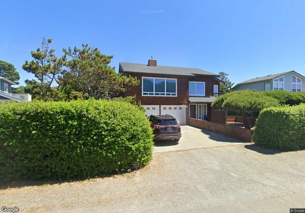
2165 Beach Loop Dr SW Bandon, OR 97411
Estimated Value: $174,000 - $959,000
2
Beds
3
Baths
2,542
Sq Ft
$211/Sq Ft
Est. Value
About This Home
This home is located at 2165 Beach Loop Dr SW, Bandon, OR 97411 and is currently estimated at $537,468, approximately $211 per square foot. 2165 Beach Loop Dr SW is a home located in Coos County with nearby schools including Ocean Crest Elementary School, Harbor Lights Middle School, and Bandon Senior High School.
Ownership History
Date
Name
Owned For
Owner Type
Purchase Details
Closed on
Mar 31, 2006
Sold by
Delavergne Warren T and Delavergne Margaret A
Bought by
Hickox Henry A and Hickox Johnna M A
Current Estimated Value
Home Financials for this Owner
Home Financials are based on the most recent Mortgage that was taken out on this home.
Original Mortgage
$160,000
Interest Rate
6.25%
Mortgage Type
Seller Take Back
Create a Home Valuation Report for This Property
The Home Valuation Report is an in-depth analysis detailing your home's value as well as a comparison with similar homes in the area
Home Values in the Area
Average Home Value in this Area
Purchase History
| Date | Buyer | Sale Price | Title Company |
|---|---|---|---|
| Hickox Henry A | $200,000 | First American Title |
Source: Public Records
Mortgage History
| Date | Status | Borrower | Loan Amount |
|---|---|---|---|
| Closed | Hickox Henry A | $160,000 |
Source: Public Records
Tax History Compared to Growth
Tax History
| Year | Tax Paid | Tax Assessment Tax Assessment Total Assessment is a certain percentage of the fair market value that is determined by local assessors to be the total taxable value of land and additions on the property. | Land | Improvement |
|---|---|---|---|---|
| 2025 | $5,490 | $498,280 | -- | -- |
| 2024 | $5,431 | $483,770 | -- | -- |
| 2023 | $5,289 | $469,680 | $0 | $0 |
| 2022 | $5,309 | $456,000 | $0 | $0 |
| 2021 | $5,101 | $442,720 | $0 | $0 |
| 2020 | $4,631 | $442,720 | $0 | $0 |
| 2019 | $4,617 | $417,320 | $0 | $0 |
| 2018 | $4,341 | $405,170 | $0 | $0 |
| 2017 | $4,241 | $393,370 | $0 | $0 |
| 2016 | $4,110 | $381,920 | $0 | $0 |
| 2015 | $3,847 | $365,230 | $0 | $0 |
| 2014 | $3,847 | $358,060 | $0 | $0 |
Source: Public Records
Map
Nearby Homes
- 2131 Beach Loop Dr SW
- 1312 Village Loop
- 1323 Village Loop
- 1313 Village Loop
- 1950 Beach Loop Dr SW
- 2485 Beach Loop Rd
- 0 Beach Loop Dr SW Unit 201837812
- 0 Whale Watch Way Unit 602 722957860
- 2778 Colony Cir
- 1575 Beach Loop Dr SW
- 2732 Lincoln Ave SW Unit 500
- 2710 Lincoln Ave SW Unit 200
- 2732 Lincoln Ave Unit 500&200
- 2776 Lincoln Ave
- 937 Carter St SW
- 2669 Cedar Loop
- 2653 Spinnaker Dr
- 00 Harrison Ave Lot B
- 2688 Cascara Ave Unit 800
- 3145 Periwinkle Ln SW
- 2179 Beach Loop Dr SW
- 0 Armstrong Unit 13139120
- 2143 Beach Loop Dr
- 1363 Village Loop
- 1361 Village Loop
- 1374 Strawberry Dr SW
- 1377 Village Loop
- 1359 Village Loop
- 1375 Village Loop
- 1357 Village Loop
- 2295 Beach Loop Dr SW
- 1345 Village Loop
- 1383 Village Loop
- 1343 Village Loop
- 1387 Village Loop
- 2099 Beach Loop Dr SW
- 1386 Village Loop
- 0 Strawberry Dr Unit 24629515
- 0 Strawberry Dr Unit 2300 23579497
- 0 Strawberry Dr Unit 212 23447468