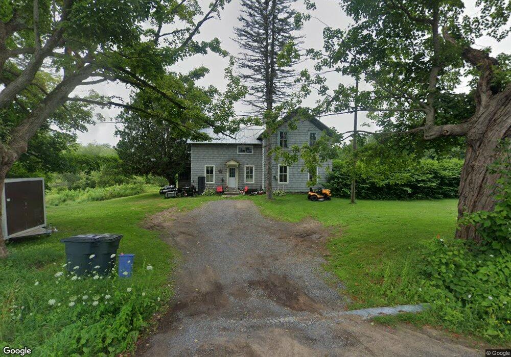
21651 Wrape Rd Carthage, NY 13619
Estimated Value: $179,000 - $562,000
4
Beds
1
Bath
1,491
Sq Ft
$309/Sq Ft
Est. Value
About This Home
This home is located at 21651 Wrape Rd, Carthage, NY 13619 and is currently estimated at $461,310, approximately $309 per square foot. 21651 Wrape Rd is a home located in Jefferson County with nearby schools including Carthage Senior High School.
Ownership History
Date
Name
Owned For
Owner Type
Purchase Details
Closed on
Aug 31, 2025
Sold by
Robert And Karen Roes Irrevocable Trust and Roes Robert A
Bought by
Blue Sky Endeavors Llc
Current Estimated Value
Purchase Details
Closed on
Aug 9, 2023
Sold by
Roes Robert A and Roes Karen D
Bought by
Robert Roes Irt and Olmstead
Purchase Details
Closed on
Sep 16, 2013
Sold by
Hoffman Harley E
Bought by
Roes Robert A
Home Financials for this Owner
Home Financials are based on the most recent Mortgage that was taken out on this home.
Original Mortgage
$60,000
Interest Rate
4.42%
Mortgage Type
New Conventional
Create a Home Valuation Report for This Property
The Home Valuation Report is an in-depth analysis detailing your home's value as well as a comparison with similar homes in the area
Home Values in the Area
Average Home Value in this Area
Purchase History
| Date | Buyer | Sale Price | Title Company |
|---|---|---|---|
| Blue Sky Endeavors Llc | $588,134 | None Listed On Document | |
| Robert Roes Irt | -- | None Available | |
| Roes Robert A | $95,000 | Tim Farley |
Source: Public Records
Mortgage History
| Date | Status | Borrower | Loan Amount |
|---|---|---|---|
| Previous Owner | Roes Robert A | $60,000 |
Source: Public Records
Tax History
| Year | Tax Paid | Tax Assessment Tax Assessment Total Assessment is a certain percentage of the fair market value that is determined by local assessors to be the total taxable value of land and additions on the property. | Land | Improvement |
|---|---|---|---|---|
| 2024 | $2,044 | $115,000 | $63,100 | $51,900 |
| 2023 | $1,941 | $95,500 | $50,500 | $45,000 |
| 2022 | $1,974 | $95,500 | $50,500 | $45,000 |
| 2021 | $1,983 | $95,500 | $50,500 | $45,000 |
| 2020 | $1,974 | $95,500 | $50,500 | $45,000 |
| 2019 | $1,979 | $95,500 | $50,500 | $45,000 |
| 2018 | $1,979 | $99,900 | $50,500 | $49,400 |
| 2017 | $2,040 | $99,900 | $50,500 | $49,400 |
| 2016 | $2,068 | $99,900 | $50,500 | $49,400 |
| 2015 | -- | $102,200 | $44,400 | $57,800 |
| 2014 | -- | $102,200 | $44,400 | $57,800 |
Source: Public Records
Map
Nearby Homes
- 22639 County Rte 42
- 22387 County Route 42
- 4895 Rogers Crossing Rd
- 3 Oxford St
- 985 West St
- 819 Beaver Ln
- 400 S Washington St
- 38942 State Route 3
- 406 S James St
- 802 West St
- 207 S Mechanic St
- 503 West St
- 121 N Clinton St
- 706 Elm St
- 127 N James St
- 213 N Clinton St
- 622 Fulton St
- 713 Fulton St
- 302 N James St
- 403 & 405 Budd St
- 21692 Wrape Rd
- 21781 Wrape Rd
- 21547 Wrape Rd
- 0 Wrape Rd Unit S330237
- 21889 Wrape Rd
- 22360 Wrape Rd
- 21438 Wrape Rd
- 0 Co Route 36 Unit S1524377
- CO RTE 163 Co Route 163
- 10667 Co Route 13
- 27929 Silver Street Rd
- 0 Co Route 36 Unit S1494373
- 34233 Waterview Dr
- 0 Co Route 163 Unit S1437929
- 36972 Nys Route 26
- 0 Martin Rd Unit S1426210
- 32576 Nys Route 26
- 21940 Wrape Rd
- 41290 Toth Rd
- 21376 Wrape Rd
Your Personal Tour Guide
Ask me questions while you tour the home.