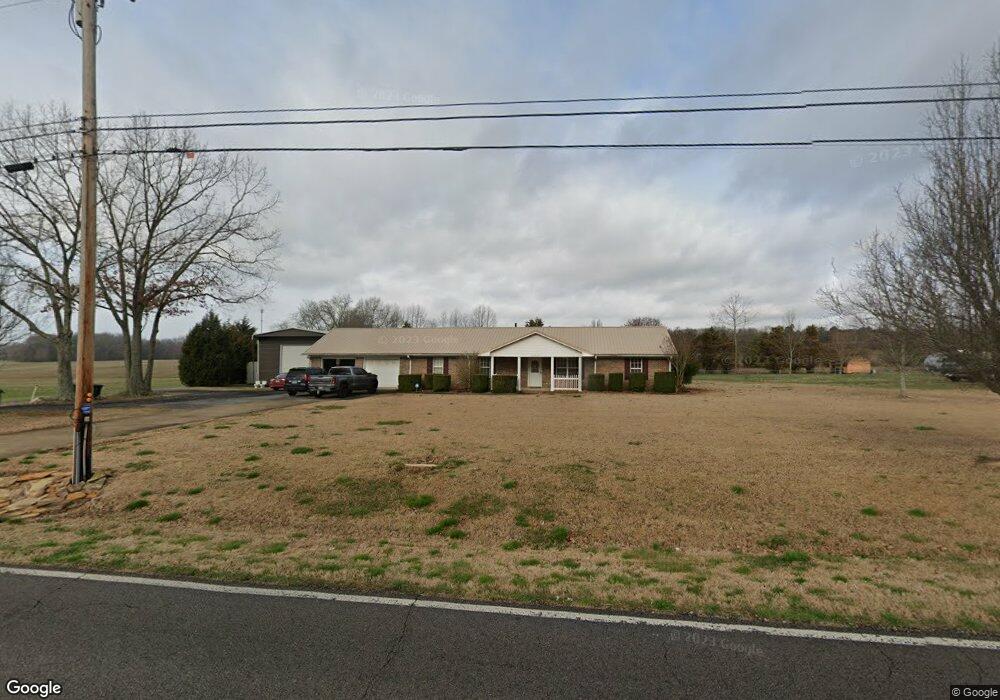
21655 Al Highway 251 Athens, AL 35613
Oak Grove-Pisgah NeighborhoodEstimated Value: $335,000 - $380,801
--
Bed
--
Bath
1,740
Sq Ft
$201/Sq Ft
Est. Value
About This Home
This home is located at 21655 Al Highway 251, Athens, AL 35613 and is currently estimated at $349,950, approximately $201 per square foot. 21655 Al Highway 251 is a home with nearby schools including Johnson Elementary School and Ardmore High School.
Ownership History
Date
Name
Owned For
Owner Type
Purchase Details
Closed on
Oct 14, 2022
Sold by
Smeenk Randy and Smeenk Marnie
Bought by
Smith Billy J
Current Estimated Value
Home Financials for this Owner
Home Financials are based on the most recent Mortgage that was taken out on this home.
Original Mortgage
$294,800
Outstanding Balance
$256,541
Interest Rate
6.15%
Mortgage Type
Construction
Estimated Equity
$93,409
Purchase Details
Closed on
Apr 1, 2016
Sold by
Stearns Victoria and Hale Glenda
Bought by
Smeenk Randy and Smeenk Marnie
Purchase Details
Closed on
Jul 1, 2015
Sold by
Woodward Ron
Bought by
Hale Glenda H
Create a Home Valuation Report for This Property
The Home Valuation Report is an in-depth analysis detailing your home's value as well as a comparison with similar homes in the area
Home Values in the Area
Average Home Value in this Area
Purchase History
| Date | Buyer | Sale Price | Title Company |
|---|---|---|---|
| Smith Billy J | $368,500 | Attorney Only | |
| Smeenk Randy | $155,000 | -- | |
| Hale Glenda H | $75,000 | -- |
Source: Public Records
Mortgage History
| Date | Status | Borrower | Loan Amount |
|---|---|---|---|
| Open | Smith Billy J | $294,800 |
Source: Public Records
Tax History Compared to Growth
Tax History
| Year | Tax Paid | Tax Assessment Tax Assessment Total Assessment is a certain percentage of the fair market value that is determined by local assessors to be the total taxable value of land and additions on the property. | Land | Improvement |
|---|---|---|---|---|
| 2024 | $1,816 | $59,520 | $0 | $0 |
| 2023 | $702 | $29,760 | $0 | $0 |
| 2022 | $512 | $21,660 | $0 | $0 |
| 2021 | $446 | $18,840 | $0 | $0 |
| 2020 | $577 | $18,240 | $0 | $0 |
| 2019 | $526 | $16,540 | $0 | $0 |
| 2018 | $474 | $14,800 | $0 | $0 |
| 2017 | $457 | $15,240 | $0 | $0 |
| 2016 | $457 | $152,320 | $0 | $0 |
| 2015 | -- | $15,240 | $0 | $0 |
| 2014 | -- | $0 | $0 | $0 |
Source: Public Records
Map
Nearby Homes
- 27395 Harvest Rd
- 21984 Hickory Hill Ln
- 20886 Johnson Dr
- LOT 2 South Rd
- LOT 1 South Rd
- 21286 Oakland Meadows
- 26220 Children Ln
- 22370 Howard St
- 22459 Howard St
- 15725 Ruthie Lynn Dr
- 15761 Ruthie Lynn Dr
- 15777 Ruthie Lynn Dr
- 15837 Ruthie Lynn Dr
- 15817 Ruthie Lynn Dr
- 20220 E Limestone Rd
- 3.82 Acres Alabama 251
- 20172 Sharp Rd
- 22018 Mulligan Pkwy
- 22040 Mulligan Pkwy
- 22052 Mulligan Pkwy
- 21683 Al Highway 251
- 21683 Alabama 251
- 21737 Al Highway 251
- 21720 Alabama 251
- 21720 Al Highway 251
- 21755 Al Highway 251
- 21760 Al Highway 251
- 21823 Al Highway 251
- 21797 Al Highway 251
- 21794 Al Highway 251
- 21828 Al Highway 251
- E Limestone Rd
- 21867 Al Highway 251
- 21759 E Limestone Rd
- 21637 E Limestone Rd
- 21717 E Limestone Rd
- 21793 E Limestone Rd
- 21835 E Limestone Rd
- 21671 E Limestone Rd
- 21593 E Limestone Rd