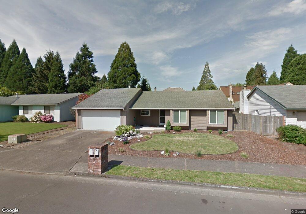
21659 SW Dakota Cir Tualatin, OR 97062
Estimated Value: $536,000 - $591,857
3
Beds
2
Baths
1,580
Sq Ft
$358/Sq Ft
Est. Value
About This Home
This home is located at 21659 SW Dakota Cir, Tualatin, OR 97062 and is currently estimated at $565,714, approximately $358 per square foot. 21659 SW Dakota Cir is a home located in Washington County with nearby schools including Byrom Elementary School, Hazelbrook Middle School, and Tualatin High School.
Ownership History
Date
Name
Owned For
Owner Type
Purchase Details
Closed on
Jun 11, 2013
Sold by
Starks William E and Starks Marianne M
Bought by
Starks William E and Starks Marianne M
Current Estimated Value
Home Financials for this Owner
Home Financials are based on the most recent Mortgage that was taken out on this home.
Original Mortgage
$83,100
Outstanding Balance
$18,481
Interest Rate
3.32%
Mortgage Type
New Conventional
Estimated Equity
$547,233
Purchase Details
Closed on
Jul 28, 2000
Sold by
Matthias Fred A and Matthias Marilyn M
Bought by
Starks William E and Starks Marianne M
Home Financials for this Owner
Home Financials are based on the most recent Mortgage that was taken out on this home.
Original Mortgage
$134,000
Interest Rate
8.2%
Create a Home Valuation Report for This Property
The Home Valuation Report is an in-depth analysis detailing your home's value as well as a comparison with similar homes in the area
Home Values in the Area
Average Home Value in this Area
Purchase History
| Date | Buyer | Sale Price | Title Company |
|---|---|---|---|
| Starks William E | -- | Lawyers Title | |
| Starks William E | $167,500 | Pacific Nw Title |
Source: Public Records
Mortgage History
| Date | Status | Borrower | Loan Amount |
|---|---|---|---|
| Open | Starks William E | $83,100 | |
| Closed | Starks William E | $134,000 | |
| Closed | Starks William E | $31,500 |
Source: Public Records
Tax History Compared to Growth
Tax History
| Year | Tax Paid | Tax Assessment Tax Assessment Total Assessment is a certain percentage of the fair market value that is determined by local assessors to be the total taxable value of land and additions on the property. | Land | Improvement |
|---|---|---|---|---|
| 2025 | $5,392 | $317,020 | -- | -- |
| 2024 | $5,251 | $307,790 | -- | -- |
| 2023 | $5,251 | $298,830 | $0 | $0 |
| 2022 | $5,024 | $298,830 | $0 | $0 |
| 2021 | $4,901 | $281,680 | $0 | $0 |
| 2020 | $4,756 | $273,480 | $0 | $0 |
| 2019 | $4,628 | $265,520 | $0 | $0 |
| 2018 | $4,440 | $257,790 | $0 | $0 |
| 2017 | $4,181 | $250,290 | $0 | $0 |
| 2016 | $3,986 | $243,000 | $0 | $0 |
| 2015 | $3,521 | $217,180 | $0 | $0 |
| 2014 | $3,421 | $210,860 | $0 | $0 |
Source: Public Records
Map
Nearby Homes
- 8811 SW Salinan St
- 8821 SW Salinan St
- 8829 Salinan St
- 8836 Salinan St
- 21932 SW Creek Dr
- 8904 Salinan St
- 8263 SW Blake St
- 21150 SW Arapaho Ct
- 8715 SW Tachi Ct
- 8501 SW Iroquois Dr
- 22222 SW Mandan Dr
- 22338 SW Pinto Dr
- 20916 SW Siletz Ct
- 9433 SW Siuslaw Ln
- 20685 SW Siletz Ct
- 22040 SW Grahams Ferry Rd Unit B
- 20839 SW Martinazzi Ave
- 9495 SW Cherry Ln
- 22030 SW Grahams Ferry Rd Unit D
- 22000 SW Grahams Ferry Rd Unit C
- 21667 SW Dakota Cir
- 21645 SW Dakota Cir
- 21484 SW Christensen Ct
- 21492 SW Christensen Ct
- 21478 SW Christensen Ct
- 21637 SW Dakota Cir
- 21675 SW Dakota Cir
- 21658 SW Dakota Cir
- 21636 SW Dakota Cir
- 21471 SW Christensen Ct
- 21502 SW Christensen Ct
- 21676 SW Dakota Cir
- 21711 SW Martinazzi Ave
- 21623 SW Dakota Cir
- 21657 SW Martinazzi Ave
- 21614 SW Dakota Cir
- 21489 SW Christensen Ct
- 21508 SW Christensen Ct
- 8826 SW Blake St
- 21615 SW Dakota Cir