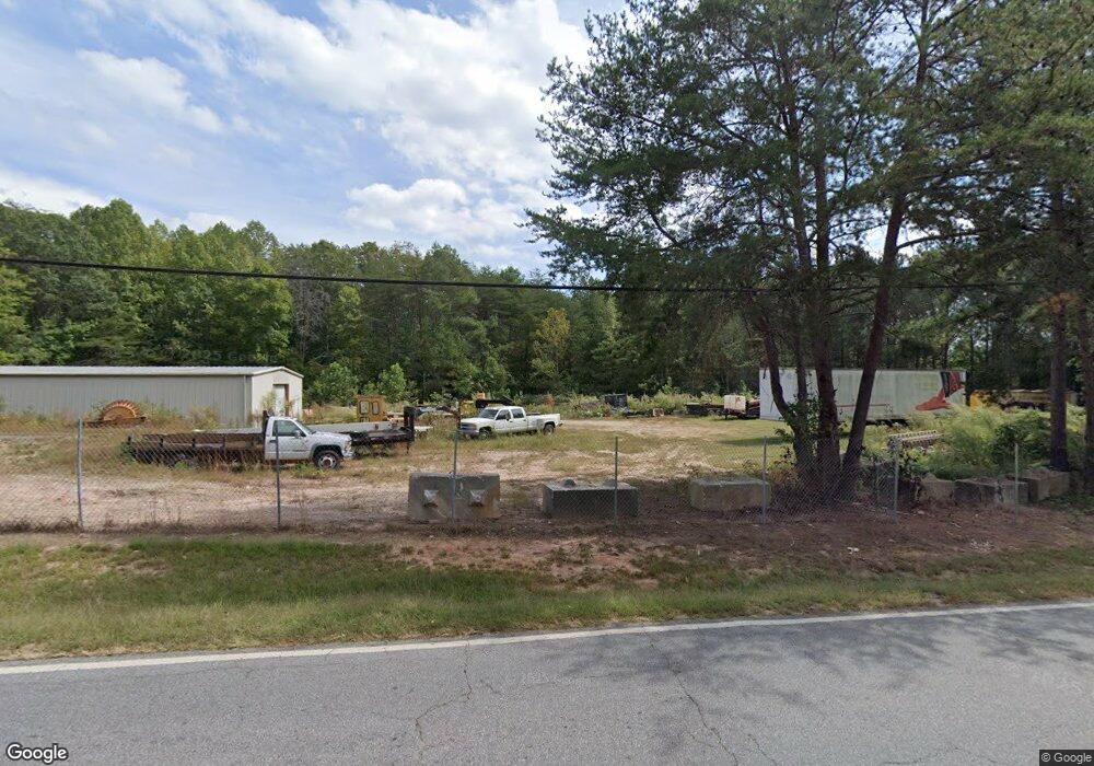
2166 Highway 19 N Dahlonega, GA 30533
Estimated Value: $479,823
--
Bed
--
Bath
4,000
Sq Ft
$120/Sq Ft
Est. Value
About This Home
This home is located at 2166 Highway 19 N, Dahlonega, GA 30533 and is currently estimated at $479,823, approximately $119 per square foot. 2166 Highway 19 N is a home located in Lumpkin County with nearby schools including Lumpkin County High School.
Ownership History
Date
Name
Owned For
Owner Type
Purchase Details
Closed on
Apr 30, 2021
Sold by
Kitchens Marshall J
Bought by
Jones Kenneth M
Current Estimated Value
Home Financials for this Owner
Home Financials are based on the most recent Mortgage that was taken out on this home.
Original Mortgage
$270,752
Interest Rate
3.1%
Mortgage Type
New Conventional
Purchase Details
Closed on
Apr 14, 1997
Sold by
Kitchens Marshall J
Bought by
Kitchens Marshall J
Purchase Details
Closed on
Oct 13, 1983
Sold by
Kitchens Marshall J
Bought by
Kitchens Marshall J
Purchase Details
Closed on
Mar 1, 1980
Bought by
Kitchens Marshall J
Create a Home Valuation Report for This Property
The Home Valuation Report is an in-depth analysis detailing your home's value as well as a comparison with similar homes in the area
Home Values in the Area
Average Home Value in this Area
Purchase History
| Date | Buyer | Sale Price | Title Company |
|---|---|---|---|
| Jones Kenneth M | $350,000 | -- | |
| Kitchens Marshall J | $102,000 | -- | |
| Kitchens Marshall J | -- | -- | |
| Kitchens Marshall J | -- | -- |
Source: Public Records
Mortgage History
| Date | Status | Borrower | Loan Amount |
|---|---|---|---|
| Closed | Jones Kenneth M | $270,752 |
Source: Public Records
Tax History Compared to Growth
Tax History
| Year | Tax Paid | Tax Assessment Tax Assessment Total Assessment is a certain percentage of the fair market value that is determined by local assessors to be the total taxable value of land and additions on the property. | Land | Improvement |
|---|---|---|---|---|
| 2024 | $3,404 | $144,738 | $99,800 | $44,938 |
| 2023 | $3,404 | $144,738 | $99,800 | $44,938 |
| 2022 | $3,466 | $145,006 | $99,800 | $45,206 |
| 2021 | $3,478 | $135,865 | $99,800 | $36,065 |
| 2020 | $3,584 | $135,865 | $99,800 | $36,065 |
| 2019 | $3,617 | $135,865 | $99,800 | $36,065 |
| 2018 | $3,855 | $135,865 | $99,800 | $36,065 |
| 2017 | $3,930 | $135,865 | $99,800 | $36,065 |
| 2016 | $4,063 | $135,865 | $99,800 | $36,065 |
| 2015 | $3,641 | $135,865 | $99,800 | $36,065 |
| 2014 | $3,641 | $138,119 | $99,800 | $38,319 |
| 2013 | -- | $138,570 | $99,800 | $38,770 |
Source: Public Records
Map
Nearby Homes
- 0 Camp Wahsega Rd Unit 7600956
- 0 Camp Wahsega Rd Unit 10547292
- 181 Gilreath Way
- 357 Camp Wahsega Rd
- 22 Deer Ridge Rd
- 77 Old River Rd
- 122 Tritt Rd
- 149 Highland Rd S
- 955 Camp Wahsega Rd
- 65 Golden Autumn Dr
- 159 Misty Way
- LOT 6 Sky Country Rd
- 96 Elbert Gaddis Rd
- 98 Elbert Gaddis Rd
- 238 Grand View St
- 94 Mountain View Dr
- 195 Green Valley Dr
- 490 N Hall Rd
- 2166 Highway 19 N
- C2 Camp Wahsega Rd
- B2 Camp Wahsega Rd
- B1 Camp Wahsega Rd
- C1 Camp Wahsega Rd
- A1 Camp Wahsega Rd
- A2 Camp Wahsega Rd
- 0 Camp Wahsega Rd Unit 8414777
- 0 Camp Wahsega Rd Unit 6040467
- 0 Camp Wahsega Rd Unit 8378220
- 0 Camp Wahsega Rd Unit 6010487
- 0 Camp Wahsega Rd Unit TR 3 7570978
- 0 Camp Wahsega Rd Unit 2606802
- 0 Camp Wahsega Rd Unit YTR 1 2820924
- 0 Camp Wahsega Rd Unit TR 2 2820940
- 0 Camp Wahsega Rd Unit TR 3 2820952
- 0 Camp Wahsega Rd Unit B2 2953469
- 0 Camp Wahsega Rd Unit C2 2953185
- 0 Camp Wahsega Rd Unit C1 2953179
- 0 Camp Wahsega Rd Unit B1 2953167