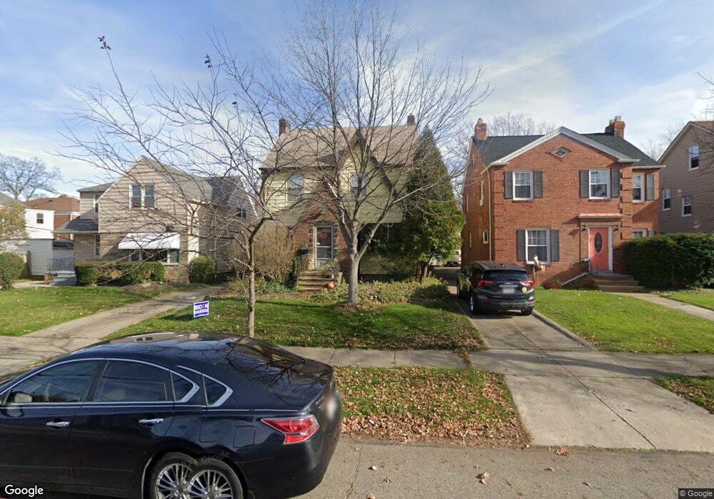
2167 Brockway Rd University Heights, OH 44118
Estimated Value: $208,749 - $258,000
3
Beds
2
Baths
1,608
Sq Ft
$147/Sq Ft
Est. Value
About This Home
This home is located at 2167 Brockway Rd, University Heights, OH 44118 and is currently estimated at $236,937, approximately $147 per square foot. 2167 Brockway Rd is a home located in Cuyahoga County with nearby schools including Canterbury Elementary School, Roxboro Middle School, and Cleveland Heights High School.
Ownership History
Date
Name
Owned For
Owner Type
Purchase Details
Closed on
Dec 7, 2021
Sold by
Davis Leigh C and Davis Richard B
Bought by
Davis Leigh C and Davis Richard B
Current Estimated Value
Purchase Details
Closed on
Sep 1, 2004
Sold by
Todd Michael D and Todd Wendy L
Bought by
Davis Leigh C
Home Financials for this Owner
Home Financials are based on the most recent Mortgage that was taken out on this home.
Original Mortgage
$117,900
Interest Rate
6.1%
Mortgage Type
Purchase Money Mortgage
Purchase Details
Closed on
Nov 14, 2001
Sold by
Toll John J
Bought by
Todd Michael D and Todd Wendy L
Home Financials for this Owner
Home Financials are based on the most recent Mortgage that was taken out on this home.
Original Mortgage
$115,710
Interest Rate
6.69%
Mortgage Type
VA
Purchase Details
Closed on
Dec 9, 1980
Sold by
Toll John J and Toll Dorothy J
Bought by
John J Toll
Purchase Details
Closed on
Jan 1, 1975
Bought by
Toll John J and Toll Dorothy J
Create a Home Valuation Report for This Property
The Home Valuation Report is an in-depth analysis detailing your home's value as well as a comparison with similar homes in the area
Home Values in the Area
Average Home Value in this Area
Purchase History
| Date | Buyer | Sale Price | Title Company |
|---|---|---|---|
| Davis Leigh C | -- | Joseph Kathryn T | |
| Davis Leigh C | $131,000 | -- | |
| Todd Michael D | $120,000 | Independence Title Agency In | |
| John J Toll | -- | -- | |
| Toll John J | -- | -- |
Source: Public Records
Mortgage History
| Date | Status | Borrower | Loan Amount |
|---|---|---|---|
| Previous Owner | Davis Leigh C | $117,900 | |
| Previous Owner | Todd Michael D | $115,710 |
Source: Public Records
Tax History Compared to Growth
Tax History
| Year | Tax Paid | Tax Assessment Tax Assessment Total Assessment is a certain percentage of the fair market value that is determined by local assessors to be the total taxable value of land and additions on the property. | Land | Improvement |
|---|---|---|---|---|
| 2024 | $6,025 | $70,000 | $12,320 | $57,680 |
| 2023 | $5,268 | $47,750 | $8,300 | $39,450 |
| 2022 | $5,242 | $47,740 | $8,300 | $39,450 |
| 2021 | $5,137 | $47,740 | $8,300 | $39,450 |
| 2020 | $5,071 | $42,630 | $7,420 | $35,210 |
| 2019 | $4,795 | $121,800 | $21,200 | $100,600 |
| 2018 | $4,696 | $42,630 | $7,420 | $35,210 |
| 2017 | $4,908 | $40,600 | $5,880 | $34,720 |
| 2016 | $4,845 | $40,600 | $5,880 | $34,720 |
| 2015 | $4,504 | $40,600 | $5,880 | $34,720 |
| 2014 | $4,504 | $39,800 | $5,780 | $34,020 |
Source: Public Records
Map
Nearby Homes
- 3621 Cedarbrook Rd
- 2208 Cranston Rd
- 13605 Cedar Rd
- 2216 Barrington Rd
- 3554 Raymont Blvd
- 13526 Cedar Rd
- 2244 Edgerton Rd
- 3526 Raymont Blvd
- 3525 Raymont Blvd
- 13785 Cedar Rd Unit 302
- 3790 Bushnell Rd
- 3544 Silsby Rd
- 3631 Cummings Rd
- 3494 Raymont Blvd
- 3474 Raymont Blvd
- 2320 Allison Rd
- 2083 Wynn Rd Unit 3
- 3575 Grosvenor Rd
- 3797 Northwood Rd
- 2085 Wynn Rd Unit 2
- 2171 Brockway Rd
- 2163 Brockway Rd
- 2175 Brockway Rd
- 2179 Brockway Rd
- 13646 Cedar Rd
- 13642 Cedar Rd
- 13650 Cedar Rd
- 2168 Cranston Rd
- 13652 Cedar Rd
- 2164 Cranston Rd
- 2172 Cranston Rd
- 2183 Brockway Rd
- 2176 Cranston Rd
- 13658 Cedar Rd #Down Rd
- 13658 Cedar Rd
- 13658 Cedar Rd Unit Up
- 13634 Cedar Rd
- 3629 Cedarbrook Rd
- 2180 Cranston Rd
- 2187 Brockway Rd