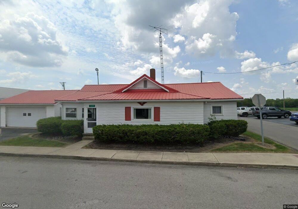
21673 State Route 347 Raymond, OH 43067
Estimated Value: $162,611 - $247,000
2
Beds
1
Bath
1,362
Sq Ft
$150/Sq Ft
Est. Value
About This Home
This home is located at 21673 State Route 347, Raymond, OH 43067 and is currently estimated at $204,653, approximately $150 per square foot. 21673 State Route 347 is a home with nearby schools including Raymond Elementary School, Creekview Intermediate Elementary School, and Bunsold Middle School.
Ownership History
Date
Name
Owned For
Owner Type
Purchase Details
Closed on
Oct 16, 2018
Sold by
Reed Steven
Bought by
Burton Nena Kaye and Reed Nena
Current Estimated Value
Purchase Details
Closed on
May 3, 2010
Sold by
Hoover Johnnie E and Estate Of Ted N Hoover
Bought by
Hoover Ted and Hoover Katherine
Purchase Details
Closed on
Feb 26, 2004
Sold by
Hoover Ted and Hoover Katherine
Bought by
United Telephone Co Of Ohio
Create a Home Valuation Report for This Property
The Home Valuation Report is an in-depth analysis detailing your home's value as well as a comparison with similar homes in the area
Home Values in the Area
Average Home Value in this Area
Purchase History
| Date | Buyer | Sale Price | Title Company |
|---|---|---|---|
| Burton Nena Kaye | -- | None Available | |
| Hoover Ted | $11,000 | Attorney | |
| United Telephone Co Of Ohio | $4,000 | -- |
Source: Public Records
Tax History Compared to Growth
Tax History
| Year | Tax Paid | Tax Assessment Tax Assessment Total Assessment is a certain percentage of the fair market value that is determined by local assessors to be the total taxable value of land and additions on the property. | Land | Improvement |
|---|---|---|---|---|
| 2024 | $1,859 | $40,340 | $4,090 | $36,250 |
| 2023 | $1,859 | $40,340 | $4,090 | $36,250 |
| 2022 | $1,829 | $40,340 | $4,090 | $36,250 |
| 2021 | $1,685 | $31,810 | $3,140 | $28,670 |
| 2020 | $1,611 | $31,810 | $3,140 | $28,670 |
| 2019 | $1,656 | $31,810 | $3,140 | $28,670 |
| 2018 | $971 | $17,310 | $2,560 | $14,750 |
| 2017 | $918 | $17,310 | $2,560 | $14,750 |
| 2016 | $915 | $17,310 | $2,560 | $14,750 |
| 2015 | $737 | $12,960 | $2,560 | $10,400 |
| 2014 | $724 | $12,960 | $2,560 | $10,400 |
| 2013 | $682 | $12,960 | $2,560 | $10,400 |
Source: Public Records
Map
Nearby Homes
- 21630 Main St
- 23156 State Route 739
- 0 Powder Lick Rd Unit 1016484
- 21875 Liberty Rd W
- 20971 Peoria Loop Rd
- 0 Liberty Rd W Unit 225028227
- 25400 Storms Rd
- 24097 Lunda Rd
- 24805 Rapp Dean Rd
- 20499 Bear Swamp Rd
- 20350 Bear Swamp Rd
- 25883 Lunda Rd
- 0 Johnson Rd Unit 225027964
- 0 Johnson Rd Unit 222024368
- 0 Johnson Rd Unit Lot 2 222024351
- 0 Benton Rd Unit Lot B 225022637
- 0 Benton Rd Unit Lot A 225022636
- 1299 Forest Edge Dr
- 1322 Forest Edge Dr
- 19463 Bear Swamp Rd
- 21664 Main St
- 21652 Main St
- 23509 Shirk Ave
- 23484 State Route 739 Ave
- 23445 Ohio 739
- 23445 Dayton Ave
- 21716 State Route 347
- 21686 Delaware St
- 21716 Main St
- 23527 Shirk Ave
- 21630 Ohio 347
- 21679 Ohio 739
- 28050 Ohio 739
- 22098 Ohio 739
- 21729 State Route 347
- 21622 State Route 347
- 21726 State Route 347
- 21726 Main St
- 23549 Shirk Ave
- 21644 Delaware St