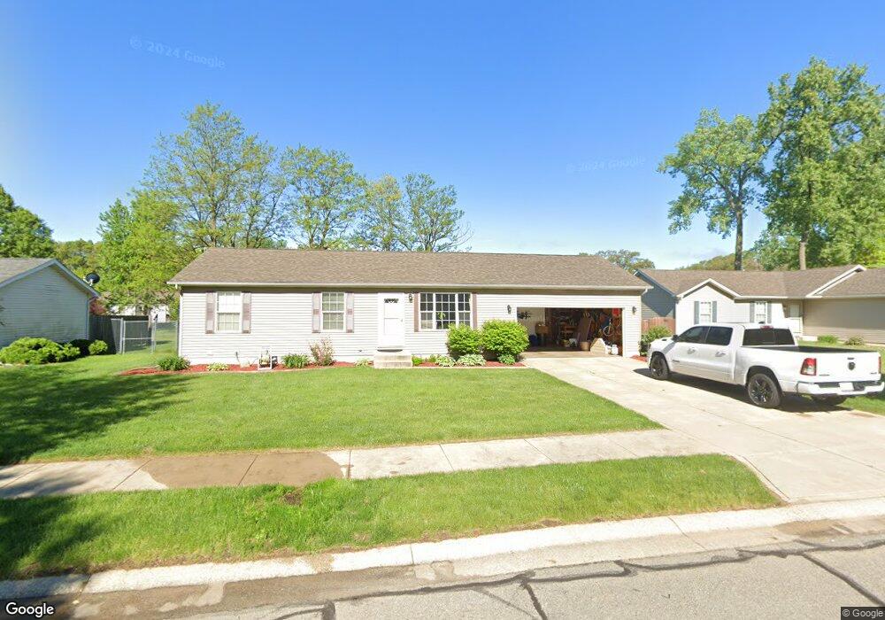
2168 Michael Dr Portage, IN 46368
Estimated Value: $246,889 - $266,000
3
Beds
1
Bath
1,144
Sq Ft
$224/Sq Ft
Est. Value
About This Home
This home is located at 2168 Michael Dr, Portage, IN 46368 and is currently estimated at $255,972, approximately $223 per square foot. 2168 Michael Dr is a home located in Porter County with nearby schools including Crisman Elementary School, Willowcreek Middle School, and Portage High School.
Ownership History
Date
Name
Owned For
Owner Type
Purchase Details
Closed on
Nov 22, 2016
Sold by
Holtzman Scott
Bought by
Holtzman Ii Scott D
Current Estimated Value
Home Financials for this Owner
Home Financials are based on the most recent Mortgage that was taken out on this home.
Original Mortgage
$109,500
Outstanding Balance
$88,048
Interest Rate
3.47%
Mortgage Type
New Conventional
Estimated Equity
$167,924
Purchase Details
Closed on
Jan 7, 2009
Sold by
The Bank Of New York Mellon Trust
Bought by
Holtzman Scott
Home Financials for this Owner
Home Financials are based on the most recent Mortgage that was taken out on this home.
Original Mortgage
$86,400
Interest Rate
5.08%
Mortgage Type
Purchase Money Mortgage
Purchase Details
Closed on
Aug 13, 2008
Sold by
Garbaciak Daniel and Garbaciak Cristina
Bought by
The Bank Of New York Mellon Trust Compan and The Bank Of New York Trust Company Na
Create a Home Valuation Report for This Property
The Home Valuation Report is an in-depth analysis detailing your home's value as well as a comparison with similar homes in the area
Home Values in the Area
Average Home Value in this Area
Purchase History
| Date | Buyer | Sale Price | Title Company |
|---|---|---|---|
| Holtzman Ii Scott D | -- | Hold For Meridian Title | |
| Holtzman Scott | -- | Investors Titlecorp | |
| The Bank Of New York Mellon Trust Compan | $116,875 | None Available |
Source: Public Records
Mortgage History
| Date | Status | Borrower | Loan Amount |
|---|---|---|---|
| Open | Holtzman Ii Scott D | $109,500 | |
| Closed | Holtzman Scott | $86,400 |
Source: Public Records
Tax History Compared to Growth
Tax History
| Year | Tax Paid | Tax Assessment Tax Assessment Total Assessment is a certain percentage of the fair market value that is determined by local assessors to be the total taxable value of land and additions on the property. | Land | Improvement |
|---|---|---|---|---|
| 2024 | $2,219 | $220,700 | $29,000 | $191,700 |
| 2023 | $2,009 | $219,100 | $27,600 | $191,500 |
| 2022 | $2,009 | $199,500 | $27,600 | $171,900 |
| 2021 | $1,777 | $176,200 | $27,600 | $148,600 |
| 2020 | $1,703 | $168,900 | $24,000 | $144,900 |
| 2019 | $1,632 | $161,800 | $24,000 | $137,800 |
| 2018 | $1,602 | $156,900 | $24,000 | $132,900 |
| 2017 | $1,483 | $147,700 | $24,000 | $123,700 |
| 2016 | $1,448 | $141,800 | $24,100 | $117,700 |
| 2014 | $1,517 | $148,400 | $24,900 | $123,500 |
| 2013 | -- | $143,000 | $25,500 | $117,500 |
Source: Public Records
Map
Nearby Homes
- 2183 Foley St
- 2230 Foley St
- 2239 Hamstrom Rd
- 6437 Windwood Ave
- 0 Airport Us 6 Unit NRA806028
- 0 Central Ave Unit NRA826855
- 0 Melton Rd Unit NRA811705
- 0 Airport Us 6 Unit NRA829208
- 6416 Old Porter Rd
- 1980 Crisman Rd
- 2400 Hamstrom Rd
- 2410 Norman St
- 6208 Lakewood Ave
- 2408 Doretta St
- 6192 Lakewood Ave
- 1912 Pleasant Meadows St
- 6184 Lakewood Ave
- 6195 Lakewood Ave
- 0 Northwood Trail Unit NRA811704
- 6170 Lakewood Ave
- 2176 Michael Dr
- 2160 Michael Dr
- 2169 Hamstrom Rd
- 6379 Michael Dr
- 2177 Hamstrom Rd
- 2152 Michael Dr
- 2184 Michael Dr
- 2161 Michael Dr
- 2177 Michael Dr
- 2185 Hamstrom Rd
- 2153 Hamstrom Rd
- 2185 Michael Dr
- 2192 Michael Dr
- 2169 Michael Dr
- 2145 Hamstrom Rd
- 2193 Hamstrom Rd
- 6409 Angel Ln
- 2193 Michael Dr
- 2168 Hamstrom Rd
- 2176 Hamstrom Rd