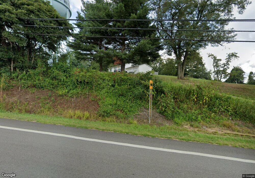
21685 State Route 676 Marietta, OH 45750
Estimated Value: $180,000 - $211,703
4
Beds
2
Baths
1,176
Sq Ft
$165/Sq Ft
Est. Value
About This Home
This home is located at 21685 State Route 676, Marietta, OH 45750 and is currently estimated at $194,426, approximately $165 per square foot. 21685 State Route 676 is a home with nearby schools including Warren High School, Veritas Classical Academy, and St. Mary Catholic School.
Ownership History
Date
Name
Owned For
Owner Type
Purchase Details
Closed on
Apr 14, 2023
Sold by
Kinzel Rodney J
Bought by
Smith Shane Patrick and Williams Katie Diane
Current Estimated Value
Home Financials for this Owner
Home Financials are based on the most recent Mortgage that was taken out on this home.
Original Mortgage
$100,000
Outstanding Balance
$97,246
Interest Rate
6.65%
Mortgage Type
New Conventional
Estimated Equity
$97,180
Purchase Details
Closed on
Nov 27, 2006
Sold by
Muntz Naomi G
Bought by
Farley Cathy J and Edgell Norma J
Purchase Details
Closed on
Jul 27, 2001
Bought by
Kinzel Rodney J and Kinzel Joan M
Purchase Details
Closed on
Mar 7, 2000
Purchase Details
Closed on
Aug 29, 1996
Bought by
Kinzel Rodney J
Purchase Details
Closed on
Oct 20, 1995
Create a Home Valuation Report for This Property
The Home Valuation Report is an in-depth analysis detailing your home's value as well as a comparison with similar homes in the area
Home Values in the Area
Average Home Value in this Area
Purchase History
| Date | Buyer | Sale Price | Title Company |
|---|---|---|---|
| Smith Shane Patrick | -- | None Listed On Document | |
| Farley Cathy J | -- | Attorney | |
| Edgell Norma J | -- | Attorney | |
| Farley David L | -- | Attorney | |
| Kinzel Rodney J | -- | -- | |
| -- | -- | -- | |
| Kinzel Rodney J | $60,000 | -- | |
| -- | -- | -- |
Source: Public Records
Mortgage History
| Date | Status | Borrower | Loan Amount |
|---|---|---|---|
| Open | Smith Shane Patrick | $100,000 |
Source: Public Records
Tax History Compared to Growth
Tax History
| Year | Tax Paid | Tax Assessment Tax Assessment Total Assessment is a certain percentage of the fair market value that is determined by local assessors to be the total taxable value of land and additions on the property. | Land | Improvement |
|---|---|---|---|---|
| 2024 | $2,228 | $58,930 | $8,340 | $50,590 |
| 2023 | $223 | $58,930 | $8,340 | $50,590 |
| 2022 | $2,669 | $70,790 | $8,340 | $62,450 |
| 2021 | $1,975 | $50,030 | $5,800 | $44,230 |
| 2020 | $1,967 | $50,030 | $5,800 | $44,230 |
| 2019 | $1,945 | $50,030 | $5,800 | $44,230 |
| 2018 | $1,815 | $45,250 | $5,050 | $40,200 |
| 2017 | $1,804 | $45,250 | $5,050 | $40,200 |
| 2016 | $1,575 | $45,250 | $5,050 | $40,200 |
| 2015 | $1,489 | $41,520 | $4,890 | $36,630 |
| 2014 | $2,137 | $41,520 | $4,890 | $36,630 |
| 2013 | $1,400 | $41,520 | $4,890 | $36,630 |
Source: Public Records
Map
Nearby Homes
- 305 Flintwood Dr
- 20645 Ohio 676
- 565 Lang Farm Rd
- 117 Clark St
- 100 Pineview Dr
- 211 Beaver St
- 203 Marion St
- 101 Laramie Rd
- 107 Strecker Hill
- 977 Gilman Ave
- 116 Pineview Dr
- 101 W Montgomery St
- 132 Mound Dr
- 111 Hanson Dr
- 721 Front St
- 213 E Montgomery St
- 904 Garfield Ave
- 817 5th St
- 204 Coventry Rd
- 722 1/2 3rd St
- 21693 State Route 676
- 21571 State Route 676
- 21577 State Route 676
- 21771 State Route 676
- 21549 State Route 676
- 21689 State Route 676
- 21475 State Route 676
- 21857 State Route 676
- 21880 State Route 676
- 21912 State Route 676
- 21923 State Route 676
- 21401 State Route 676
- 21920 State Route 676
- 21941 State Route 676
- 21362 State Route 676
- 21940 State Route 676
- 10 Kern Dr
- 1413 Lancaster St
- 1413 Lancaster St
- 1413 Lancaster St Unit H
