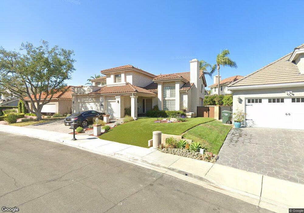
2169 Brookfield Dr Thousand Oaks, CA 91362
Estimated Value: $1,189,000 - $1,492,085
4
Beds
4
Baths
3,518
Sq Ft
$376/Sq Ft
Est. Value
About This Home
This home is located at 2169 Brookfield Dr, Thousand Oaks, CA 91362 and is currently estimated at $1,323,771, approximately $376 per square foot. 2169 Brookfield Dr is a home located in Ventura County with nearby schools including Lang Ranch, Los Cerritos Middle School, and Westlake High School.
Ownership History
Date
Name
Owned For
Owner Type
Purchase Details
Closed on
Mar 10, 2020
Sold by
Fleishman Lee
Bought by
Fleishman Lee
Current Estimated Value
Home Financials for this Owner
Home Financials are based on the most recent Mortgage that was taken out on this home.
Original Mortgage
$277,000
Interest Rate
3.4%
Mortgage Type
New Conventional
Create a Home Valuation Report for This Property
The Home Valuation Report is an in-depth analysis detailing your home's value as well as a comparison with similar homes in the area
Purchase History
We collect this data history from publicly available records. To have your information removed, we recommend requesting removal directly through your county’s website.
| Date | Buyer | Sale Price | Title Company |
|---|---|---|---|
| Fleishman Lee | -- | Placer Title Company |
Source: Public Records
Mortgage History
We collect this data history from publicly available records. To have your information removed, we recommend requesting removal directly through your county’s website.
| Date | Status | Borrower | Loan Amount |
|---|---|---|---|
| Closed | Fleishman Lee | $277,000 |
Source: Public Records
Tax History
| Year | Tax Paid | Tax Assessment Tax Assessment Total Assessment is a certain percentage of the fair market value that is determined by local assessors to be the total taxable value of land and additions on the property. | Land | Improvement |
|---|---|---|---|---|
| 2025 | $6,943 | $589,973 | $196,383 | $393,590 |
| 2024 | $6,943 | $578,405 | $192,532 | $385,873 |
| 2023 | $6,736 | $567,064 | $188,757 | $378,307 |
| 2022 | $6,601 | $555,946 | $185,056 | $370,890 |
| 2021 | $6,468 | $545,046 | $181,428 | $363,618 |
| 2020 | $6,023 | $539,460 | $179,569 | $359,891 |
| 2019 | $5,863 | $528,884 | $176,049 | $352,835 |
| 2018 | $5,740 | $518,515 | $172,598 | $345,917 |
| 2017 | $5,623 | $508,349 | $169,214 | $339,135 |
| 2016 | $5,564 | $498,383 | $165,897 | $332,486 |
| 2015 | $5,463 | $490,899 | $163,406 | $327,493 |
| 2014 | $5,380 | $481,285 | $160,206 | $321,079 |
Source: Public Records
Map
Nearby Homes
- 2181 Brookfield Dr
- 2229 Meadowside Dr
- 2233 Country Park Ct
- 2085 Brookfield Dr
- 2283 Northpark St
- 2231 Willowpark Ct
- 2099 Ralley Ct
- 1953 Laurel Wood Ct
- 1855 Brooktree Ct
- 2524 Kensington Ave
- 2805 Queens Way
- 3182 Toulouse Cir
- 1733 Alderwood Place
- 2326 Sunny Point St
- 3240 Casino Dr
- 1570 Burning Tree Dr
- 2736 Whitechapel Place
- 3283 Windmist Ave
- 1711 Tiburon Ct
- 3434 Fayance Place
- 2767 Hilary Ct
- 2732 Hilary Ct
- 2720 Hilary Ct
- 2157 Brookfield Dr
- 2182 Brookfield Dr
- 2779 Hilary Ct
- 2170 Brookfield Dr
- 2768 Hilary Ct
- 2738 Hilary Ct
- 2217 Brookfield Dr
- 2145 Brookfield Dr
- 2158 Brookfield Dr
- 2791 Hilary Ct
- 2179 Meadow Brook Ct
- 2780 Hilary Ct
- 2171 Meadow Brook Ct
- 2744 Hilary Ct
- 2163 Meadow Brook Ct
- 2146 Brookfield Dr
- 2762 Hilary Ct
Your Personal Tour Guide
Ask me questions while you tour the home.