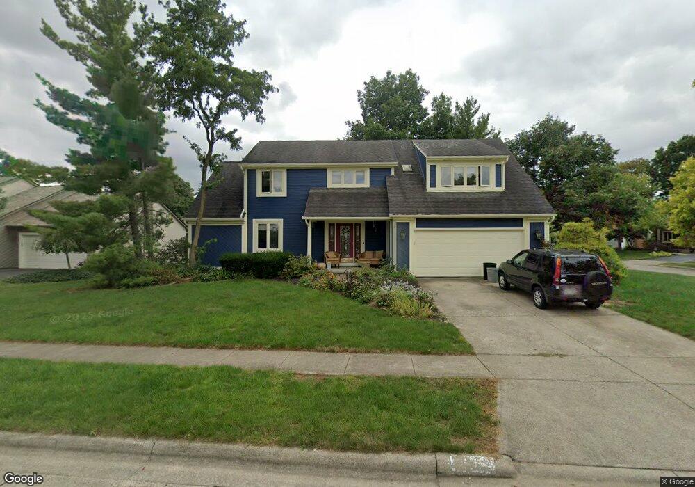
2169 Shawnmont Ct Dublin, OH 43016
Olde Sawmill NeighborhoodEstimated Value: $479,000 - $512,000
4
Beds
3
Baths
2,548
Sq Ft
$193/Sq Ft
Est. Value
About This Home
This home is located at 2169 Shawnmont Ct, Dublin, OH 43016 and is currently estimated at $491,040, approximately $192 per square foot. 2169 Shawnmont Ct is a home located in Franklin County with nearby schools including Granby Elementary School, McCord Middle School, and Worthington Kilbourne High School.
Ownership History
Date
Name
Owned For
Owner Type
Purchase Details
Closed on
Aug 25, 2005
Sold by
Macrae Peter S and Macrae Joan D
Bought by
Lemmon Michele R and Lemmon Tracy L
Current Estimated Value
Home Financials for this Owner
Home Financials are based on the most recent Mortgage that was taken out on this home.
Original Mortgage
$208,200
Outstanding Balance
$111,667
Interest Rate
5.89%
Mortgage Type
Purchase Money Mortgage
Estimated Equity
$379,373
Purchase Details
Closed on
Nov 29, 1990
Bought by
Macrae Peter S and Macrae Joan D
Purchase Details
Closed on
May 1, 1985
Purchase Details
Closed on
Nov 1, 1984
Create a Home Valuation Report for This Property
The Home Valuation Report is an in-depth analysis detailing your home's value as well as a comparison with similar homes in the area
Home Values in the Area
Average Home Value in this Area
Purchase History
| Date | Buyer | Sale Price | Title Company |
|---|---|---|---|
| Lemmon Michele R | $245,000 | Title First | |
| Macrae Peter S | $146,500 | -- | |
| -- | $126,000 | -- | |
| -- | $24,500 | -- |
Source: Public Records
Mortgage History
| Date | Status | Borrower | Loan Amount |
|---|---|---|---|
| Open | Lemmon Michele R | $208,200 |
Source: Public Records
Tax History Compared to Growth
Tax History
| Year | Tax Paid | Tax Assessment Tax Assessment Total Assessment is a certain percentage of the fair market value that is determined by local assessors to be the total taxable value of land and additions on the property. | Land | Improvement |
|---|---|---|---|---|
| 2024 | $8,643 | $140,780 | $44,420 | $96,360 |
| 2023 | $8,265 | $140,770 | $44,415 | $96,355 |
| 2022 | $7,645 | $103,330 | $27,620 | $75,710 |
| 2021 | $7,053 | $103,330 | $27,620 | $75,710 |
| 2020 | $6,794 | $103,330 | $27,620 | $75,710 |
| 2019 | $6,249 | $85,760 | $23,000 | $62,760 |
| 2018 | $5,842 | $85,760 | $23,000 | $62,760 |
| 2017 | $5,600 | $85,760 | $23,000 | $62,760 |
| 2016 | $5,631 | $79,310 | $23,170 | $56,140 |
| 2015 | $5,632 | $79,310 | $23,170 | $56,140 |
| 2014 | $5,630 | $79,310 | $23,170 | $56,140 |
| 2013 | $2,801 | $79,310 | $23,170 | $56,140 |
Source: Public Records
Map
Nearby Homes
- 7898 Sarahurst Dr
- 7907 Sarahurst Dr
- 8108 Smoky Row Rd
- 8345 Smoky Row Rd Unit 8345
- 1986 Sutter Pkwy
- 7734 Henry David Ct
- 1908 Lost Valley Rd
- 2475 Slateshire Dr
- 2208 Otter Ln
- 7680 Foxboro Ln
- 2074 Hard Rd
- 2423 Sutter Pkwy
- 2220 Surreygate Dr
- 8205 Longhorn Rd
- 2488 Dunstan Dr
- 8669 Ripton Dr
- 2620 Cedar Lake Dr Unit 2620
- 2469 Sandstrom Dr
- 2456 Sanford Dr
- 1960 Barnard Dr
- 2161 Shawnmont Ct
- 7731 Southwick Dr
- 7739 Southwick Dr
- 2153 Shawnmont Ct
- 7758 Southwick Dr
- 7723 Southwick Dr
- 7747 Southwick Dr
- 2158 Shawnmont Ct
- 2178 Stowmont Ct
- 2150 Shawnmont Ct
- 7711 Southwick Dr
- 2145 Shawnmont Ct
- 7755 Southwick Dr
- 2172 Stowmont Ct
- 7750 Seddon Dr
- 7762 Seddon Dr
- 7742 Seddon Dr
- 7699 Southwick Dr
- 7763 Southwick Dr
- 2137 Stancrest Rd