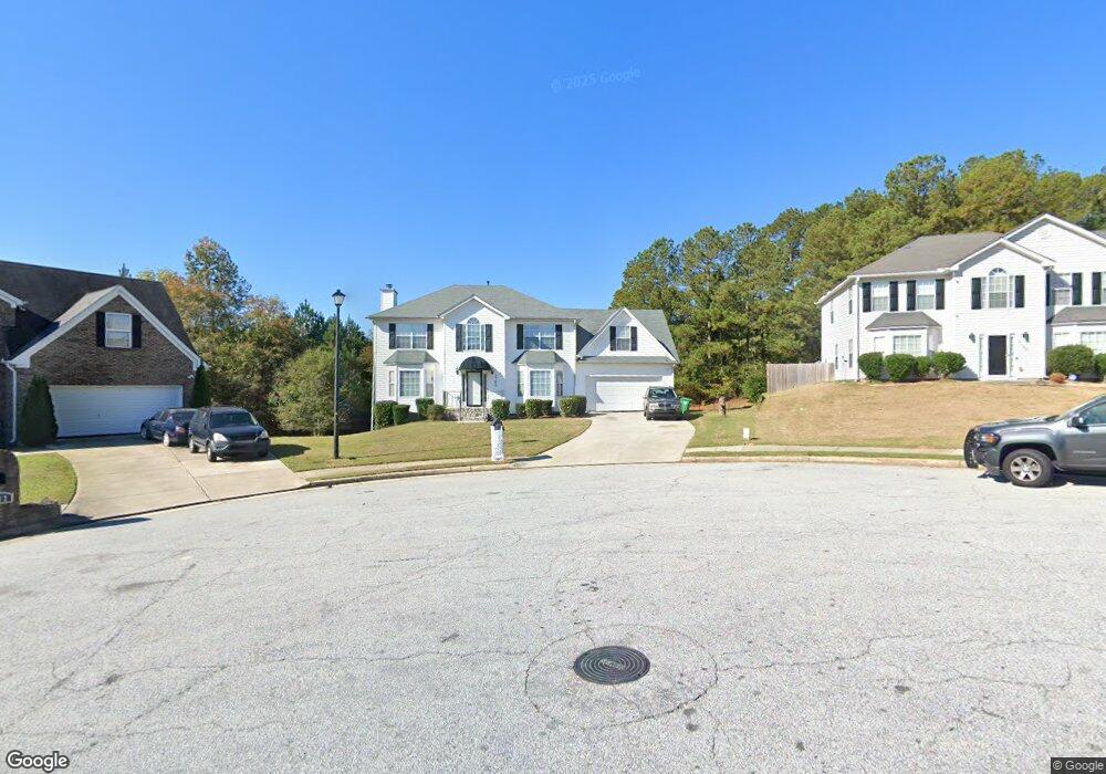
2169 Strang Blvd Lithonia, GA 30058
Estimated Value: $334,636 - $380,000
4
Beds
3
Baths
2,367
Sq Ft
$151/Sq Ft
Est. Value
About This Home
This home is located at 2169 Strang Blvd, Lithonia, GA 30058 and is currently estimated at $357,409, approximately $150 per square foot. 2169 Strang Blvd is a home located in DeKalb County with nearby schools including Rock Chapel Elementary School, Lithonia Middle School, and Lithonia High School.
Ownership History
Date
Name
Owned For
Owner Type
Purchase Details
Closed on
Oct 31, 2002
Sold by
Wayne Thomas Group Inc
Bought by
Anderson Andy D
Current Estimated Value
Home Financials for this Owner
Home Financials are based on the most recent Mortgage that was taken out on this home.
Original Mortgage
$179,200
Outstanding Balance
$74,139
Interest Rate
5.98%
Mortgage Type
FHA
Estimated Equity
$283,270
Create a Home Valuation Report for This Property
The Home Valuation Report is an in-depth analysis detailing your home's value as well as a comparison with similar homes in the area
Home Values in the Area
Average Home Value in this Area
Purchase History
| Date | Buyer | Sale Price | Title Company |
|---|---|---|---|
| Anderson Andy D | $182,500 | -- |
Source: Public Records
Mortgage History
| Date | Status | Borrower | Loan Amount |
|---|---|---|---|
| Open | Anderson Andy D | $179,200 |
Source: Public Records
Tax History Compared to Growth
Tax History
| Year | Tax Paid | Tax Assessment Tax Assessment Total Assessment is a certain percentage of the fair market value that is determined by local assessors to be the total taxable value of land and additions on the property. | Land | Improvement |
|---|---|---|---|---|
| 2025 | $3,901 | $134,720 | $20,000 | $114,720 |
| 2024 | $4,022 | $134,800 | $20,000 | $114,800 |
| 2023 | $4,022 | $118,840 | $20,000 | $98,840 |
| 2022 | $3,412 | $110,440 | $20,000 | $90,440 |
| 2021 | $2,934 | $89,720 | $15,000 | $74,720 |
| 2020 | $2,602 | $77,080 | $15,000 | $62,080 |
| 2019 | $2,466 | $73,920 | $15,000 | $58,920 |
| 2018 | $1,948 | $65,280 | $15,000 | $50,280 |
| 2017 | $2,428 | $70,320 | $15,000 | $55,320 |
| 2016 | $2,106 | $61,720 | $5,840 | $55,880 |
| 2014 | $1,841 | $55,360 | $5,840 | $49,520 |
Source: Public Records
Map
Nearby Homes
- 7786 Providence Point Way
- 7992 Browning Dr
- 7808 Providence Point Way
- 2051 Poplar Falls Ave
- 7977 Union Grove Rd
- 7492 Ferrara Dr
- 2442 Harmony Ridge Ct
- 7523 Poplar Falls Trail
- 2467 Overlook Ave
- 2231 Mason Point
- 2004 Poplar Falls Rd
- 2477 Osceola Rd
- 1862 Oak Hill Springs Blvd
- 2391 Harmony Ridge Ct
- 8332 Union Grove Rd
- 2496 Osceola Rd
- 1857 Oak Hill Springs Blvd
- 2330 Haliard Way
- 2289 Overlook Ave
- 2325 Haliard Way
- 2165 Strang Blvd
- 2173 Strang Blvd
- 2174 Strang Blvd
- 2159 Strang Blvd
- 2170 Strang Blvd
- 2166 Strang Blvd Unit 2B
- 2166 Strang Blvd
- 2153 Strang Blvd
- 2160 Strang Blvd
- 2037 Locksley Terrace
- 2154 Strang Blvd
- 2033 Locksley Terrace Unit 2B
- 2041 Locksley Terrace Unit 2B
- 2027 Locksley Terrace
- 2148 Strang Blvd
- 2141 Strang Blvd Unit 2B
- 2021 Locksley Terrace Unit 2B
- 2142 Strang Blvd Unit B
- 2015 Locksley Terrace
- 2135 Strang Blvd