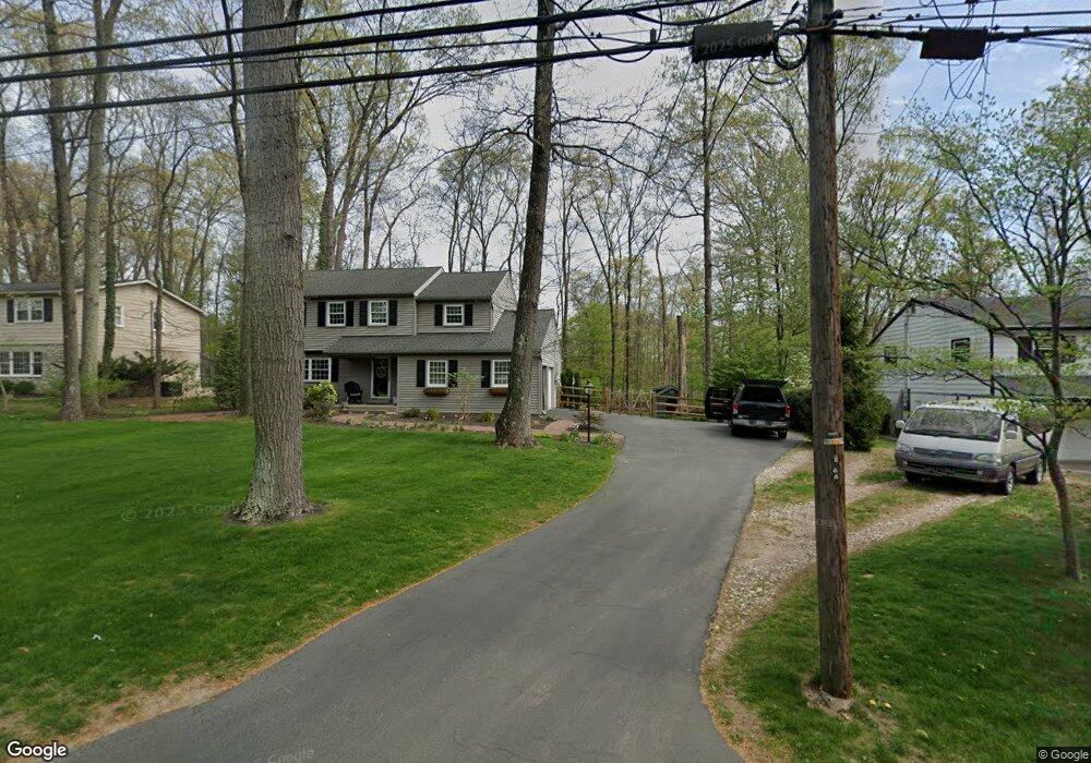
2169 Turk Rd Doylestown, PA 18901
Estimated Value: $624,579 - $794,000
3
Beds
3
Baths
2,235
Sq Ft
$323/Sq Ft
Est. Value
About This Home
This home is located at 2169 Turk Rd, Doylestown, PA 18901 and is currently estimated at $721,645, approximately $322 per square foot. 2169 Turk Rd is a home located in Bucks County with nearby schools including Kutz Elementary School, Lenape Middle School, and Central Bucks High School-West.
Ownership History
Date
Name
Owned For
Owner Type
Purchase Details
Closed on
Jun 28, 2005
Sold by
Mason Jonathan and Mason Debbie
Bought by
Mcgroggan Richard and Mcgroggan Michele W
Current Estimated Value
Home Financials for this Owner
Home Financials are based on the most recent Mortgage that was taken out on this home.
Original Mortgage
$50,000
Outstanding Balance
$26,117
Interest Rate
5.67%
Mortgage Type
Credit Line Revolving
Estimated Equity
$695,528
Purchase Details
Closed on
Nov 22, 1995
Sold by
Mahoney Patricia T and Murphy Patricia T
Bought by
Ueland Steven and Ueland Lois H
Home Financials for this Owner
Home Financials are based on the most recent Mortgage that was taken out on this home.
Original Mortgage
$153,900
Interest Rate
7.31%
Purchase Details
Closed on
Sep 30, 1993
Sold by
Mahoney Robert E and Mahoney Patricia T
Bought by
Mahoney Patricia T
Create a Home Valuation Report for This Property
The Home Valuation Report is an in-depth analysis detailing your home's value as well as a comparison with similar homes in the area
Home Values in the Area
Average Home Value in this Area
Purchase History
| Date | Buyer | Sale Price | Title Company |
|---|---|---|---|
| Mcgroggan Richard | $450,000 | -- | |
| Ueland Steven | $162,000 | -- | |
| Mahoney Patricia T | -- | -- |
Source: Public Records
Mortgage History
| Date | Status | Borrower | Loan Amount |
|---|---|---|---|
| Open | Mcgroggan Richard | $50,000 | |
| Open | Mcgroggan Richard | $150,000 | |
| Previous Owner | Ueland Steven | $153,900 |
Source: Public Records
Tax History Compared to Growth
Tax History
| Year | Tax Paid | Tax Assessment Tax Assessment Total Assessment is a certain percentage of the fair market value that is determined by local assessors to be the total taxable value of land and additions on the property. | Land | Improvement |
|---|---|---|---|---|
| 2025 | $5,380 | $30,400 | $6,120 | $24,280 |
| 2024 | $5,380 | $30,400 | $6,120 | $24,280 |
| 2023 | $5,130 | $30,400 | $6,120 | $24,280 |
| 2022 | $5,073 | $30,400 | $6,120 | $24,280 |
| 2021 | $4,968 | $30,400 | $6,120 | $24,280 |
| 2020 | $4,945 | $30,400 | $6,120 | $24,280 |
| 2019 | $4,892 | $30,400 | $6,120 | $24,280 |
| 2018 | $4,877 | $30,400 | $6,120 | $24,280 |
| 2017 | $4,839 | $30,400 | $6,120 | $24,280 |
| 2016 | $4,809 | $30,400 | $6,120 | $24,280 |
| 2015 | -- | $30,400 | $6,120 | $24,280 |
| 2014 | -- | $30,400 | $6,120 | $24,280 |
Source: Public Records
Map
Nearby Homes
- 137 Pebble Woods Dri Pebble Woods Dr
- 78 Tower Hill Rd
- 2320 Turk Rd
- 82 Avalon Ct Unit 2005
- 17 Addison Ct Unit 2703
- 1 Squirrel Rd
- 60 Quarry Rd
- 272 Fox Chase Ln
- 3 Steeplechase Dr
- 21 Shady Springs Dr
- 403 S Main St Unit S201
- 45 Bedford Ave
- 125 Edison Furlong Rd
- 89 Homestead Dr
- 420 Edison Furlong Rd
- 223 Cherry Ln
- 152 Watercrest Dr
- 150 Watercrest Dr
- 236 Green St
- 195 Lafayette St