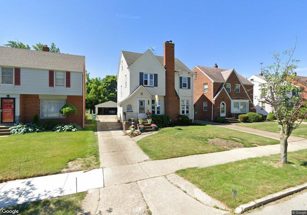
21690 Kennison Ave Euclid, OH 44123
Estimated Value: $165,046 - $182,000
4
Beds
1
Bath
1,538
Sq Ft
$112/Sq Ft
Est. Value
About This Home
This home is located at 21690 Kennison Ave, Euclid, OH 44123 and is currently estimated at $172,262, approximately $112 per square foot. 21690 Kennison Ave is a home located in Cuyahoga County with nearby schools including Arbor Elementary School, Euclid Middle School, and Euclid High School.
Ownership History
Date
Name
Owned For
Owner Type
Purchase Details
Closed on
Apr 2, 1985
Sold by
Francis E Ivory
Bought by
Ivory Francis E and Ivory Ellen M
Current Estimated Value
Purchase Details
Closed on
Jul 14, 1983
Sold by
Patrick J Lyons
Bought by
Francis E Ivory
Purchase Details
Closed on
Apr 25, 1980
Sold by
Lyons Patrick J
Bought by
Patrick J Lyons
Purchase Details
Closed on
Sep 27, 1979
Sold by
Mobbs Joseph D and Mobbs Barbara
Bought by
Lyons Patrick J
Purchase Details
Closed on
Jan 1, 1975
Bought by
Mobbs Joseph D and Mobbs Barbara
Create a Home Valuation Report for This Property
The Home Valuation Report is an in-depth analysis detailing your home's value as well as a comparison with similar homes in the area
Home Values in the Area
Average Home Value in this Area
Purchase History
| Date | Buyer | Sale Price | Title Company |
|---|---|---|---|
| Ivory Francis E | -- | -- | |
| Francis E Ivory | $66,000 | -- | |
| Patrick J Lyons | -- | -- | |
| Lyons Patrick J | $65,500 | -- | |
| Mobbs Joseph D | -- | -- |
Source: Public Records
Tax History Compared to Growth
Tax History
| Year | Tax Paid | Tax Assessment Tax Assessment Total Assessment is a certain percentage of the fair market value that is determined by local assessors to be the total taxable value of land and additions on the property. | Land | Improvement |
|---|---|---|---|---|
| 2024 | $2,924 | $53,060 | $9,450 | $43,610 |
| 2023 | $2,377 | $37,070 | $6,790 | $30,280 |
| 2022 | $2,355 | $37,070 | $6,790 | $30,280 |
| 2021 | $2,630 | $37,070 | $6,790 | $30,280 |
| 2020 | $2,606 | $34,340 | $6,300 | $28,040 |
| 2019 | $2,360 | $98,100 | $18,000 | $80,100 |
| 2018 | $1,191 | $34,340 | $6,300 | $28,040 |
| 2017 | $2,435 | $30,560 | $5,250 | $25,310 |
| 2016 | $2,440 | $30,560 | $5,250 | $25,310 |
| 2015 | $2,267 | $30,560 | $5,250 | $25,310 |
| 2014 | $2,267 | $30,560 | $5,250 | $25,310 |
Source: Public Records
Map
Nearby Homes
- 22000 Kennison Ave
- 290 E 216th St
- 21561 Maydale Ave
- 421 Kenwood Dr Unit G
- 254 E 214th St
- 441 Kenwood Dr Unit M
- 226 E 216th St
- 430 Kenwood Dr Unit C11
- 450 Kenwood Dr Unit E12
- 362 E 214th St
- 461 Kenwood Dr Unit T3
- 22301 Milton Dr
- 470 Kenwood Dr Unit D
- 231 E 210th St
- 22751 Fox Ave
- 490 Kenwood Dr Unit B
- 174 E 212th St
- 521 Kenwood Dr Unit A5
- 21251 S Lake Shore Blvd
- 273 E 208th St
- 21660 Kennison Ave
- 21720 Kennison Ave
- 21630 Kennison Ave
- 21750 Kennison Ave
- 21600 Kennison Ave
- 21780 Kennison Ave
- 21631 Roberts Ave
- 21701 Roberts Ave
- 21611 Roberts Ave
- 317 E 216th St
- 21731 Roberts Ave
- 21784 Kennison Ave
- 21590 Kennison Ave
- 21561 Roberts Ave
- 21761 Roberts Ave
- 21691 Kennison Ave
- 21721 Kennison Ave
- 315 E 216th St
- 321 E 215th St
- 21790 Kennison Ave