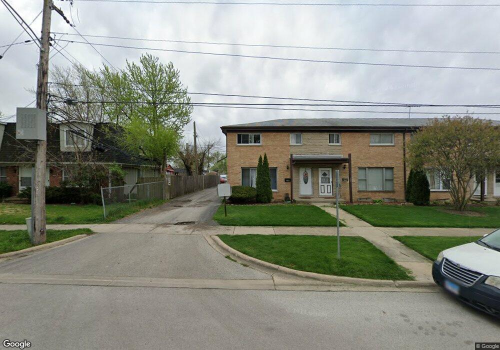
216D Dee Rd North Aurora, IL 60542
Estimated Value: $205,000 - $271,000
3
Beds
--
Bath
1,218
Sq Ft
$194/Sq Ft
Est. Value
About This Home
This home is located at 216D Dee Rd, North Aurora, IL 60542 and is currently estimated at $236,899, approximately $194 per square foot. 216D Dee Rd is a home located in Kane County with nearby schools including Schneider Elementary School, Herget Middle School, and West Aurora High School.
Ownership History
Date
Name
Owned For
Owner Type
Purchase Details
Closed on
Dec 7, 2009
Sold by
Ayaia Bonifacio D
Bought by
Najera Rosa
Current Estimated Value
Purchase Details
Closed on
Dec 4, 2009
Sold by
Najera Rosa
Bought by
Mastache Antonio
Purchase Details
Closed on
Jul 12, 2005
Sold by
Tackett Brenda S
Bought by
Ayala Bonifacia D
Home Financials for this Owner
Home Financials are based on the most recent Mortgage that was taken out on this home.
Original Mortgage
$26,400
Interest Rate
5.68%
Mortgage Type
Stand Alone Second
Create a Home Valuation Report for This Property
The Home Valuation Report is an in-depth analysis detailing your home's value as well as a comparison with similar homes in the area
Home Values in the Area
Average Home Value in this Area
Purchase History
We collect this data history from publicly available records. To have your information removed, we recommend requesting removal directly through your county’s website.
| Date | Buyer | Sale Price | Title Company |
|---|---|---|---|
| Najera Rosa | -- | None Available | |
| Mastache Antonio | -- | None Available | |
| Ayala Bonifacia D | $132,000 | Multiple |
Source: Public Records
Mortgage History
We collect this data history from publicly available records. To have your information removed, we recommend requesting removal directly through your county’s website.
| Date | Status | Borrower | Loan Amount |
|---|---|---|---|
| Previous Owner | Ayala Bonifacia D | $26,400 |
Source: Public Records
Tax History
| Year | Tax Paid | Tax Assessment Tax Assessment Total Assessment is a certain percentage of the fair market value that is determined by local assessors to be the total taxable value of land and additions on the property. | Land | Improvement |
|---|---|---|---|---|
| 2024 | $3,002 | $47,934 | $5,360 | $42,574 |
| 2023 | $2,682 | $40,960 | $4,865 | $36,095 |
| 2022 | $1,803 | $27,812 | $4,547 | $23,265 |
| 2021 | $1,732 | $26,377 | $4,312 | $22,065 |
| 2020 | $2,005 | $29,184 | $4,229 | $24,955 |
| 2019 | $2,014 | $28,151 | $4,079 | $24,072 |
| 2018 | $1,939 | $26,625 | $3,924 | $22,701 |
| 2017 | $1,791 | $24,504 | $3,795 | $20,709 |
| 2016 | $1,311 | $19,150 | $3,684 | $15,466 |
| 2015 | -- | $15,226 | $3,600 | $11,626 |
| 2014 | -- | $14,747 | $3,487 | $11,260 |
| 2013 | -- | $14,459 | $3,419 | $11,040 |
Source: Public Records
Map
Nearby Homes
- 201 Lilac Ln
- 209 Sharon Ln
- 401 Hill Ave
- 104 Sharon Ln
- 217 Ridge Rd
- 357 Ridge Rd
- 217 Sussex Ct
- 734 Lindsay Cir
- 31 Oak Creek Ct
- 208 W State St
- 76 Johnson Ct Unit 6
- 77 Johnson Ct Unit 1
- 451 Pheasant Hill Dr
- 823 Columbia Cir
- 108 Schneider Ct Unit 108
- 423 Prairie Ridge Ln
- 28 S Willow Way
- 864 Wingfoot Dr
- 357 Pheasant Hill Dr
- 444 Prairie Ridge Ln
- 216C Dee Rd
- 225 Linn Ct Unit B
- 225 Linn Ct Unit A
- 225 Linn Ct Unit C
- 225 Linn Ct Unit D
- 216 Dee Rd Unit A
- 216 Dee Rd Unit B
- 216 Dee Rd Unit C
- 218A Dee Rd Unit B
- 223 Linn Ct Unit B
- 223 Linn Ct Unit A
- 223 Linn Ct Unit D
- 223 Linn Ct Unit C
- 220 Dee Rd
- 222B Laurel Dr
- 217 Dee Rd
- 222A Laurel Dr
- 221 Linn Ct Unit A
- 221 Linn Ct Unit B
- 221 Linn Ct Unit C
Your Personal Tour Guide
Ask me questions while you tour the home.