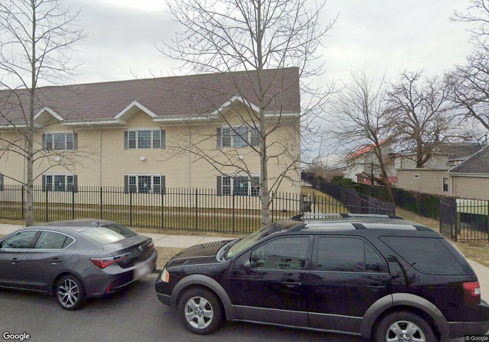
217 Admiral Ln Unit 2217G Bronx, NY 10473
Clason Point NeighborhoodEstimated Value: $404,000 - $511,000
2
Beds
2
Baths
1,061
Sq Ft
$423/Sq Ft
Est. Value
About This Home
This home is located at 217 Admiral Ln Unit 2217G, Bronx, NY 10473 and is currently estimated at $448,667, approximately $422 per square foot. 217 Admiral Ln Unit 2217G is a home located in Bronx County with nearby schools including P.S. 182 and Holy Cross Elementary School.
Ownership History
Date
Name
Owned For
Owner Type
Purchase Details
Closed on
Jun 30, 2006
Sold by
Allen Bedford and Allen Cicely
Bought by
Allen Bedford and Allen Cicely
Current Estimated Value
Home Financials for this Owner
Home Financials are based on the most recent Mortgage that was taken out on this home.
Original Mortgage
$272,000
Interest Rate
6.47%
Mortgage Type
Commercial
Create a Home Valuation Report for This Property
The Home Valuation Report is an in-depth analysis detailing your home's value as well as a comparison with similar homes in the area
Home Values in the Area
Average Home Value in this Area
Purchase History
| Date | Buyer | Sale Price | Title Company |
|---|---|---|---|
| Allen Bedford | -- | -- | |
| Allen Bedford | -- | -- |
Source: Public Records
Mortgage History
| Date | Status | Borrower | Loan Amount |
|---|---|---|---|
| Closed | Allen Bedford | $272,000 |
Source: Public Records
Tax History Compared to Growth
Tax History
| Year | Tax Paid | Tax Assessment Tax Assessment Total Assessment is a certain percentage of the fair market value that is determined by local assessors to be the total taxable value of land and additions on the property. | Land | Improvement |
|---|---|---|---|---|
| 2025 | $2,706 | $24,025 | $14,499 | $9,526 |
| 2024 | $2,706 | $23,967 | $14,499 | $9,468 |
| 2023 | $1,896 | $23,816 | $15,510 | $8,306 |
| 2022 | $1,834 | $23,492 | $14,499 | $8,993 |
| 2021 | $2,431 | $22,276 | $14,499 | $7,777 |
| 2020 | $1,800 | $25,656 | $14,499 | $11,157 |
| 2019 | $2,430 | $23,546 | $19,558 | $3,988 |
| 2018 | $2,385 | $21,159 | $19,559 | $1,600 |
| 2017 | $2,209 | $20,944 | $19,558 | $1,386 |
| 2016 | $1,905 | $20,712 | $19,559 | $1,153 |
| 2015 | $1,813 | $21,650 | $19,558 | $2,092 |
| 2014 | $1,813 | $20,944 | $19,558 | $1,386 |
Source: Public Records
Map
Nearby Homes
- 230 Fleet Ct Unit 16230
- 230 Sunset Blvd Unit 12230
- 112 Sunset Blvd Unit 11112
- 217 Sunset Blvd
- 106 Bolton Ave Unit 1
- 109 Neptune Ln Unit 5
- 618 Harding Park
- 114 Beacon Ln
- 100 Neptune Ln Unit 15100
- 109 Fleet Ct
- 197 Surf Dr Unit 123
- 163 Surf Dr Unit 199
- 170 Soundview Ave
- 1540 Harding Park
- 122 Stephens Ave
- 179 Surf Dr Unit 114
- 109 Heron Ln Unit 447
- 109 Dolphin Ct
- 160 Stephens Ave
- 203 White Plains Rd
- 227 Admiral Ln
- 133 Sunset Blvd Unit 10133
- 137 Sunset Blvd
- 137 Sunset Blvd Unit 10137
- 129 Sunset Blvd Unit 10129
- 129 Sunset Blvd Unit 1
- 125 Sunset Blvd Unit 10125
- 121 Sunset Blvd Unit 10121
- 145 Sunset Blvd Unit 10145
- 141 Sunset Blvd Unit 10141
- 149 Sunset Blvd Unit 10149
- 113 Sunset Blvd Unit 10113
- 301 Admiral Ln Unit 1301C
- 109 Sunset Blvd Unit 10109
- 153 Sunset Blvd Unit 10153
- 331 Admiral Ln Unit 343
- 331 Admiral Ln Unit 2
- 331 Admiral Ln Unit 234
- 157 Sunset Blvd Unit 10157
- 335 Admiral Ln Unit 343