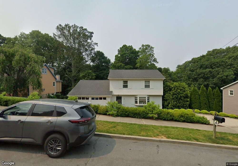
217 Carroll Rd Fairfield, CT 06824
University NeighborhoodEstimated Value: $803,000 - $1,052,000
3
Beds
3
Baths
1,630
Sq Ft
$582/Sq Ft
Est. Value
About This Home
This home is located at 217 Carroll Rd, Fairfield, CT 06824 and is currently estimated at $948,231, approximately $581 per square foot. 217 Carroll Rd is a home located in Fairfield County with nearby schools including Riverfield Elementary School, Roger Ludlowe Middle School, and Fairfield Ludlowe High School.
Ownership History
Date
Name
Owned For
Owner Type
Purchase Details
Closed on
Mar 1, 1999
Sold by
Rosner David and Rosner Debra A
Bought by
Desmond Sean and Desmond Amanda
Current Estimated Value
Purchase Details
Closed on
Mar 1, 1991
Sold by
Pavlik Joseph V and Pavlik Barbara J
Bought by
Rosner Debra A and Rosner David
Purchase Details
Closed on
Jul 8, 1987
Sold by
Lindstrom Richard E
Bought by
Paulik Jos V
Create a Home Valuation Report for This Property
The Home Valuation Report is an in-depth analysis detailing your home's value as well as a comparison with similar homes in the area
Home Values in the Area
Average Home Value in this Area
Purchase History
| Date | Buyer | Sale Price | Title Company |
|---|---|---|---|
| Desmond Sean | $280,000 | -- | |
| Desmond Sean | $280,000 | -- | |
| Rosner Debra A | $250,000 | -- | |
| Paulik Jos V | $275,000 | -- |
Source: Public Records
Mortgage History
| Date | Status | Borrower | Loan Amount |
|---|---|---|---|
| Open | Paulik Jos V | $304,500 | |
| Closed | Paulik Jos V | $147,780 | |
| Closed | Paulik Jos V | $179,500 |
Source: Public Records
Tax History
| Year | Tax Paid | Tax Assessment Tax Assessment Total Assessment is a certain percentage of the fair market value that is determined by local assessors to be the total taxable value of land and additions on the property. | Land | Improvement |
|---|---|---|---|---|
| 2025 | $11,145 | $392,560 | $279,300 | $113,260 |
| 2024 | $10,952 | $392,560 | $279,300 | $113,260 |
| 2023 | $10,799 | $392,560 | $279,300 | $113,260 |
| 2022 | $10,693 | $392,560 | $279,300 | $113,260 |
| 2021 | $10,591 | $392,560 | $279,300 | $113,260 |
| 2020 | $10,813 | $403,620 | $276,430 | $127,190 |
| 2019 | $10,813 | $403,620 | $276,430 | $127,190 |
| 2018 | $10,639 | $403,620 | $276,430 | $127,190 |
| 2017 | $10,421 | $403,620 | $276,430 | $127,190 |
| 2016 | $10,272 | $403,620 | $276,430 | $127,190 |
| 2015 | $10,282 | $414,750 | $290,990 | $123,760 |
| 2014 | $10,120 | $414,750 | $290,990 | $123,760 |
Source: Public Records
Map
Nearby Homes
- 105 Charter Oak Rd
- 218 Lower Farm Rd
- 148 Millspaugh Dr
- 360 Duck Farm Rd
- 1091 Round Hill Rd
- 1353 Mill Plain Rd
- 42 Robin Cir
- 196 Robin Ln
- 359 Reid St
- 1478 Jennings Rd
- 68 Figlar Ave
- 245 Reid St
- 54 Ridgedale Rd
- 341 Crestwood Rd
- 115 Mayfair Rd
- 706 Judd St
- 15 Barton Rd
- 210 Pansy Rd
- 41 Pepperbush Ln
- 12 Sugar Plum Ln
- 237 Carroll Rd
- 195 Carroll Rd
- 224 Carroll Rd
- 192 Carroll Rd
- 177 Carroll Rd
- 202 Woods End Rd
- 251 Carroll Rd
- 218 Woods End Rd
- 196 Woods End Rd
- 240 Carroll Rd
- 163 Carroll Rd
- 269 Carroll Rd
- 182 Woods End Rd
- 182 Woods End Rd
- 232 Woods End Rd
- 258 Carroll Rd
- 287 Carroll Rd
- 176 Carroll Rd
- 43 Thor Place
- 13 Thor Place
Your Personal Tour Guide
Ask me questions while you tour the home.