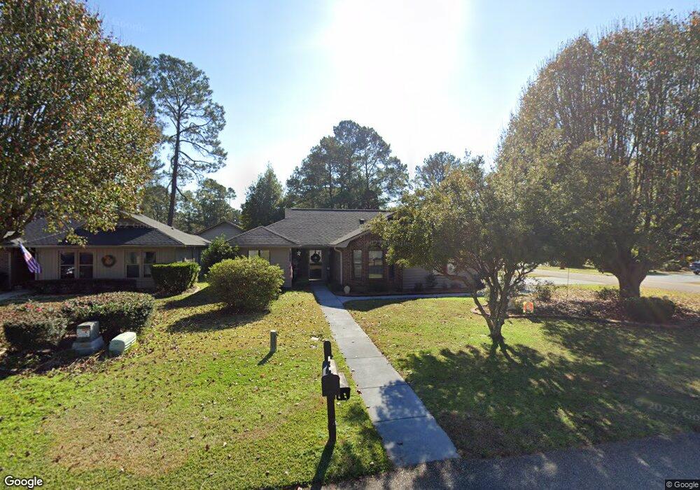
217 Cedar Ridge Ln Unit Myrtle Trace Conway, SC 29526
Estimated Value: $303,000 - $330,000
3
Beds
2
Baths
1,755
Sq Ft
$178/Sq Ft
Est. Value
About This Home
This home is located at 217 Cedar Ridge Ln Unit Myrtle Trace, Conway, SC 29526 and is currently estimated at $312,157, approximately $177 per square foot. 217 Cedar Ridge Ln Unit Myrtle Trace is a home located in Horry County with nearby schools including Carolina Forest Elementary School, Ten Oaks Middle, and Carolina Forest High School.
Ownership History
Date
Name
Owned For
Owner Type
Purchase Details
Closed on
Jun 20, 2022
Sold by
Sibley Nicholas S
Bought by
Recker Marsha M
Current Estimated Value
Home Financials for this Owner
Home Financials are based on the most recent Mortgage that was taken out on this home.
Original Mortgage
$217,000
Outstanding Balance
$206,168
Interest Rate
5.1%
Mortgage Type
New Conventional
Estimated Equity
$105,989
Purchase Details
Closed on
Feb 24, 2020
Sold by
Tatum Ronald G
Bought by
Sibley Priscille B
Purchase Details
Closed on
Jun 2, 2000
Sold by
Thompson Paul W and Thompson Jane L
Bought by
Tatum Ronald G and Tatum Ronda M
Home Financials for this Owner
Home Financials are based on the most recent Mortgage that was taken out on this home.
Original Mortgage
$310,000
Interest Rate
8.27%
Mortgage Type
Purchase Money Mortgage
Create a Home Valuation Report for This Property
The Home Valuation Report is an in-depth analysis detailing your home's value as well as a comparison with similar homes in the area
Home Values in the Area
Average Home Value in this Area
Purchase History
| Date | Buyer | Sale Price | Title Company |
|---|---|---|---|
| Recker Marsha M | $310,000 | -- | |
| Sibley Priscille B | $195,000 | -- | |
| Tatum Ronald G | $142,000 | -- |
Source: Public Records
Mortgage History
| Date | Status | Borrower | Loan Amount |
|---|---|---|---|
| Open | Recker Marsha M | $217,000 | |
| Previous Owner | Tatum Ronald G | $310,000 |
Source: Public Records
Tax History Compared to Growth
Tax History
| Year | Tax Paid | Tax Assessment Tax Assessment Total Assessment is a certain percentage of the fair market value that is determined by local assessors to be the total taxable value of land and additions on the property. | Land | Improvement |
|---|---|---|---|---|
| 2024 | $3,750 | $18,213 | $4,843 | $13,370 |
| 2023 | $3,750 | $7,914 | $1,454 | $6,460 |
| 2021 | $2,614 | $7,914 | $1,454 | $6,460 |
| 2020 | $502 | $7,914 | $1,454 | $6,460 |
| 2019 | $502 | $7,914 | $1,454 | $6,460 |
| 2018 | $0 | $6,313 | $1,213 | $5,100 |
| 2017 | $0 | $6,313 | $1,213 | $5,100 |
| 2016 | $0 | $6,313 | $1,213 | $5,100 |
| 2015 | -- | $6,313 | $1,213 | $5,100 |
| 2014 | $385 | $6,313 | $1,213 | $5,100 |
Source: Public Records
Map
Nearby Homes
- 108 Ashwood Cir
- 111 Laurelwood Ln
- 338 Myrtle Meadows Dr
- 339 Myrtle Meadows Dr
- 355 Myrtle Meadows Dr
- 8244 Timber Ridge Rd
- 109 Lakeside Crossing Dr
- 705 Wincrest Ct
- 570 Woodholme Dr
- 567 Woodholme Dr
- 594 Woodholme Dr
- 112 Mayberry Ln
- 107 Myrtle Trace Dr
- 237 Wellspring Dr
- 8223 Forest Lake Dr
- 216 Walden Lake Rd
- 253 Wellspring Dr
- 627 Woodholme Dr
- 157 Lakeside Crossing Dr
- 117 Boxwood Ln
- 217 Cedar Ridge Ln
- 215 Cedar Ridge Ln
- 205 Butternut Cir
- 213 Cedar Ridge Ln
- 213 Cedar Ridge Ln Unit Myrtle Trace
- 202 Butternut Cir
- 204 Butternut Cir
- 207 Butternut Cir Unit Myrtle Trace
- 207 Butternut Cir
- 218 Cedar Ridge Ln
- 216 Cedar Ridge Ln Unit Myrtle Trace
- 216 Cedar Ridge Ln
- 206 Butternut Cir Unit Myrtle Trace
- 206 Butternut Cir
- 220 Cedar Ridge Ln
- 101 Juneberry Ln
- 214 Cedar Ridge Ln Unit Myrtle Trace
- 214 Cedar Ridge Ln
- 222 Cedar Ridge Ln
- 209 Butternut Cir