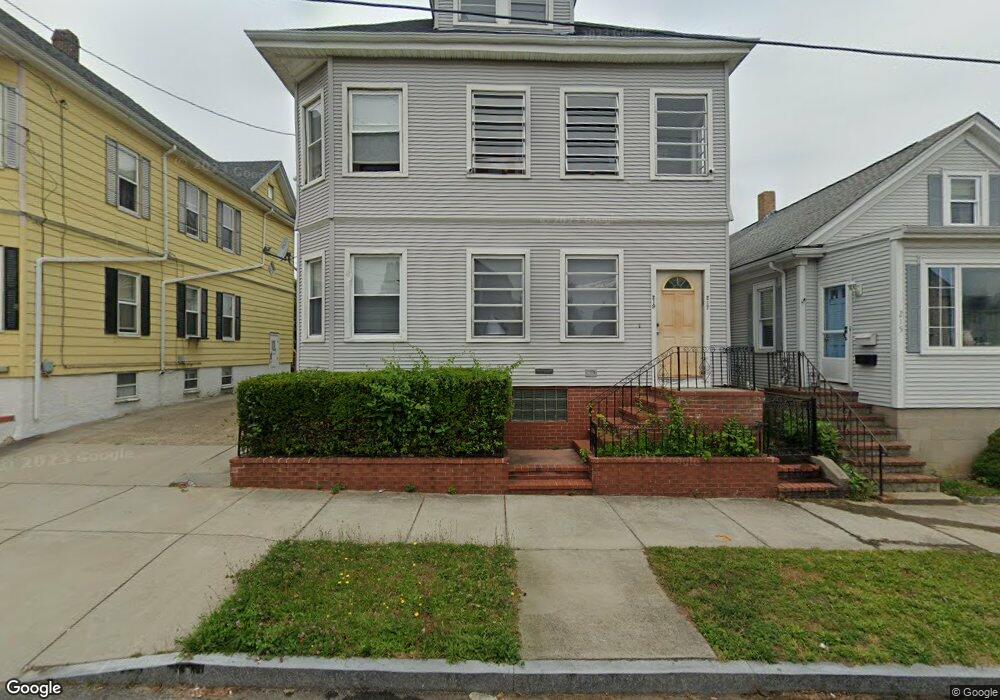
217 Clifford St Unit 219 New Bedford, MA 02745
Acushnet Station NeighborhoodEstimated Value: $493,099 - $602,000
6
Beds
2
Baths
2,382
Sq Ft
$227/Sq Ft
Est. Value
About This Home
This home is located at 217 Clifford St Unit 219, New Bedford, MA 02745 and is currently estimated at $541,525, approximately $227 per square foot. 217 Clifford St Unit 219 is a home located in Bristol County with nearby schools including Charles S. Ashley Elementary School, Normandin Middle School, and New Bedford High School.
Ownership History
Date
Name
Owned For
Owner Type
Purchase Details
Closed on
Mar 20, 2002
Sold by
Lopes Carlos A and Lopes Lauren A
Bought by
Faria Jesse J
Current Estimated Value
Home Financials for this Owner
Home Financials are based on the most recent Mortgage that was taken out on this home.
Original Mortgage
$140,000
Interest Rate
6.91%
Mortgage Type
Purchase Money Mortgage
Purchase Details
Closed on
Sep 8, 1992
Sold by
Cabral Adeline P Est
Bought by
Lopes Carlos A and Lopes Lauren A
Create a Home Valuation Report for This Property
The Home Valuation Report is an in-depth analysis detailing your home's value as well as a comparison with similar homes in the area
Home Values in the Area
Average Home Value in this Area
Purchase History
| Date | Buyer | Sale Price | Title Company |
|---|---|---|---|
| Faria Jesse J | $157,500 | -- | |
| Faria Jesse J | $157,500 | -- | |
| Lopes Carlos A | $112,500 | -- | |
| Lopes Carlos A | $112,500 | -- |
Source: Public Records
Mortgage History
| Date | Status | Borrower | Loan Amount |
|---|---|---|---|
| Open | Lopes Carlos A | $187,000 | |
| Closed | Lopes Carlos A | $134,271 | |
| Closed | Lopes Carlos A | $140,000 |
Source: Public Records
Tax History Compared to Growth
Tax History
| Year | Tax Paid | Tax Assessment Tax Assessment Total Assessment is a certain percentage of the fair market value that is determined by local assessors to be the total taxable value of land and additions on the property. | Land | Improvement |
|---|---|---|---|---|
| 2025 | $5,375 | $475,200 | $99,900 | $375,300 |
| 2024 | $4,747 | $395,600 | $96,600 | $299,000 |
| 2023 | $4,580 | $320,500 | $81,200 | $239,300 |
| 2022 | $4,140 | $266,400 | $77,300 | $189,100 |
| 2021 | $4,153 | $266,400 | $77,300 | $189,100 |
| 2020 | $4,014 | $248,400 | $78,900 | $169,500 |
| 2019 | $3,922 | $238,100 | $78,900 | $159,200 |
| 2018 | $3,682 | $221,400 | $78,900 | $142,500 |
| 2017 | $3,220 | $192,900 | $72,500 | $120,400 |
| 2016 | $3,046 | $184,700 | $69,300 | $115,400 |
| 2015 | $2,846 | $180,900 | $69,300 | $111,600 |
| 2014 | $2,727 | $179,900 | $67,600 | $112,300 |
Source: Public Records
Map
Nearby Homes
- 208 Princeton St
- 223 225 Prinston
- 162 Princeton St
- 250-252 Shaw St
- 135-137 Query St
- 40 Glennon St Unit 42
- 98 Seabury St
- 209-211 Eugenia St
- 228 Eugenia St
- 42 Princeton St
- 1840 1846 Acushnet Ave
- 11 Moynan St
- 18 Edison St
- 113 Eugenia St
- 203-205 Tinkham St
- 42 Query St
- 125 +135 Tinkham St
- 128 Nash Rd
- 219 Hathaway St
- 363 Earle St
- 215 Clifford St
- 221 Clifford St Unit 223
- 222 Princeton St
- 230 Princeton St
- 220 Princeton St
- 220 Princeton St Unit 1
- 229 Clifford St
- 205 Clifford St
- 234 Princeton St Unit 236
- 234-236 Princeton St
- 216 Princeton St
- 218 Clifford St
- 238 Princeton St
- 222 Clifford St
- 214 Clifford St
- 231 Clifford St Unit 233
- 226 Clifford St
- 210 Clifford St
- 231-233 Clifford St
- 240 Princeton St Unit 242