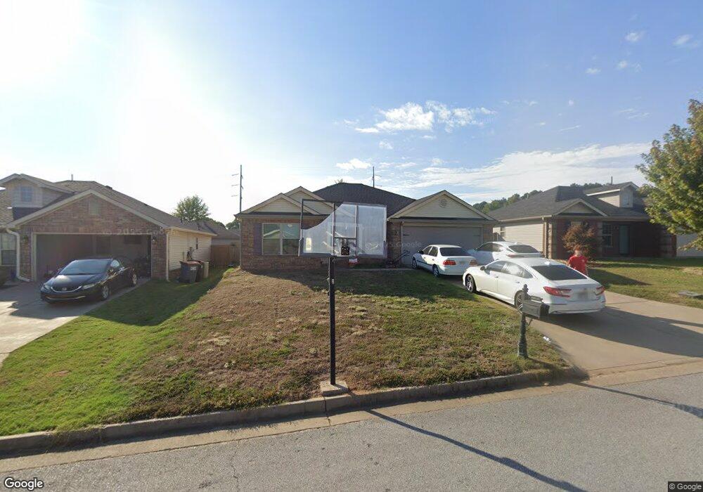
217 Colony Ct Barling, AR 72923
Estimated Value: $219,670 - $249,000
--
Bed
--
Bath
1,524
Sq Ft
$153/Sq Ft
Est. Value
About This Home
This home is located at 217 Colony Ct, Barling, AR 72923 and is currently estimated at $232,418, approximately $152 per square foot. 217 Colony Ct is a home with nearby schools including Barling Elementary School, L.A. Chaffin Junior High School, and Southside High School.
Ownership History
Date
Name
Owned For
Owner Type
Purchase Details
Closed on
Jun 12, 2023
Sold by
Denham Jennifer
Bought by
Denham Jennifer and Denham John
Current Estimated Value
Purchase Details
Closed on
Dec 1, 2011
Sold by
Rausch Coleman Heritage Llc
Bought by
Pettygrew Nathan and Pettygrew Jennifer
Home Financials for this Owner
Home Financials are based on the most recent Mortgage that was taken out on this home.
Original Mortgage
$4,000
Interest Rate
4.03%
Mortgage Type
Stand Alone Second
Create a Home Valuation Report for This Property
The Home Valuation Report is an in-depth analysis detailing your home's value as well as a comparison with similar homes in the area
Home Values in the Area
Average Home Value in this Area
Purchase History
| Date | Buyer | Sale Price | Title Company |
|---|---|---|---|
| Denham Jennifer | -- | None Listed On Document | |
| Pettygrew Nathan | $121,000 | None Available |
Source: Public Records
Mortgage History
| Date | Status | Borrower | Loan Amount |
|---|---|---|---|
| Previous Owner | Pettygrew Nathan | $4,000 | |
| Previous Owner | Pettygrew Nathan | $117,127 |
Source: Public Records
Tax History Compared to Growth
Tax History
| Year | Tax Paid | Tax Assessment Tax Assessment Total Assessment is a certain percentage of the fair market value that is determined by local assessors to be the total taxable value of land and additions on the property. | Land | Improvement |
|---|---|---|---|---|
| 2024 | $1,387 | $27,860 | $5,600 | $22,260 |
| 2023 | $1,123 | $27,860 | $5,600 | $22,260 |
| 2022 | $1,173 | $27,860 | $5,600 | $22,260 |
| 2021 | $1,146 | $27,860 | $5,600 | $22,260 |
| 2020 | $1,077 | $27,860 | $5,600 | $22,260 |
| 2019 | $1,008 | $24,890 | $4,000 | $20,890 |
| 2018 | $1,028 | $24,890 | $4,000 | $20,890 |
| 2017 | $890 | $24,890 | $4,000 | $20,890 |
| 2016 | $1,240 | $24,890 | $4,000 | $20,890 |
| 2015 | $1,240 | $24,890 | $4,000 | $20,890 |
| 2014 | $888 | $24,850 | $4,400 | $20,450 |
Source: Public Records
Map
Nearby Homes
- 211 Colony Ct
- 221 Colony Ct
- 221 Regency Dr
- 2218 Regency Ln
- TBD Painter Ln
- 1922 Yellowstone Dr
- 1906 Yellowstone Dr
- 1910 Yellowstone Dr
- 2100 Yellowstone Dr
- 1916 Yellowstone Dr
- 401 Waggoner Ln
- 405 Waggoner Ln
- 400 Waggoner Ln
- 509 Waggoner Ln
- 500 Buffalo Pass
- 2101 Ivey Ridge Rd
- 1921 Ivey Ridge Rd
- 2005 Ivey Ridge Rd
- 1915 Ivey Ridge Rd
- 2105 Ivey Ridge Rd
- 205 Colony Ct
- 301 Colony Ct
- 216 Regency Dr
- 210 Colony Ct
- 216 Colony Ct
- 220 Regency Dr
- 210 Regency Dr
- 220 Colony Ct
- 302 Regency Dr
- 204 Regency Dr
- 204 Colony Ct
- 302 Colony Ct
- 306 Regency Dr
- 306 Colony Ct
- 309 Colony Ct
- 215 Bridgewater Dr
- 219 Bridgewater Dr
- 310 Regency Dr
- 203 Bridgewater Dr
- 310 Colony Ct