Estimated Value: $129,000 - $164,000
Studio
1
Bath
1,344
Sq Ft
$108/Sq Ft
Est. Value
About This Home
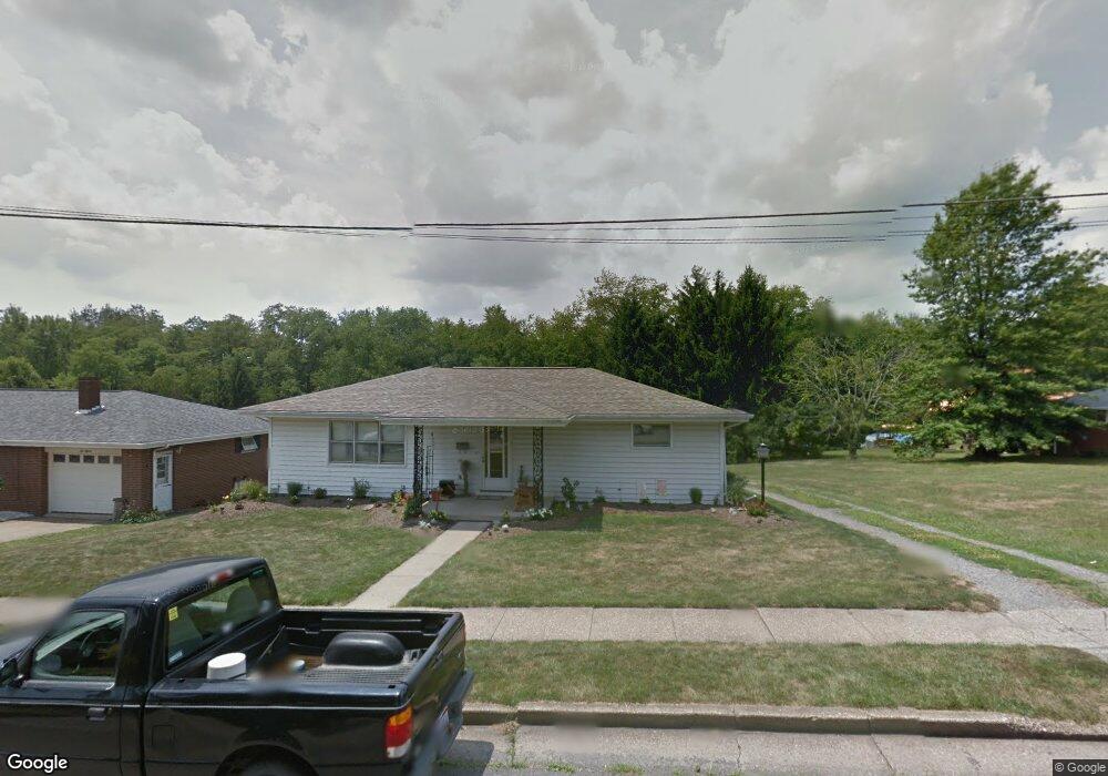
This home is located at 217 Cunningham Ave, Cadiz, OH 43907 and is currently estimated at $145,468, approximately $108 per square foot. 217 Cunningham Ave is a home located in Harrison County with nearby schools including Harrison Central Elementary School and Harrison Central Junior/Senior High School.
Ownership History
Date
Name
Owned For
Owner Type
Purchase Details
Closed on
Jul 15, 2013
Sold by
Zolensky James and Zolensky Michele Lynn
Bought by
Zolensky James and Zolensky Michele Lynn
Current Estimated Value
Home Financials for this Owner
Home Financials are based on the most recent Mortgage that was taken out on this home.
Original Mortgage
$69,942
Interest Rate
3.37%
Mortgage Type
New Conventional
Purchase Details
Closed on
Jun 5, 2008
Sold by
Dunfee Timothy and Dunfee Amie
Bought by
Zolensky James and Chisnell Michele L
Home Financials for this Owner
Home Financials are based on the most recent Mortgage that was taken out on this home.
Original Mortgage
$72,000
Interest Rate
6.09%
Mortgage Type
New Conventional
Purchase Details
Closed on
May 3, 1996
Purchase Details
Closed on
Mar 7, 1992
Purchase Details
Closed on
Apr 4, 1991
Create a Home Valuation Report for This Property
The Home Valuation Report is an in-depth analysis detailing your home's value as well as a comparison with similar homes in the area
Home Values in the Area
Average Home Value in this Area
Purchase History
| Date | Buyer | Sale Price | Title Company |
|---|---|---|---|
| Zolensky James | -- | None Available | |
| Zolensky James | -- | None Available | |
| -- | -- | -- | |
| -- | $30,000 | -- | |
| -- | $40,500 | -- | |
| -- | -- | -- |
Source: Public Records
Mortgage History
| Date | Status | Borrower | Loan Amount |
|---|---|---|---|
| Previous Owner | Zolensky James | $69,942 | |
| Previous Owner | Zolensky James | $72,000 |
Source: Public Records
Tax History
| Year | Tax Paid | Tax Assessment Tax Assessment Total Assessment is a certain percentage of the fair market value that is determined by local assessors to be the total taxable value of land and additions on the property. | Land | Improvement |
|---|---|---|---|---|
| 2024 | $1,409 | $35,440 | $6,000 | $29,440 |
| 2023 | $1,408 | $35,440 | $6,000 | $29,440 |
| 2022 | $1,293 | $30,440 | $4,420 | $26,020 |
| 2021 | $1,250 | $30,440 | $4,420 | $26,020 |
| 2020 | $1,246 | $30,440 | $4,420 | $26,020 |
| 2019 | $1,069 | $25,800 | $3,750 | $22,050 |
| 2018 | $1,068 | $25,800 | $3,750 | $22,050 |
| 2017 | $1,081 | $25,800 | $3,750 | $22,050 |
| 2016 | $1,133 | $25,230 | $3,530 | $21,700 |
| 2015 | $1,131 | $25,230 | $3,530 | $21,700 |
| 2014 | $923 | $24,250 | $3,210 | $21,040 |
| 2013 | $923 | $24,250 | $3,210 | $21,040 |
Source: Public Records
Map
Nearby Homes
- 593 Dewey Ave
- 413 Saint Clair Ave
- 419 Saint Clair Ave
- 413 Oakwood Dr
- 545 E Market St
- 265 Old Steubenville Pike
- 273 Old Steubenville Pike
- 0 N Main St Unit 5153554
- 0 E Market St
- 390 Oak Park Rd
- 83478 Monzula Dr
- 0 Monzula Dr
- 44501 Hanover Ridge Rd
- 0 Brewer Rd
- 39000 Lees Run Rd
- 77900 Slater Rd
- 85200 Merryman Rd
- Brough Rd
- 315 Euclid Ave
- 42535 Jewett Scio Rd
- 215 Cunningham Ave
- 709 Peppard Ave
- 213 Cunningham Ave
- 715 Peppard Ave
- 623 Peppard Ave
- 664 Mccready Ave
- 211 Cunningham Ave
- 665 Mccready Ave
- 662 Mccready Ave
- 661 Mccready Ave
- 619 Peppard Ave
- 658 Mccready Ave
- 209 Cunningham Ave
- 620 Peppard Ave
- 620 Peppard Ave
- 122 Jones Ave
- 655 Mccready Ave
- 208 Cunningham Ave
- 656 Mccready Ave
- 118 Jones Ave