Estimated Value: $182,000 - $282,000
--
Bed
--
Bath
2,008
Sq Ft
$106/Sq Ft
Est. Value
About This Home
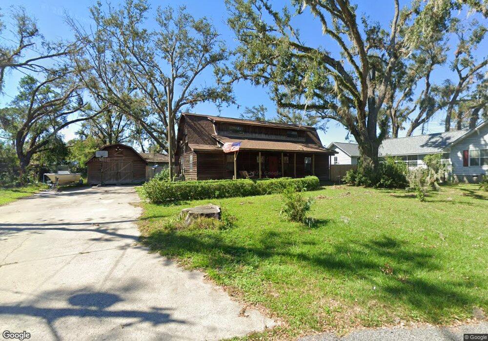
This home is located at 217 Cypress Rd, Perry, FL 32348 and is currently estimated at $213,635, approximately $106 per square foot. 217 Cypress Rd is a home located in Taylor County with nearby schools including Steinhatchee School, Perry Primary School, and Taylor County Elementary School.
Ownership History
Date
Name
Owned For
Owner Type
Purchase Details
Closed on
Dec 12, 2022
Sold by
Keen Billy Troy and Keen Melissa
Bought by
Keen Billy Troy and Archar-Keen Melissa
Current Estimated Value
Purchase Details
Closed on
Jun 13, 2003
Sold by
Anderson Isham Lafayette
Bought by
Keen Billy Troy
Home Financials for this Owner
Home Financials are based on the most recent Mortgage that was taken out on this home.
Original Mortgage
$69,380
Interest Rate
5.68%
Mortgage Type
FHA
Create a Home Valuation Report for This Property
The Home Valuation Report is an in-depth analysis detailing your home's value as well as a comparison with similar homes in the area
Home Values in the Area
Average Home Value in this Area
Purchase History
| Date | Buyer | Sale Price | Title Company |
|---|---|---|---|
| Keen Billy Troy | $100 | -- | |
| Keen Billy Troy | $70,000 | -- |
Source: Public Records
Mortgage History
| Date | Status | Borrower | Loan Amount |
|---|---|---|---|
| Previous Owner | Keen Billy Troy | $69,380 |
Source: Public Records
Tax History Compared to Growth
Tax History
| Year | Tax Paid | Tax Assessment Tax Assessment Total Assessment is a certain percentage of the fair market value that is determined by local assessors to be the total taxable value of land and additions on the property. | Land | Improvement |
|---|---|---|---|---|
| 2025 | $982 | $94,770 | -- | -- |
| 2024 | $900 | $92,100 | -- | -- |
| 2023 | $900 | $89,420 | $0 | $0 |
| 2022 | $865 | $86,820 | $0 | $0 |
| 2021 | $846 | $84,300 | $0 | $0 |
| 2020 | $831 | $83,140 | $2,380 | $80,760 |
| 2019 | $881 | $85,080 | $2,380 | $82,700 |
| 2018 | $860 | $84,020 | $2,380 | $81,640 |
| 2017 | $908 | $83,230 | $2,380 | $80,850 |
| 2016 | $889 | $85,030 | $2,380 | $82,650 |
| 2015 | $890 | $92,940 | $8,500 | $84,440 |
| 2014 | -- | $83,544 | $0 | $0 |
Source: Public Records
Map
Nearby Homes
- 707 Puckett Rd
- 517 Judson Dr
- 415 Judson Dr
- 136 Palmetto St
- 150 Houck Rd
- 0 Airport Rd Unit 25458733
- 117 O Quinn Rd
- 1124 S Orange St
- 1124 S Orange St Unit 2
- 1212 S Center St
- 608 Plantation Rd
- 00 Paige St
- 1100 S Wilder St
- 00 U S Highway 19
- 0 U S Highway 19 Unit 390248
- 0 U S Highway 19 Unit 795534
- 831 U S 27
- 0 U S 27
- 27 Colorado Land and Grazing
- 0 US Highway 98 Unit 10649270