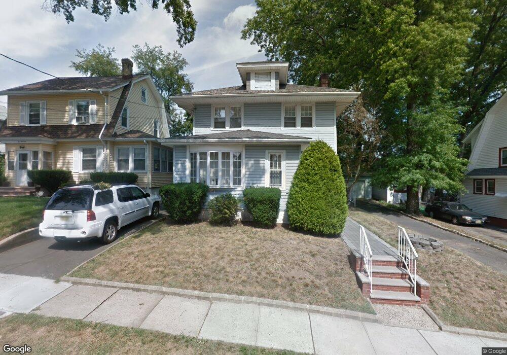
217 Dorer Ave Hillside, NJ 07205
Estimated Value: $476,000 - $566,000
Studio
--
Bath
1,842
Sq Ft
$283/Sq Ft
Est. Value
About This Home
This home is located at 217 Dorer Ave, Hillside, NJ 07205 and is currently estimated at $521,473, approximately $283 per square foot. 217 Dorer Ave is a home located in Union County with nearby schools including Abram P. Morris-Saybrook Elementary School, Ola Edwards Community School, and Hurden Looker School.
Ownership History
Date
Name
Owned For
Owner Type
Purchase Details
Closed on
Jul 12, 2000
Sold by
Murray Robin D and Tonsul Christine
Bought by
Murray Robin D and Tonsul Christine
Current Estimated Value
Purchase Details
Closed on
Feb 14, 1994
Sold by
Rheim John
Bought by
Murray Robin and Tonsul Christine
Home Financials for this Owner
Home Financials are based on the most recent Mortgage that was taken out on this home.
Original Mortgage
$122,000
Interest Rate
7.18%
Create a Home Valuation Report for This Property
The Home Valuation Report is an in-depth analysis detailing your home's value as well as a comparison with similar homes in the area
Home Values in the Area
Average Home Value in this Area
Purchase History
| Date | Buyer | Sale Price | Title Company |
|---|---|---|---|
| Murray Robin D | -- | -- | |
| Murray Robin | $125,000 | -- |
Source: Public Records
Mortgage History
| Date | Status | Borrower | Loan Amount |
|---|---|---|---|
| Closed | Murray Robin | $122,000 |
Source: Public Records
Tax History
| Year | Tax Paid | Tax Assessment Tax Assessment Total Assessment is a certain percentage of the fair market value that is determined by local assessors to be the total taxable value of land and additions on the property. | Land | Improvement |
|---|---|---|---|---|
| 2025 | $10,820 | $131,100 | $59,400 | $71,700 |
| 2024 | $10,505 | $131,100 | $59,400 | $71,700 |
| 2023 | $10,505 | $131,100 | $59,400 | $71,700 |
| 2022 | $10,408 | $131,100 | $59,400 | $71,700 |
| 2021 | $10,340 | $131,100 | $59,400 | $71,700 |
| 2020 | $10,280 | $131,100 | $59,400 | $71,700 |
| 2019 | $10,080 | $131,100 | $59,400 | $71,700 |
| 2018 | $9,979 | $131,100 | $59,400 | $71,700 |
| 2017 | $9,919 | $131,100 | $59,400 | $71,700 |
| 2016 | $9,907 | $131,100 | $59,400 | $71,700 |
| 2015 | $9,819 | $131,100 | $59,400 | $71,700 |
| 2014 | $9,665 | $131,100 | $59,400 | $71,700 |
Source: Public Records
Map
Nearby Homes
- 1570-72 Clinton Place
- 261 Winans Ave
- 1437 Parkview Terrace
- 1431 Compton Terrace
- 277 Clark St
- 1406 Maple Ave
- 1603 Bayview Ave
- 236-238 Keer Ave
- 151 Keer Ave
- 252 Keer Ave
- 1414 Boa Place Unit 2
- 1470B Liberty Ave
- 315 Winans Ave
- 1442 Highland Ave
- 75 Hillside Ave
- 203-205 Hansbury Ave
- 207-209 Hansbury Ave
- 95 Keer Ave
- 91 Keer Ave Unit 95
- 327 Field Place
- 219 Dorer Ave
- 211 Dorer Ave
- 216 Winans Ave
- 214 Winans Ave
- 1525 Compton Terrace
- 1531 Compton Terrace
- 218 Winans Ave
- 212 Winans Ave
- 209 Dorer Ave
- 222 Winans Ave
- 216 Dorer Ave
- 210 Winans Ave
- 218 Dorer Ave
- 1517 Compton Terrace
- 212 Dorer Ave
- 224 Winans Ave
- 208 Winans Ave
- 210 Dorer Ave
- 1515 Compton Terrace
- 1528 Maple Ave
Your Personal Tour Guide
Ask me questions while you tour the home.